

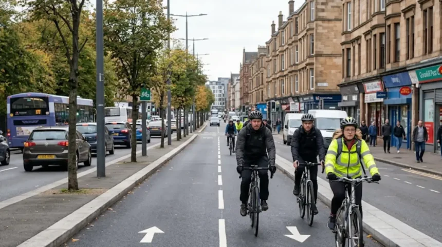
Glasgow’s daily commuter cycling network consists of segregated on-street tracks, converted railway paths, canal towpaths, and shared-use bridges. These routes separate bicycles from motor traffic, connect residential suburbs to commercial districts, and provide direct, low-gradient transit corridors across the city.
- How Does the South City Way Connect Southside Commuters to Central Glasgow?
- What Makes the South-West City Way an Essential Route for Daily Commuters?
- How Does the West City Way Facilitate Daily Commutes Across the West End?
- What Role Does the Forth and Clyde Canal Towpath Play in North Glasgow Commuting?
- How Does National Cycle Network Route 75 Serve East-West Urban Commuters?
- What Impact Does the Govan-Partick Bridge Have on Cross-River Daily Commuting?
- How Will the Connecting Glasgow Framework Expand Commuter Infrastructure by 2032?
Glasgow active travel infrastructure integrates three distinct highway models: fully kerb-segregated cycleways, off-road greenways, and quietway street connections. Glasgow City Council, the local government authority responsible for municipal transport planning, manages this network in partnership with Sustrans, the United Kingdom active travel charity. The primary objective of this network is to shift urban mobility away from private motor vehicles to zero-emission active travel.
Automatic counter data collected by Cycling Scotland, the national cycling promotion agency, recorded 4.65 million cycling trips across Glasgow between January and August 2025. This total represents a 43% increase compared to 3.25 million trips recorded during the equivalent eight-month period in 2024. Safety enhancements and route continuity drive this modal shift. Physical separation from motor vehicles addresses road safety concerns, which survey data identifies as the primary barrier to utility cycling.
Primary Structural Components of the Network
The utility cycling network comprises three core structural categories: arterial city ways, canal towpaths, and river corridors.
Arterial city ways provide high-capacity, bidirectional protected cycle tracks along major radial roadways. Three primary examples include the South City Way along Victoria Road, the South-West City Way along Shields Road, and the East City Way through Bridgeton.
Canal towpaths utilize historic industrial waterways managed by Scottish Canals, the public body overseeing inland navigations. The primary example is the Forth and Clyde Canal towpath, designated as National Cycle Network Route 754.
River corridors follow natural topography along waterway embankments. The primary example is National Cycle Network Route 75, which runs parallel to the River Clyde along the Clyde Walkway.
Topographical and Geographical Layout
Glasgow sits within the Clyde Valley, featuring flat terrain along the river basin and steeper gradients in the north and west. Commuter routes capitalize on low-gradient natural corridors such as river valleys and former rail alignments. This geological layout minimizes physical exertion for daily utility riders traveling into the central business district.
How Does the South City Way Connect Southside Commuters to Central Glasgow?
The South City Way provides a 3-kilometer segregated cycling corridor linking Queen’s Park to Trongate in central Glasgow. It features bidirectional protected lanes, signal-controlled junctions, and dedicated priority crossings, allowing commuters to complete the journey in approximately 14 minutes.
The South City Way originates at Queen’s Park in the Southside district and proceeds north along Victoria Road, Pollokshaws Road, and Gorbals Street, terminating at Candleriggs in the Merchant City. Construction began in December 2017 following a £3.25 million award from the Scottish Government Places for Everyone program, administered by Sustrans. Final construction phases connecting the route into Candleriggs reached completion in 2024.
Traffic monitoring surveys conducted by Cycling Scotland in September 2025 recorded 5,287 bicycle movements along Victoria Road during a 48-hour count period. Bicycles accounted for 16.1% of all vehicles recorded on the corridor during this survey, marking a record cycling modal share for an urban street in Scotland. Monthly automated counter data at the intersection of Victoria Road, Calder Street, and Allison Street logged 131,324 cycle trips in September 2025, compared to 70,827 trips in September 2021—an increase of 85% over four years.
Engineering and Intersection Design
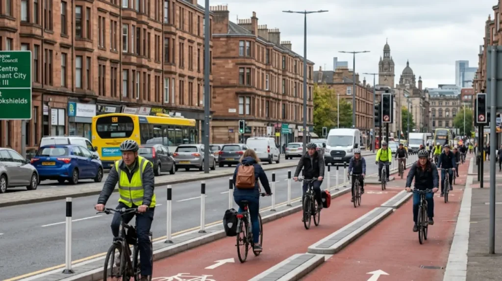
The South City Way uses continuous stepped kerbs and red asphalt surfaces to delineate cycle lanes from footways and carriageways. Physical protection eliminates vehicle overtaking risks and illegal parking obstructions.
At major intersections, the route incorporates cycle-optimized signal phasing. Three specific design implementations include:
- Low-level bicycle signals synchronized with pedestrian crossing phases.
- Advanced stop lines providing priority positioning at junctions.
- Continuous footway crossings across side streets, establishing right-of-way for non-motorized transport.
Commuter Feeders and Suburban Integration
The South City Way acts as a spine receiving traffic from feeder roads across the Southside. Two primary feeder routes include Nithsdale Road in Pollokshields and the Connecting Battlefield active travel corridor. Connecting Battlefield Phase 1 links the New Victoria Hospital and Cathcart Road directly into the South City Way at Victoria Road, expanding the safe catchment area for south-side hospital and office workers.
What Makes the South-West City Way an Essential Route for Daily Commuters?
The South-West City Way delivers a 4-kilometer protected cycleway connecting Pollok Park and Pollokshields to the Tradeston Footbridge and the financial district. Its physical barriers prevent vehicle encroachment, offering smooth, flat transit for south-western suburban commuters.
The South-West City Way extends 4 kilometers from Pollok Country Park through the residential neighbourhood of Pollokshields, running along Shields Road and West Street toward the River Clyde. The route terminates at the Tradeston Footbridge, known locally as the Squiggly Bridge, which delivers cyclists into the International Financial Services District adjacent to Glasgow Central Station.
Following infrastructure expansion completed in 2024, commuter usage increased substantially. Data from automated cycle counters recorded 13,487 cycle trips along the South-West City Way during September 2025. This volume represents a 116% increase compared to 6,241 trips recorded along the same segment in September 2021.
Multi-Modal Transit Integration
The South-West City Way integrates directly with public transport hubs operated by Strathclyde Partnership for Transport, the regional transport executive. The route passes two subway stations:
- Shields Road Subway Station.
- West Street Subway Station.
Both subway stations offer secure, covered bicycle parking facilities. This infrastructure enables park-and-ride commuting, where cyclists from suburban areas such as Shawlands or Dumbreck cycle to the subway, lock their bicycles, and board underground trains into north or west Glasgow.
Infrastructure Profile and Safety Standards
The corridor utilizes full kerb segregation on high-speed road sections along Shields Road. Where the route encounters industrial railway bridges, dedicated signal phases hold turning heavy goods vehicles to protect cyclists. The entirely flat elevation profile allows commuters to maintain a constant speed of 15 to 20 kilometers per hour without encountering major gradients.
How Does the West City Way Facilitate Daily Commutes Across the West End?
The West City Way connects Kelvingrove Park and Kelvinbridge to Glasgow Central Station through protected road tracks and the Charing Cross pedestrian-cycle bridge. It integrates with National Cycle Network Route 75, offering West End commuters safe urban links.
The West City Way connects the West End to the central business district. The route begins at the eastern border of Kelvingrove Park, traverses the Anderston district via a converted highway overpass known as the Anderston Footbridge, and descends into Argyle Street and Waterloo Street.
The route handles dense commuter traffic generated by the University of Glasgow, local government offices, and financial institutions. It bridges the M8 motorway, a major multi-lane urban freeway constructed in the 1960s that historically severed pedestrian and cycle movement between the West End and the city centre.
Key Segments and West End Expansions
The West End active travel network connects to the West City Way through two newly redeveloped corridors:
Phase one redevelopment of Byres Road introduced fully protected, kerb-segregated cycle lanes between Partick Cross and University Avenue. Traffic surveys conducted in September 2025 recorded 1,681 daily bike trips along this completed southern section.
The Connecting Woodside project provides a 1-kilometer bidirectional protected lane along Garscube Road. Count data from September 2025 recorded 1,636 cycle journeys over a 48-hour monitoring window, connecting northern West End residents from Maryhill and St George’s Cross into the West City Way network.
What Role Does the Forth and Clyde Canal Towpath Play in North Glasgow Commuting?
The Forth and Clyde Canal towpath, designated as National Cycle Network Route 754, provides a completely traffic-free, low-gradient corridor for north Glasgow commuters. It connects Bowling, Maryhill, and Kirkintilloch directly to Speirs Wharf near the city center.
The Forth and Clyde Canal was constructed between 1768 and 1790 as a commercial shipping route across Central Scotland. Operated today by Scottish Canals, the canal towpath forms National Cycle Network Route 754, a 35-mile traffic-free active travel artery. Within Glasgow, the towpath serves northern suburbs including Lambhill, Maryhill, Ruchill, and Bishopbriggs.
The towpath enters the urban core at Speirs Wharf in Port Dundas, positioned 100 meters above the central city grid. From Speirs Wharf, ramps and cycling lanes link down to Cowcaddens, Buchanan Street Bus Station, and Queen Street Railway Station.
Surface Construction and Year-Round Usability
Historically composed of unpaved earth and gravel, the towpath underwent systematic resurfacing funded by Transport Scotland, the national transport agency. Upgrades replaced gravel with 2.5-meter-wide sealed asphalt, installed solar-powered cat’s-eye LED lighting, and reinforced canal embankments. These technical improvements ensure all-weather operational capacity for winter commuters.
Traffic Isolation and Speed Dynamics
Because the canal towpath does not intersect any road carriageways at grade, cyclists encounter zero traffic signals or motor vehicle interactions. Commuters travel under road bridges and over historic aqueducts, such as the Kelvin Aqueduct in Maryhill. The absence of motor traffic reduces commute times and eliminates collision risks associated with urban street riding.
How Does National Cycle Network Route 75 Serve East-West Urban Commuters?
National Cycle Network Route 75 spans the River Clyde corridor, connecting Cambuslang, Bridgeton, Glasgow Green, and Clydebank. The route uses traffic-free riverside paths and the East City Way to transfer thousands of east-west commuters directly to employment hubs.
National Cycle Network Route 75 is a long-distance cycling corridor managed nationally by Sustrans. Within the Glasgow municipal boundary, Route 75 follows the Clyde Walkway along the north bank of the River Clyde, providing a flat east-west transit trunk. It connects eastern suburban communities like Cambuslang, Rutherglen, and Dalmarnock directly to the central business district, Broomielaw financial zone, and western industrial estates near Yoker.
The eastern section integrates with the East City Way, an urban active travel route running through Bridgeton and Parkhead. Automatic cycle counter analysis showed an 81% growth in cycle traffic on the East City Way between September 2021 (1,246 trips) and September 2025 (2,257 trips).
Spatial Distribution Along the Clyde Corridor
Route 75 passes through major urban landmarks and commuter origin-destination hubs. Four key anchor points along the corridor include:
- Glasgow Green—Scotland’s oldest public park, functioning as a traffic-free convergence zone for eastern commuters.
- The Broomielaw—a major commercial riverside boulevard housing corporate offices.
- The Scottish Event Campus (SEC) and Finnieston precinct—a high-density employment and entertainment district.
- The Riverside Museum—a multimodal transit junction at the mouth of the River Kelvin.
Explore More Area Guide
What Is the Clockwork Orange Glasgow Subway and Key Stops
Is Cycling in Glasgow City Actually Safe or Are Roads Too Dangerous
What Impact Does the Govan-Partick Bridge Have on Cross-River Daily Commuting?
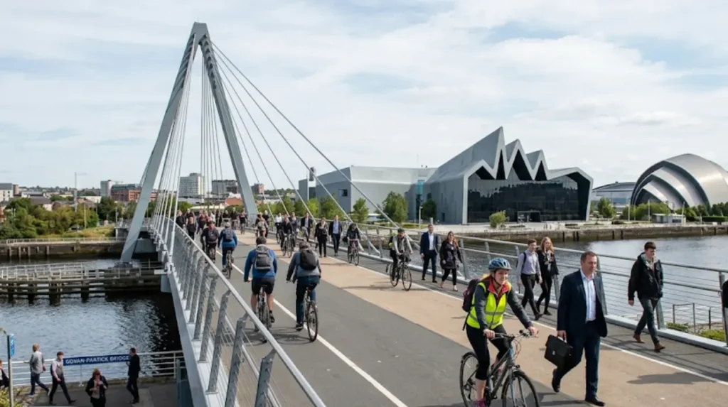
The Govan-Partick Bridge provides a dedicated cross-river link for pedestrians and cyclists, opening a direct connection between North and South Glasgow. It eliminates detour miles, links Govan directly to Partick, and recorded over 1.4 million crossings within months.
The Govan-Partick Bridge opened in September 2024 as part of the £1.13 billion Glasgow City Region City Deal, funded jointly by the UK Government and Scottish Government. The structure is a 110-meter-long cable-stayed opening swing bridge crossing the River Clyde between Water Row in Govan and the Riverside Museum in Partick.
Between September 2024 and August 2025, counter data logged over 1.4 million total trips across the bridge. Automated sensors confirmed that 20% of these movements—equating to over 280,000 trips—were made by bicycles.
Strategic Network Impact
Prior to the bridge’s construction, cyclists traveling between Govan and Partick had to detour 2 kilometers east to the Kingston Bridge or the Clyde Arc (Squinty Bridge), or use the Clyde Tunnel to the west, which features steep access stairs and narrow subterranean footways. The Govan-Partick Bridge eliminates these physical detours, establishing a direct 2-minute river crossing.
Integration with Greater Govan Active Travel Schemes
The bridge acts as a catalyst for the Connecting Greater Govan project, designed by AECOM and WAVEparticle for Glasgow City Council. This scheme introduces 20 kilometers of upgraded cycleways and footways across four key residential streets:
- Govan Road.
- Broomloan Road.
- Orkney Street.
- Summertown Road.
These protected lanes feed commuter traffic directly onto the Govan-Partick Bridge, enabling south-western suburban commuters to access Partick Interchange station and the University of Glasgow without driving.
How Will the Connecting Glasgow Framework Expand Commuter Infrastructure by 2032?
The Connecting Glasgow framework prioritizes the delivery of 54 kilometers of protected cycling routes by 2032. The plan establishes a 23-kilometer inner orbital loop and 31 kilometers of spoke routes, integrating active travel directly into urban transport policy.
The Connecting Glasgow delivery framework, approved by the Glasgow City Council City Administration Committee in June 2026, unifies two transport programs: the City Network and Liveable Neighbourhoods. The framework targets the short-term completion of 54 kilometers of high-priority segregated cycle routes by 2032 as the first phase of an ultimate 270-kilometer citywide active travel network.
The strategic blueprint focuses investment on filling missing links between existing routes such as the South City Way, West City Way, and East City Way. The strategy adjusts local delivery mechanisms to align with annual capital allocations from the Scottish Government’s active travel budget.
The 23-Kilometer Inner Orbital Loop
The core structural element of Connecting Glasgow is a 23-kilometer inner orbital loop surrounding the city center. This loop connects six inner-city residential districts:
- Dennistoun in the east.
- Calton in the south-east.
- Shawlands in the south.
- Govan in the south-west.
- Maryhill in the north-west.
- Partick in the west.
Existing infrastructure, including the South City Way and 7.9 kilometers of routes under construction in 2026, forms part of this ring. Completing the loop requires building less than 16 kilometers of new protected lanes.
Radial Spoke Routes and Avenues Projects
Extending outward from the inner orbital loop, 31 kilometers of planned “spoke” routes will connect peripheral residential housing areas directly to industrial hubs and commercial districts.
Concurrently, the Glasgow City Centre Avenues Program—funded by the £1.13 billion City Deal—reconfigures main commercial thoroughfares. Completed projects include Sauchiehall Street, Cambridge Street, and Holland Street. Construction ongoing in 2026 on the Argyle Street West Avenue adds dedicated cycleways from the Kingston Bridge to Union Street. These public realm redesigns convert motor vehicle lanes into protected bike tracks, completing the urban network that supports daily bicycle commuting across Glasgow.