
The geographic and economic link between uk/local/paisley/">Paisley and Glasgow is a highly integrated regional corridor within the West Central Scotland conurbation, defined by a 7-mile distance and shared transit systems that connect Renfrewshire to the Glasgow metropolitan economy.
- How Do You Travel From Paisley to Glasgow by Rail?
- What Regional Bus Services Connect Paisley to Glasgow City Centre?
- How Does Driving and Ridesharing Compare via the Motorway Network?
- What Is the Historical Context of Transit Infrastructure Between These Cities?
- What Future Trends and Sustainable Infrastructure Projects Shape This Route?
The town of Paisley constitutes the administrative center of the Renfrewshire council area. It positions itself exactly 7 miles west of Glasgow city center. The infrastructure between these two urban centers serves as a vital economic pipeline. Thousands of commuters travel daily across this path to access employment, education, and commercial services. This structural integration dates back to the Industrial Revolution. During that period, the textile dynamics of Paisley and the heavy engineering industries of Glasgow created a mutually dependent manufacturing network along the River Clyde basin.
In contemporary regional economics, the transport corridor handles extensive multi-modal traffic daily. Paisley hosts the University of the West of Scotland and West College Scotland. These educational institutions draw substantial student populations directly from Glasgow. Conversely, the central business district of Glasgow absorbs a massive proportion of the skilled workforce residing in Paisley. The infrastructure contains key geographic nodes. These nodes include the M8 motorway, the Inverclyde and Ayrshire railway lines, and Glasgow Airport, which physically sits within the boundaries of Renfrewshire, directly adjacent to Paisley.
How Do You Travel From Paisley to Glasgow by Rail?
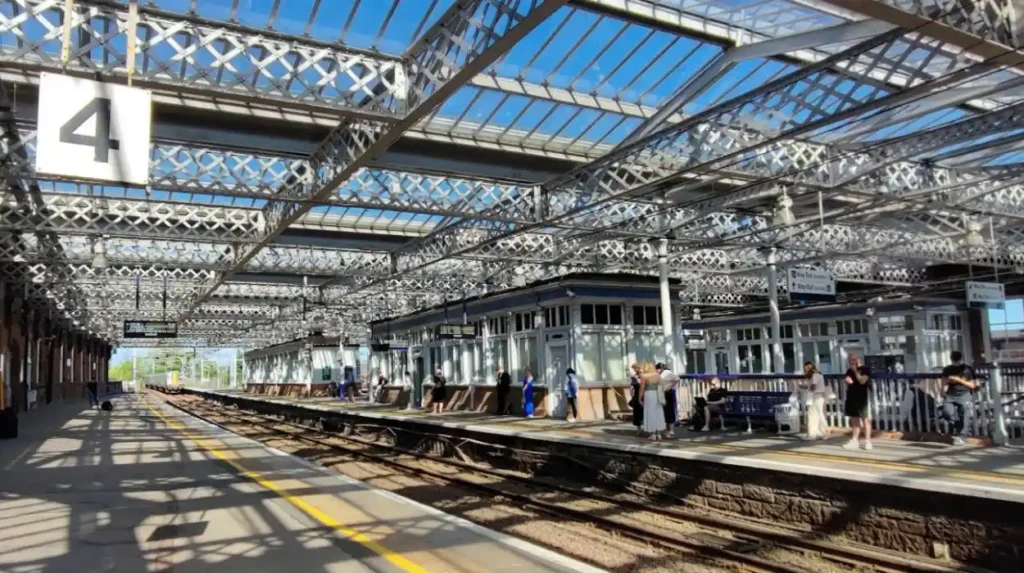
To travel from Paisley to Glasgow by rail, you must board a direct ScotRail train from Paisley Gilmour Street Station to Glasgow Central Station, which provides a fast 10-to-15-minute journey across the 7-mile transit line.
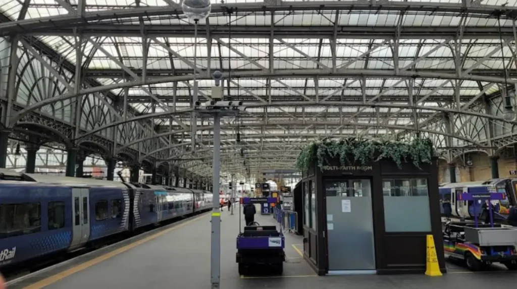
The railway connection represents the fastest and most reliable transport option between the two locations. Paisley Gilmour Street Station operates as the fourth busiest railway hub in Scotland. It manages all passenger train services heading east into the city center of Glasgow. ScotRail operates as the primary national train operator for this specific route. The service functions with high frequency, providing up to 218 trains per day. This means a train departs the platform approximately every 5 to 10 minutes during peak commuting hours.
The physical journey spans approximately 7 miles of track. The fastest direct express services complete the transit in exactly 10 minutes. Standard stopping services take up to 18 minutes. These stopping services pause at intermediate suburban stations, which include Paisley St James, Hillington West, Hillington East, and Cardonald. The terminal destination is Glasgow Central Station, which positions travelers directly within the heart of the low emission zone of the city center.
Financially, rail travel remains a highly cost-effective strategy for daily commuters. Standard anytime single tickets cost approximately £3 to £6. Passengers can secure lower tariffs by purchasing advance singles or utilizing specific national railcards, which grant a 33% discount on standard fares. The service schedule begins early in the morning, with the first eastbound train departing Paisley Gilmour Street at 04:53. The final service of the night departs at 23:13, ensuring comprehensive coverage for late-shift workers and night-time travelers.
What Regional Bus Services Connect Paisley to Glasgow City Centre?
Regional bus services connect Paisley to Glasgow city centre via dedicated public routes operated by McGill’s Buses and First Greater Glasgow, utilizing the local road network and the M8 motorway corridor to deliver passengers in 17 to 49 minutes.
Public bus transportation provides an alternative transit mechanism, prioritizing local accessibility across various neighborhoods. McGill’s Buses stands as the dominant regional private operator in Renfrewshire, maintaining over 70 bus movements per hour within Paisley town center. For direct travel to Glasgow, passengers rely on specific main services, including the McGill’s 17, 26, and 38 routes. These buses depart from central points such as Smithhills Street and Gauze Street, navigating through suburban corridors before terminating near Glasgow Central Station or the Buchanan Bus Station.
The travel duration for standard local bus routes ranges from 38 to 49 minutes. This timeline fluctuates depending heavily on peak traffic congestion along the route. For rapid transit, the First Greater Glasgow operator runs the Glasgow Airport Express Service 500. This specialized route uses the dedicated lanes of the M8 motorway. It links the airport terminal building directly to Waterloo Lane in Glasgow city center in approximately 12 to 17 minutes.
Bus fares remain highly competitive with rail transit, with average single tickets costing approximately £3 to £5. Operators offer flexible ticketing products. These products include day trippers, weekly passes, and multi-journey smartcards. These options lower the individual trip cost for consistent commuters. The bus networks operate extensive timetables, with services running every 15 minutes during standard daylight hours, alongside reduced schedules during late-night intervals.
How Does Driving and Ridesharing Compare via the Motorway Network?
Driving and ridesharing via the motorway network provide direct point-to-point transit from Paisley to Glasgow in approximately 12 to 23 minutes by utilizing Junction 27 of the eastbound M8 motorway for an 8.2-mile journey.
Navigating the route via a private automobile or a rideshare vehicle offers distinct advantages in spatial flexibility. The standard vehicular route demands that drivers slip onto the M8 motorway at Junction 27 westbound or eastbound depending on their precise departure point in Paisley. Under optimal traffic flow conditions, a 12-minute drive connects the two town centers across an 8.2-mile motorway stretch. This route circumvents local suburban traffic lights by utilizing three or four lanes of continuous highway infrastructure.
Ridesharing platforms, including Uber and local private hire taxi firms, operate continuously across the Renfrewshire and Glasgow boundary. A standard single taxi trip costs between £30 and £40. This capital expenditure is significantly higher than public transit options. In contrast, utilizing a structured peer-to-peer rideshare option can reduce the individual cost to as low as £2 per trip. This makes it highly economical when sharing vehicle space with multiple passengers.
Drivers must calculate secondary operational costs when choosing to pilot a private vehicle into Glasgow. The city enforces a strict Low Emission Zone across the central square mile. This zone penalizes non-compliant vehicles with immediate financial fines. Additionally, city center parking rates represent a substantial financial burden. Rates at multi-story facilities regularly exceed £4 per hour, neutralizing the initial convenience of private vehicular travel for long-duration stays.
Explore More Area Guide
Sanctuary Scotland Receives Approval For 46 New Glasgow Social Housing Homes
How to Get University Hospital Hairmyres Photos in Glasgow: Essential Guide
What Is the Historical Context of Transit Infrastructure Between These Cities?
The historical context of transit infrastructure between these cities centers on the evolution of industrial trade channels, moving from 18th-century river transport on the White Cart Water to the 1841 opening of the Gilmour Street railway line.
The structural necessity for rapid transit grew directly out of the economic expansion of the late 18th century. In 1760, Paisley operated as a modest market town housing roughly 7,000 inhabitants. By 1820, the textile explosion transformed it into a global hub for thread making and intricate weaving, ballooning the population to nearly 60,000 individuals. To facilitate the massive exchange of raw materials and finished goods with the shipping ports of Glasgow, early industrialists heavily modified the local waterways. They built the Carlile Quay and widened the River White Cart to allow heavy cargo barges to float downstream.
The definitive transformation occurred during the golden age of steam rail power. In 1841, engineers officially opened Paisley Gilmour Street Station, establishing a direct, permanent iron link to Glasgow and the coastal ports of Ayrshire. This rail connection immediately altered local demographics and commerce. It permitted the daily movement of thousands of textile workers, mill owners, and mechanical engineers. The industrial firms of Paisley, such as the Clark and Coats thread empires, relied entirely on this high-speed corridor to transport cargo directly to Glasgow warehouses for global export.
What Future Trends and Sustainable Infrastructure Projects Shape This Route?
Future trends and sustainable infrastructure projects shape this route through the planned integration of the Clyde Metro light rail system and active travel networks designed to eliminate vehicular carbon emissions by 2030.
Transport planning for the Paisley-to-Glasgow corridor focuses on environmental decarbonization and smart city multi-modal connectivity. The most significant structural development on the horizon is the Clyde Metro project. This is a multibillion-pound mass transit initiative backed by Transport Scotland and the Glasgow City Region. The Clyde Metro plan intends to introduce a brand-new light rail and rapid tram network. This network will directly link Paisley Gilmour Street, Glasgow Airport, and Glasgow city center, bridging existing gaps between heavy rail and local bus networks.
Simultaneously, local councils are implementing dedicated active travel infrastructure. These projects include protected cycle highways and pedestrian paths running parallel to major roadways. These paths aim to encourage human-powered commuting across short suburban distances. These infrastructure adjustments align directly with Scotland’s statutory target to reduce total car kilometers traveled by 20% by the year 2030. These initiatives will systematically favor electric mass transit, automated ticketing integration, and strict vehicular restrictions within both urban cores.
How far is Paisley from Glasgow?
Paisley is located approximately 7 miles (11 km) west of Glasgow city centre, making it one of the closest major towns to the city.