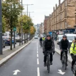

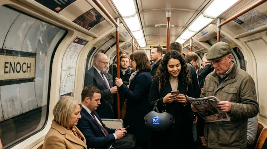
Glasgow possesses the densest public transport network in Scotland, making car-free living practical and cost-effective for new residents. According to census data from the Scottish Government, 46% of households in the Glasgow City Council area do not own a vehicle. The city features an underground metro, an extensive suburban rail system, deregulation-era commercial bus networks, and bike-sharing infrastructure.
- Is Glasgow a car-friendly city or is public transport sufficient for new residents?
- What are the main public transport options available in Glasgow?
- How does the Glasgow Subway system operate for daily commuters?
- How extensive is the suburban rail network in Glasgow?
- What bus services operate across the Glasgow metropolitan area?
- How much does public transport cost in Glasgow and how do ticketing systems work?
- What is the Strathclyde ZoneCard and how does multi-modal ticketing work?
- What digital payment options and smartcards exist for Glasgow transport?
- How walkability and cycling infrastructure support car-free living in Glasgow?
- What active travel routes and cycle share schemes exist in Glasgow?
- Which neighborhoods in Glasgow are most walkable for new residents?
- What are the main challenges of living in Glasgow without a personal vehicle?
- How do weekend timetables and night transit availability impact travel?
- How does regional transport connectivity compare to inner-city travel?
- How do municipal transport policies and environmental zones affect carless travel in Glasgow?
Is Glasgow a car-friendly city or is public transport sufficient for new residents?
Glasgow is highly suited for car-free navigation due to its dense public transport infrastructure, high urban walking connectivity, and high vehicle non-ownership rates. A total of 46% of resident households operate without a car, relying entirely on public transit.
Public transportation in Glasgow provides complete coverage across the central zone and surrounding suburbs. The city layout relies on grid patterns within the municipal center and radial transit corridors connecting outlying neighborhoods. New residents can reach commercial centers, universities, healthcare facilities, and industrial parks using public transit.
Urban transit integration in the region falls under the administrative oversight of the Strathclyde Partnership for Transport (SPT), a regional transport executive established under the Transport Act 1968 and the Local Government (Scotland) Act 1994. SPT sets multi-modal fare structures and manages regional infrastructure alongside private transit companies.
Living without a personal automobile reduces living costs in Glasgow. Vehicle owners face charges including the Glasgow City Centre Low Emission Zone (LEZ) non-compliance penalties, resident parking permits issued by Glasgow City Council, fuel duty, and annual MOT inspections. In contrast, non-car owners utilize multi-modal passes and pay-as-you-go electronic fare systems.
What are the main public transport options available in Glasgow?
Glasgow features three primary public transit modes: the Glasgow Subway underground rail, the ScotRail suburban train network, and private bus services. Together, these three systems move over 100 million passengers through the Glasgow metropolitan area each year.
How does the Glasgow Subway system operate for daily commuters?
The Glasgow Subway is an underground light metro system operating on a double-track circular loop. Opened on 14 December 1896, it is the third-oldest underground rail system in the world after the London Underground and the Budapest Metro.
The system spans 10.5 kilometers (6.5 miles) and consists of 15 stations distributed across the North and South sides of the River Clyde. The route comprises two parallel tracks:
- The Outer Circle: Trains travel clockwise.
- The Inner Circle: Trains travel anticlockwise.
A full circuit around the 15 stations takes 24 minutes. Trains operate at peak frequencies of every 4 minutes from Monday through Saturday, and every 6 to 8 minutes off-peak. The system serves key locations including:
- University of Glasgow: Served by Hillhead station.
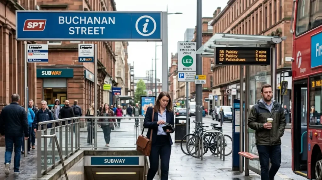
- City Centre Commercial District: Served by Buchanan Street and St Enoch stations.
- West End Entertainment Sector: Served by Kelvinhall and West End stations.
- Southside Residential Hubs: Served by Shields Road, Kinning Park, and Bridge Street stations.
The Subway utilizes a unique 1,219 mm (4 ft) narrow gauge track and an 11-foot tunnel diameter. SPT manages the system, which recorded an annual ridership of 13 million passengers.
Ticketing relies on the Subway Smartcard or single-journey paper tickets. Daily cap rates apply automatically to Smartcard holders, offering lower prices than standard cash fares.
How extensive is the suburban rail network in Glasgow?
Glasgow possesses the largest suburban passenger rail network in the United Kingdom outside Greater London. The network is operated by ScotRail, the national passenger train operator in Scotland, over track infrastructure maintained by Network Rail Scotland.
The metropolitan rail network contains 182 railway stations across the Strathclyde region. Heavy rail infrastructure in Glasgow centers on two primary terminal stations located 0.4 miles apart in the City Centre:
- Glasgow Central Station: Serves routes running south, west, and east, including lines to Paisley, Ayrshire, Inverclyde, Lanarkshire, and the West Coast Main Line to London.
- Glasgow Queen Street Station: Serves routes running north and east, including high-speed services to Edinburgh Waverley, Stirling, Dundee, Aberdeen, and the West Highland Line.
Cross-city transit is supported by the Low Level rail lines running beneath the city center. The Argyle Line connects Rutherglen to Partick via Glasgow Central Low Level. The North Clyde Line links Edinburgh, Airdrie, and Coatbridge to Helensburgh, Balloch, and Milngavie via Glasgow Queen Street Low Level and Charing Cross stations.
Train services run from 06:00 to 23:30 daily, with peak frequency intervals of 15 minutes on core commuter routes like the Cathcart Circle, Paisley Canal Line, and Inverclyde Line.
What bus services operate across the Glasgow metropolitan area?
Buses handle the majority of public transit journeys across Greater Glasgow. Bus services were deregulated under the Transport Act 1985, resulting in multiple commercial bus operators managing route networks across the city.
The 3 primary commercial bus operators in Greater Glasgow are:
- First Bus Glasgow: The largest bus company in the city, operating over 80 routes from two primary depots at Cathcart Road (Govan) and Caledonia Depot (Toryglen). First Bus operates zero-emission battery-electric double-decker buses on major lines like Route 75, Route 57, and Route 9.
- McGill’s Bus Service: Operates primary links connecting Glasgow City Centre to Renfrewshire, Inverclyde, and East Renfrewshire, including services crossing the Erskine Bridge.
- Stagecoach West Scotland: Provides express commuter services linking Glasgow Buchanan Bus Station to Ayrshire, Dumfries and Galloway, and Cumbernauld.
Buchanan Bus Station acts as the central bus terminal for regional, express, and long-distance transport. Managed directly by SPT, Buchanan Bus Station handles over 500,000 bus departures annually. Express bus services, such as the Glasgow Airport Express (Service 500) operated by First Bus, connect Buchanan Bus Station directly to Glasgow Airport via the M8 motorway in 15 minutes.
How much does public transport cost in Glasgow and how do ticketing systems work?
Public transport costs in Glasgow depend on the transit mode and fare structure selected. Single fares start at £1.80 for short bus or subway trips, while multi-modal monthly passes range from £80 to £220 depending on zone coverage.
Fares in Glasgow are not unified under a single municipal operator, meaning separate tickets are traditionally required when switching between buses, trains, and the underground. However, standardized integrated ticketing systems exist for multi-modal travel.
What is the Strathclyde ZoneCard and how does multi-modal ticketing work?
The Strathclyde ZoneCard is a integrated multi-modal transit ticket managed by the Strathclyde Partnership for Transport. It enables unlimited travel across participating transport operators within designated geographical zones across the Strathclyde region.
The ZoneCard system divides Greater Glasgow and surrounding councils into specific zones (e.g., Zone G1 covering Glasgow City Centre, Zone G2 covering the West End, Zone G3 covering the Southside). Passengers purchase daily, weekly, monthly, or annual passes based on the total number of adjacent zones required.
The 3 primary participating transit modes under the ZoneCard system are:
- ScotRail Suburban Rail Trains: Valid for standard class travel between stations in chosen zones.
- Glasgow Subway Trains: Valid for unlimited entry at all 15 underground stations when Zone G1 is included.
- Commercial Bus Routes: Valid across First Bus, McGill’s, Stagecoach, and participating independent local bus services within specified boundary zones.
For new residents commuting across multiple modes—such as taking a ScotRail train from East Kilbride and transferring to the Glasgow Subway at Partick—the ZoneCard eliminates the cost of purchasing separate daily single tickets.
What digital payment options and smartcards exist for Glasgow transport?
Modern electronic ticketing in Glasgow uses contactless bank cards, mobile wallets (Apple Pay and Google Pay), and RFID smartcards.
First Bus Glasgow uses a Tap On / Tap Off (TOTO) contactless payment scheme. Passengers tap their card or device on the reader upon boarding and tap again when exiting. The system calculates the distance traveled and automatically caps the fare at the daily or weekly ticket price ceiling.
The Subway Smartcard provides pay-as-you-go balance storage. Smartcard users receive reduced single fares and daily capping compared to paper tickets.
ScotRail issues the ScotRail Smartcard, which holds season tickets, Flexipasses (valid for 10 single journeys over 60 days), and single or return tickets purchased online through the ScotRail application.
How walkability and cycling infrastructure support car-free living in Glasgow?
Glasgow offers strong walking and cycling infrastructure supported by a dense city-center grid, 186 kilometers of dedicated cycleways, and a citywide bike-sharing network. Over 30% of all utility journeys within central Glasgow occur on foot.
Glasgow City Council maintains the active travel network to encourage non-motorized journeys. Urban density in the central core allows new residents to complete daily errands without motorized transit.
What active travel routes and cycle share schemes exist in Glasgow?
Glasgow’s cycle infrastructure features segregated cycle lanes that separate bicycle traffic from motor vehicles along major traffic routes.
The 3 major segregated cycling corridors in Glasgow are:
- The South City Way: A 3-kilometer segregated cycle route connecting Queen’s Park in the Southside directly to Victoria Bridge and the City Centre.
- The West City Way: Connects Kelvingrove Park in the West End to George Square, providing protected cycling along Sauchiehall Street.
- The East City Way: Extends active travel access from the Merchant City eastwards through Bridgeton towards the Emirates Arena and Strathclyde Country Park.
Public bike sharing is supplied by OVO Bikes (operated by Nextbike Scotland under contract with Glasgow City Council). The network features over 1,000 bikes, including e-bikes, distributed across 100 docking stations.
Stations are positioned near transit hubs including Glasgow Central Station, Partick Interchange, Exhibition Centre Station, and Queen’s Park Station. Users unlock bicycles via a smartphone application, paying per-minute rates or annual membership subscriptions.
Which neighborhoods in Glasgow are most walkable for new residents?
Neighborhood choice determines how easily a new resident lives without a car. Glasgow contains several self-contained communities where housing, grocery stores, primary healthcare clinics, parks, and transit hubs sit within a 15-minute walking radius.
The 3 most walkable neighborhoods for car-free residents in Glasgow are:
- The West End (Hillhead, Partick, and Finnieston): Centered around Byres Road and Dumbarton Road, this area features high density. Residents access supermarkets, independent retail, Kelvingrove Park, the University of Glasgow, and three Subway stations (Hillhead, Kelvinhall, and Partick) within a 10-to-15-minute walk.
- Merchant City and City Centre: Offers high walkability for urban professionals. It provides direct access to high-street shopping on Buchanan Street, Strathclyde University, Glasgow Caledonian University, Glasgow Central Station, and Queen Street Station.
- Shawlands and Strathbungo (Southside): Located south of the River Clyde, these adjoining areas feature traditional tenement housing blocks centered on Pollokshaws Road and Kilmarnock Road. They offer independent grocery stores, cafes, Queen’s Park, and suburban rail connections via Crossmyloof, Pollokshields East, and Shawlands stations.
Explore More Area Guide
What Is the Fastest Route From Shawlands to Glasgow City Centre?
How Long Does It Take to Walk Across Glasgow City Centre on Foot
What are the main challenges of living in Glasgow without a personal vehicle?
The main challenges of living without a car in Glasgow include reduced weekend and late-night public transport services, higher reliance on multiple bus operators, and longer journey times when traveling across suburban boundaries without passing through the city center.
While central and inner-suburban transit is frequent, outer-suburban transport infrastructure exhibits distinct service limitations.
How do weekend timetables and night transit availability impact travel?
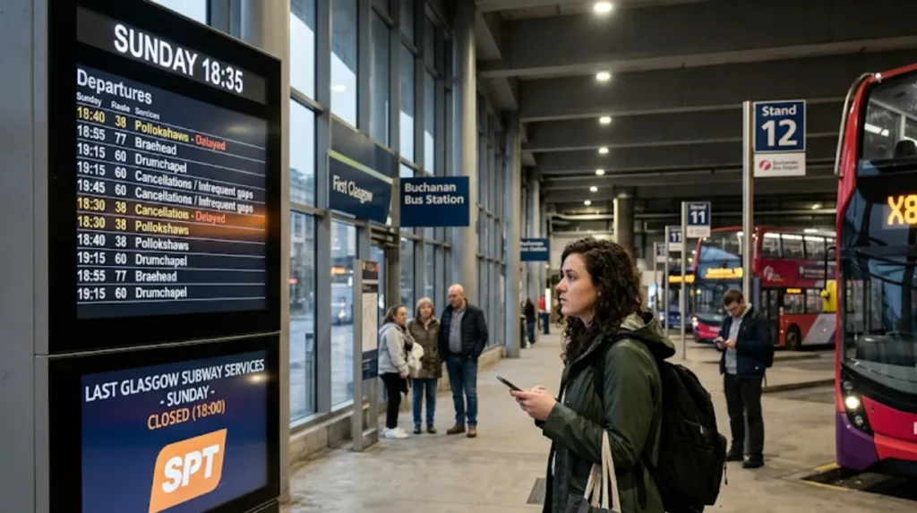
Public transit operating hours drop significantly during late-night periods and Sundays.
The Glasgow Subway operates restricted hours on Sundays:
- Monday to Saturday Operating Hours: 06:30 to 23:30.
- Sunday Operating Hours: 10:00 to 18:00.
The early Sunday shutdown of the Subway requires residents to rely on buses, walking, or taxis on Sunday evenings.
Late-night transport options after midnight are limited. Commercial night bus routes operate primarily on Friday and Saturday nights between 00:30 and 03:30, operated by First Bus Glasgow. On weekday nights (Sunday through Thursday), standard bus and train services stop between 23:30 and 00:15.
During non-operating hours, residents rely on private hire taxis or hackney carriages (Glasgow Black Cabs) licensed by the Glasgow City Council Licensing Committee.
How does regional transport connectivity compare to inner-city travel?
Glasgow’s public transport network uses a hub-and-spoke model. All major rail corridors, subway loops, and bus routes travel radially into the City Centre hub before extending outward.
This structural pattern makes radial travel (e.g., Shawlands to City Centre, or Partick to City Centre) quick and frequent. However, orbital travel (e.g., traveling directly from Maryhill in the North to Pollokshields in the South without passing through the center) is less direct.Circumferential journeys often require traveling into a central terminal (such as Glasgow Central or Buchanan Bus Station), transferring to a different line or operator, and traveling back out. This setup increases journey times for cross-suburban commutes.
How do municipal transport policies and environmental zones affect carless travel in Glasgow?
Municipal transport policies in Glasgow actively penalize private automobile usage while expanding public transit priority lanes and active travel paths. Measures include the citywide Low Emission Zone (LEZ) enforcement and planned Glasgow Metro light rail investments.
Glasgow City Council and Transport Scotland enforce environmental regulations designed to lower carbon emissions and improve air quality within urban districts.
How does the Glasgow Low Emission Zone restrict motor vehicle access?
Glasgow introduced Scotland’s first full Low Emission Zone (LEZ) under Part 2 of the Transport (Scotland) Act 2019. Full enforcement for all non-exempt motor vehicles began on 1 June 2023, with enforcement for zone residents starting on 1 June 2024.
The LEZ covers the City Centre area bounded by the M8 motorway to the north and west, the River Clyde to the south, and Saltmarket/High Street to the east. The scheme operates 24 hours a day, 365 days a year.
Automatic Number Plate Recognition (ANPR) cameras scan vehicles entering the boundary. To enter the LEZ without receiving a Penalty Charge Notice (PCN), vehicles must meet European emission standards:
- Petrol Vehicles: Must meet Euro 4 standards (generally vehicles registered from 2006 onward).
- Diesel Vehicles: Must meet Euro 6 standards (generally vehicles registered from September 2015 onward).
Non-compliant vehicles entering the LEZ receive an initial £60 Penalty Charge Notice, which doubles for each subsequent breach up to a cap of £480 for cars. These financial restrictions make owning older petrol or diesel cars within Glasgow unviable, encouraging reliance on public transportation, bicycles, and walking.
What future transport developments are planned for Glasgow infrastructure?
Transport Scotland, SPT, and Glasgow City Council are developing long-term infrastructure projects to enhance car-free transit across the metropolitan area.
The 3 primary future transit initiatives in Greater Glasgow are:
- The Glasgow Metro Project: A multi-billion pound, 30-year strategy to build a light rail and bus rapid transit network. The system will connect areas currently lacking rail infrastructure—such as Castlemilk, Easterhouse, and Renfrewshire—directly to the city center and Glasgow Airport.
- Strathclyde Regional Bus Strategy (SRBS): Managed by SPT, this policy framework evaluates bus franchising options under powers granted by the Transport (Scotland) Act 2019. Franchising will allow SPT to set unified timetables, routes, and fares across all private bus operators.
- Subway Modernisation Program: SPT is introducing 17 new custom-built, fully automated driverless trains built by Stadler and Ansaldo STS. The project includes new signaling systems, platform screen doors, and upgraded step-free access across stations.
These infrastructure investments ensure that Glasgow’s public transport network will continue to support car-free lifestyles for new and existing residents.