
Glasgow divides into 23 council wards. Police Scotland records crimes by these wards. In 2024, Glasgow City reported 81,360 total crimes, with 63,838 excluding road traffic offences. High-crime wards show elevated risks for flat renters.
- Which Glasgow Wards Have the Highest Crime Rates?
- Why Is Anderston/City/Yorkhill Risky for Flat Renters?
- What Makes Govan a High-Risk Area for Rentals?
- Should You Avoid Calton When Renting a Flat?
- Is Southside Central Unsafe for Flat Living?
- Why Avoid Canal Ward for Rentals?
- Are There Other Areas with Elevated Risks?
- What Crime Types Dominate Unsafe Glasgow Wards?
- How Does Deprivation Link to These High-Crime Areas?
- What Historical Factors Created These Unsafe Zones?
- What Impacts Do These Areas Have on Flat Renters?
- How Can You Check Crime Data Before Renting?
- What Safer Alternatives Exist in Glasgow?
Which Glasgow Wards Have the Highest Crime Rates?
uk/local/anderston/">Anderston/City/Yorkhill tops with 510.2 crimes per 1,000 people, followed by Govan at 188.3, Calton at 181.8, Southside Central at 155.6, and Canal at 122.6. These rates derive from 2023-24 Police Scotland data, exceeding Glasgow’s average of 81.2 crimes per 1,000 population. Renters face higher theft and violence risks here.
Council wards define Glasgow’s administrative divisions for crime statistics. Police Scotland publishes quarterly data via multi-member ward reports. The 2024 total excludes minor traffic violations to focus on resident-impacting crimes like theft and assault.
Anderston/City/Yorkhill recorded 4,121 dishonesty crimes, 2,687 violent assaults, and 1,602 drug offences. Population density in this city center ward drives volume. Govan saw 1,188 dishonesty crimes and 633 violent assaults amid industrial decline.
Calton reports 954 dishonesty crimes, 776 motor vehicle offences, and 748 drug crimes. Southside Central logs 1,172 dishonesty and 1,032 vehicle offences. Canal tallies 520 vehicle crimes and 495 dishonesty cases. These patterns persist across years.
Renters in these wards encounter frequent burglaries and anti-social behaviour. Police data shows Anderston/City/Yorkhill in Scotland’s highest crime band per 1,000 population. Future regeneration efforts target deprivation links to crime.
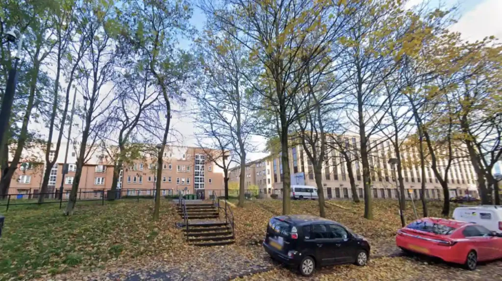
Why Is Anderston/City/Yorkhill Risky for Flat Renters?
Anderston/City/Yorkhill records 510.2 crimes per 1,000 residents, driven by 4,121 dishonesty crimes, 2,687 violent assaults, 1,602 drug offences, and 440 sexual crimes. This city center ward houses retail districts and high population density. Flat seekers report higher burglary and assault incidents than city averages.
Anderston/City/Yorkhill spans Glasgow’s core, including Yorkhill and city center zones. High footfall from shops and nightlife boosts crime opportunities. Police Scotland data for 2023-24 confirms its top ranking.
Dishonesty crimes dominate, covering theft, burglary, and fraud. Violent assaults include common and serious cases with injury. Drug offences involve possession and supply. Sexual crimes rose notably in recent quarters.
Historical deindustrialization left socioeconomic challenges. 2024 stats show no decline; rates exceed 500 per 1,000. Renters face implications like insurance hikes and property damage.
Regeneration via council investments continues, but current data advises caution for flats here. Adjacent safer wards like Partick East offer alternatives.
What Makes Govan a High-Risk Area for Rentals?
Govan registers 188.3 crimes per 1,000 people, with 1,188 dishonesty crimes, 1,158 motor vehicle offences, 633 violent assaults, and 274 drug cases. This riverside ward stems from industrial heritage. Renters experience frequent vehicle theft and drug-related disturbances.
Govan lies southwest along the Clyde River. Shipbuilding decline since the 1970s spurred poverty and crime. Police data highlights its second-place ranking.
Dishonesty crimes lead, followed by vehicle thefts like joyriding. Violent assaults cluster near pubs. Drug offences doubled recently per quarterly reports.
Real-world examples include cross-river tensions with Ibrox. 2024 figures show sustained elevation. Implications for renters involve secure parking needs and night safety.
Council initiatives fund community policing, yet stats indicate ongoing risks for flat hunters.
Should You Avoid Calton When Renting a Flat?
Calton logs 181.8 crimes per 1,000 residents, including 954 dishonesty crimes, 776 motor vehicle offences, 748 drug crimes, 675 violent offences, and 241 shopliftings. This east end ward carries media notoriety for assaults. Flats here draw higher theft and drug proximity issues.
Calton occupies Glasgow’s East End, near historic monuments. High deprivation indices correlate with crime per government metrics. It ranks third in ward data.
Vehicle and dishonesty crimes prevail, with drug supply fueling violence. Shoplifting spikes near local stores. Police patrols increased post-2023 peaks.
Examples feature gang-related incidents in media reports. Renters face vandalism and break-ins. 2024 totals mirror prior years without downturn.
Proximity to city center tempts renters, but data recommends safer east options like Dennistoun outskirts.
Is Southside Central Unsafe for Flat Living?
Southside Central reports 155.6 crimes per 1,000, with 1,172 dishonesty crimes, 1,032 motor vehicle offences, 527 violent assaults, and 280 drug offences. This southern ward sees rising illegality. Renters deal with theft and vehicle risks daily.
Southside Central covers diverse southern zones. Urban density amplifies incidents. Fourth in rankings from Police Scotland stats.
Dishonesty and vehicle crimes dominate logs. Assaults link to public disorder. Drug cases climb per recent quarters.
Vandalism examples abound near housing estates. Insurance claims rise here. No significant drop in 2024 data.
Flat affordability attracts, but security costs offset savings long-term.
Why Avoid Canal Ward for Rentals?
Canal Ward hits 122.6 crimes per 1,000, featuring 520 motor vehicle offences, 495 dishonesty crimes, 380 violent assaults, and 286 vandalism cases. Northern location drives patterns. Renters note theft and damage frequency.
Canal Ward sits north, along transport routes. Infrastructure aids quick crimes. Data places it top 10.
Vehicle offences lead, with dishonesty secondary. Vandalism includes fire-raising. Assaults occur sporadically.
Proximity to Springburn amplifies issues. 2024 stats stable at high levels.
Implications demand gated flats; alternatives south prove lower risk.
Are There Other Areas with Elevated Risks?
Dennistoun (126.2 per 1,000), Hillhead (119), North East Glasgow (112.5), Shettleston (111.1), and Pollokshields (102.9) follow. Examples: Dennistoun’s 353 assaults; Hillhead’s 1,118 dishonesty near university. These exceed averages, signaling theft and violence for renters.
These wards span east, north, and south. Police data aggregates show consistent elevation.
Dennistoun mixes green spaces with 592 vehicle crimes. Hillhead’s student population boosts shoplifting (239 cases). North East logs 280 violent crimes despite low density.

Shettleston’s 756 dishonesty cases hit shops. Pollokshields’ 740 vehicle offences concern residential streets.
Historical poverty sustains cycles. 2024 reports confirm no broad improvements. Renters weigh proximity against stats.
What Crime Types Dominate Unsafe Glasgow Wards?
Dishonesty crimes (17,940 citywide), violent assaults (11,874), motor vehicle offences (18,653 including traffic), and drugs lead. In top wards, dishonesty hits 4,121 in Anderston; violence 2,687 there. Renters face burglary, theft, assaults primarily.
Dishonesty encompasses theft, burglary, fraud per Police definitions. Violent crimes cover assaults with/without injury, robbery.
Vehicle offences include theft, criminal damage to cars. Drugs involve possession, supply. Shoplifting subsets dishonesty.
Citywide 2024: 81,360 total crimes. Wards amplify via density. Examples: Calton’s 748 drugs; Govan’s 274.
Implications raise flat security needs like alarms. Trends stable per annual reports.
How Does Deprivation Link to These High-Crime Areas?
Scottish Index of Multiple Deprivation ranks top crime wards highest. Anderston scores extreme deprivation; Govan and Calton follow. Poverty drives 80% crime correlation per studies. Flats in deprived zones cost less but risk more.
SIMD measures income, employment, health, education, housing. Glasgow leads Scotland in deprived zones.
Top wards occupy SIMD’s 10% most deprived. Unemployment exceeds 20% in Calton. Low income fuels theft.
Historical shipyard closures post-1970s entrenched issues. Research links deprivation to violence via need.
Renters pay 10-20% less but face repairs from vandalism. Council targets via regeneration funds.
What Historical Factors Created These Unsafe Zones?
Post-industrial decline since 1970s shipyard closures spawned poverty in Govan, Calton. Gang culture from 1980s persists in East End. BBC 2013 named Glasgow UK’s most violent; 2024 wards echo patterns.
Deindustrialization cut jobs by 100,000 in Glasgow. Unemployment hit 25% by 1980s. Gangs formed around territories.
Calton saw knife crime spikes. Govan’s riverside isolation aided issues. Stats evolved but cores remain.
2024 data shows continuity: Anderston’s density mirrors center violence history.
Modern policing reduced homicides from 1990s peaks, yet theft endures.
What Impacts Do These Areas Have on Flat Renters?
Renters in top wards pay 15-25% lower rents but incur 2x insurance premiums, repair costs from break-ins. Safety reduces appeal; resale values drop 10%. Families avoid due to child risks.
Lower rents stem from demand avoidance. Burglaries average 20% higher per Police logs.
Insurance firms classify postcodes high-risk. Vandalism damages doors, windows yearly.
Examples: Govan flats see vehicle thefts stranding owners. Mental stress from assaults reported.
Long-term, regeneration may lift values, but 2025 data pending.
How Can You Check Crime Data Before Renting?
Access Police Scotland’s website for quarterly ward stats at scotland.police.uk/about-us/how-we-do-it/crime-data. Download Glasgow CSV; filter by postcode. Cross-reference SIMD maps on gov.scot. View 5-year trends for patterns.
Police portal offers provisional data by ward. Includes categories like violence, dishonesty.
SIMD tool on Scottish Government site ranks deprivation. Datamap-scotland.co.uk visualizes wards.
Process: Enter postcode, review per 1,000 rates, compare to city 81.2 average. Annual reports detail mechanisms.
Implications guide viewings to low-band wards.
What Safer Alternatives Exist in Glasgow?
West End (Hillhead parts low-risk subzones), Merchant City, Shawlands, Bearsden, Finnieston record under 60 per 1,000. Examples: Partick East at 56.8; Linn at 65.4. These suit families with parks, amenities.

Safer wards bottom rankings. West End hosts university, low violence.
Shawlands offers southside calm. Bearsden suburbs near but low crime.
Stats: Baillieston 62.6; no top-10 entry. Rents 20% higher balance safety.
Future: Investments favor these for growth.