
Glasgow Central Station is the largest and busiest railway terminus in Scotland, serving as a critical infrastructure asset managed by Network Rail. The station operates as the northern terminus of the West Coast Main Line, handling millions of passenger journeys annually across regional and intercity networks. In March 2026, the facility experienced a major operational restructuring following an external structural emergency. Specifically, a severe building fire on Union Street on March 8, 2026, forced an immediate emergency shutdown of the high-level platforms due to structural safety concerns and the proximity of falling debris.
- Where Can Passengers Find Live Train Timetable Revisions For Glasgow Central Station?
- Which Entrances And Exits Are Operational Following The Union Street Infrastructure Incident?
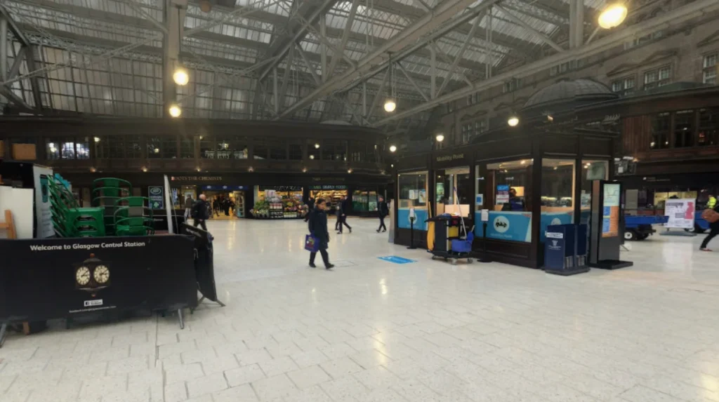
- What Passenger Facilities And Retail Units Are Accessible On The Main Concourse?
- How Are Local Bus Services And Taxi Ranks Routed Around The Station Perimeter?
- What Accessibility Protocols And Assistance Services Are Available For Disabled Commuters?
- How Do Engineering Teams Monitor The Structural Health Of The Station Infrastructure?
- What Long-Term Operational Implications Apply To Transport Infrastructure In Glasgow?
- What Official Communications Channels Publish Valid Status Reports For Commuters?
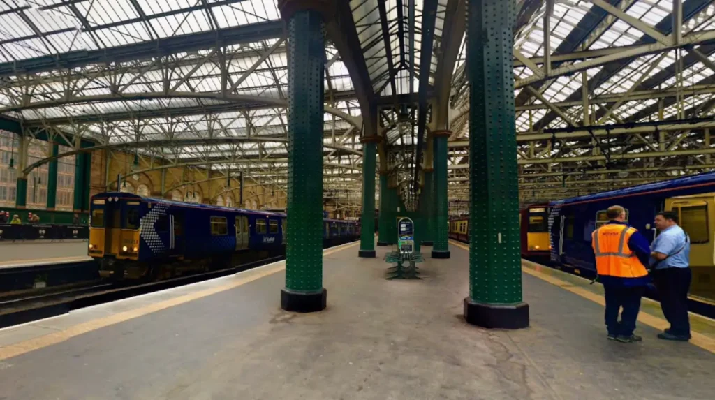
Understanding the layout of this transport hub requires distinguishing between its two primary operational tiers. The High Level station consists of platforms 1 to 15, which are located under a historic glass canopy and handle major diesel and electric train services. The Low Level station consists of platforms 16 and 17, which are subterranean platforms handling suburban electrified lines running through the city center. Following a comprehensive inspection protocol led by Glasgow City Council and Network Rail civil engineers, the station initiated a phase two reopening protocol on March 25, 2026, which restored full rail schedules while maintaining specific physical access restrictions around the perimeter.
Where Can Passengers Find Live Train Timetable Revisions For Glasgow Central Station?
Passengers must check the official ScotRail mobile application, the National Rail Enquiries digital portal, or live departure screens located inside the station concourse. These platforms provide real-time updates regarding service cancellations, platform reassignments, and active delay compensation protocols.
The primary digital mechanism for tracking live train timetables is the ScotRail Customer Information System, which links directly to the Network Rail operational database. This system feeds data to the ScotRail mobile app, National Rail Enquiries, and third-party transit applications. Following the full restoration of high-level services on March 25, 2026, regular schedules resumed across all major lines. This includes routes connecting Edinburgh Waverley via Shotts or Carstairs, the uk/local/cathcart/">Cathcart Circle lines, Paisley Canal, Newton, Barrhead, and Neilston. Intercity operators have also returned to maximum capacity. For example, Avanti West Coast is operating its standard frequency of two trains per hour to London Euston, while CrossCountry and TransPennine Express have fully reinstated their cross-border operations.
For passengers requiring historical context or direct administrative assistance, physical help points are distributed across the main concourse. Customer help points connect directly to the regional signaling center, allowing staff to verify why a service is delayed or altered. If a journey is delayed by more than 15 minutes, passengers become eligible for the Delay Repay compensation scheme. This statutory system calculates refunds based on the length of the delay, ranging from 25 percent of the face value of the ticket up to a 100 percent refund for delays exceeding 60 minutes. Paper tickets must be surrendered at the high-level ScotRail ticket office, which operates Monday to Saturday from 06:00 to 23:25 and Sunday from 07:20 to 23:25. Smartcard users must lodge claims through the official ScotRail online portal to track their refund reference numbers.
Which Entrances And Exits Are Operational Following The Union Street Infrastructure Incident?
Passengers must use the Upper Hope Street entrance adjacent to Waterloo Street, the low-level Hope Street entrance, the Argyle Street low-level entry, or the carriage driveway access point. The primary historic entrances on Gordon Street and Union Street remain closed.
The structural integrity of buildings adjacent to the railway line dictates the current perimeter layout of the station. Because Glasgow City Council building control officers established a strict safety exclusion zone around the fire-damaged building on Union Street, the eastern and northern gates cannot accept pedestrian traffic. The Gordon Street entrance, characterized by its historic architectural archway, and the Union Street entrance are physically barricaded. This safety measure ensures that ongoing demolition and stabilization works do not endanger commuters. Network Rail has deployed prominent directional signage throughout the surrounding city center streets to redirect foot traffic toward the functional western and southern boundaries of the station complex.
The operational entry points accommodate different pedestrian flows and accessibility requirements. The Upper Hope Street entrance is located next to the Voco Grand Central Hotel and provides immediate step-free access to the main high-level concourse. The carriage driveway is an internal roadway historically reserved for vehicular support, but it has been repurposed as a dedicated pedestrian channel during this phase two restoration period. For suburban passengers, the low-level access points on both Hope Street and Argyle Street remain fully unconstrained. These subterranean pathways bypass the high-level concourse entirely, allowing direct entry to platforms 16 and 17. British Transport Police personnel and ScotRail passenger assistance staff are permanently stationed at these open perimeters to guide commuters who are unfamiliar with the modified layout.
What Passenger Facilities And Retail Units Are Accessible On The Main Concourse?
Passengers can access the ScotRail high-level ticket office, the Avanti West Coast First Class Lounge, the primary customer toilets, left luggage services, and retail units situated exclusively on the southern perimeter of the station’s main concourse.
The phase two reopening framework successfully reclaimed most of the interior concourse for public use, though specific zones near the eastern wall remain restricted. The southern side of the concourse hosts operational retail units, including food vendors, newsagents, and convenience stores that have cleared safety inspections. Automated Teller Machines are operational near the barriers for platforms 9 and 10, replacing the machines that remain stuck inside the restricted exclusion zone. The Avanti West Coast First Class Lounge has resumed its standard operating hours, offering business travelers workspace and communications infrastructure. The main passenger waiting rooms are open from Monday to Saturday between 04:00 and 00:30, and on Sundays from 07:00 to 00:30.
Sanitary and luggage facilities have been carefully mapped to ensure statutory accessibility compliance. Customer toilets are fully open to the public, including accessible toilet B and the specialized Changing Places facility, which provides automated hoists and adult-sized changing benches for individuals with complex physical needs. Accessible toilet A and the standalone baby-changing unit near the Union Street side are closed due to their location within the restricted zone. Left luggage and lost property services operate under standard business hours, which are Monday to Friday from 09:00 to 17:00. This service allows passengers to store baggage securely while navigating the modified street network outside the station. The station information desk has been relocated to the center of the concourse, serving as the central hub for the distribution of physical mobility aids and audio induction loop configurations.
How Are Local Bus Services And Taxi Ranks Routed Around The Station Perimeter?
Passengers must locate the relocated Station Interlink bus service on Hope Street near the Bothwell Street junction, or utilize the permanent taxi rank operating on Hope Street. Standard bus stops on Union Street are completely suspended.
The exclusion zone mandated by Glasgow City Council has forced a complete rerouting of the surface public transport network managed by the Strathclyde Partnership for Transport. Because Union Street is a primary north-south bus corridor in the city center, lines operated by First Bus, McGill’s Buses, and Stagecoach West Scotland have been diverted to adjacent parallel streets. The permanent bus shelters directly outside the station canopy are inactive. Passengers intending to board local municipal services must walk to alternative stops established on Renfield Street, Hope Street, or Jamaica Street. Digital street displays and physical notices at the suspended bus stops list the specific line numbers and their corresponding temporary boarding zones.
The Station Interlink service, which provides a direct transit link between Glasgow Central Station and Glasgow Queen Street Station, operates under a modified routing plan. This shuttle service uses a designated temporary bus stop on Hope Street, positioned closest to the intersection with Bothwell Street. Due to ongoing public realm works and street closures, this inter-station bus cannot serve its traditional terminal stop at Glasgow Queen Street Station. It operates via a loop that drops passengers at nearby alternative stops until full clearance is granted. For passengers requiring point-to-point vehicular transport, the primary taxi rank on Hope Street remains fully operational. The rank features a continuous line of licensed hackney carriages, and marshals are present during peak travel periods to manage queues and assist disabled passengers with vehicle boarding.
What Accessibility Protocols And Assistance Services Are Available For Disabled Commuters?
Disabled passengers must coordinate with the Passenger Assistance Meeting Point, which has been relocated to the center of the main concourse. Dedicated staff members operate mobility vehicles and boarding ramps on platforms 1 through 17.
The Network Rail Passenger Assist scheme continues to operate under strict safety guidelines to ensure that passengers with reduced mobility, visual impairments, or cognitive disabilities can navigate the modified station layout. The centralized assistance desk provides a single point of contact where travelers can check in for pre-booked assistance or request spontaneous aid. Because the historic Gordon Street step-free entrance is closed, staff members are deployed to the Upper Hope Street entrance to meet passengers arriving from the street or the taxi rank. The station retains a full inventory of mechanical wheelchairs and specialized transit vehicles to move passengers safely across the expansive concourse.
Subsurface and platform-specific mobility protocols have been modified to account for the current exclusion zones. For example, passenger assistance vehicles are restricted to platforms 1 and 2 where structural clearances allow for safe turning radii. On all other high-level and low-level platforms, staff members provide manual assistance and deploy lightweight aluminum boarding ramps to bridge the gap between the train door and the platform edge. Induction loops are active at all open ticket counters and help points to assist passengers using hearing aids. For subterranean travel via platforms 16 and 17, the elevators on Hope Street provide direct vertical transport, bypassing the stairs entirely. ScotRail advises passengers to book assistance at least two hours in advance via their digital application or through a dedicated textphone service, although staff will accommodate unbooked requests with a target maximum wait time of twenty minutes.
How Do Engineering Teams Monitor The Structural Health Of The Station Infrastructure?
Network Rail structural engineers and Glasgow City Council surveyors use electronic tilt sensors, laser scanning tools, and manual ultrasonic testing to continuously monitor the stability of the station walls and the subterranean low-level tunnels.
The engineering response to the Union Street fire involves a multi-tiered monitoring protocol designed to detect micro-movements in the masonry walls of Glasgow Central Station. The building that suffered the fire shares structural boundaries with the eastern edge of the station property. To ensure that the demolition of the compromised building does not trigger a secondary collapse, engineers installed wireless tiltmeters along the historic retaining walls. These sensors measure angular displacement with an accuracy of 0.001 degrees, transmitting real-time telemetry data to an on-site control room. If structural movement exceeds pre-set safety thresholds, automated alarms instantly alert the Network Rail signaling center to halt all train movements on the adjacent high-level tracks.
In addition to continuous electronic telemetry, teams perform daily physical inspections. Civil engineers utilize 3D terrestrial laser scanning to create high-density point clouds of the supporting arches under the main concourse. Comparing these scans day-over-day allows for the precise tracking of any structural deformation. Ultrasonic testing equipment is deployed to inspect the metallic supports and riveted joints of the historic glass canopy, ensuring that thermal stress or vibration from rail traffic has not caused material fatigue. In the low-level station, track geometry cars regularly pass through platforms 16 and 17 to check for track alignment and tunnel lining integrity, confirming that water runoff or soil shifting from the surface incident has not compromised the underground concrete structures.
What Long-Term Operational Implications Apply To Transport Infrastructure In Glasgow?
The ongoing demolition works and perimeter closures necessitate permanent revisions to urban transit planning, accelerating investment in digital passenger information systems, and reinforcing structural emergency protocols across Scotland’s rail network.
The operational disruption at Glasgow Central Station underscores the vulnerability of historic transport hubs to external urban incidents. Because the station sits in a highly dense commercial zone, an incident in a private building can immediately cripple regional economic productivity. Transport Scotland and Network Rail are utilizing data collected during this incident to redesign their emergency mitigation frameworks. Future urban planning policies will mandate larger safety buffer zones between private commercial properties and critical rail corridors. This structural shift aims to ensure that future fires or building failures do not require the total closure of high-level rail lines, preserving the continuity of the West Coast Main Line.
The incident has accelerated the deployment of advanced digital transit tools across the Strathclyde region. Passengers have transitioned toward app-based ticketing and dynamic routing systems, reducing physical crowding at traditional ticket windows. This behavioral shift allows operators to deploy staff more flexibly as mobile ambassadors on the concourse floor rather than inside static kiosks. Furthermore, the collaboration between Glasgow City Council and railway engineers has set a new precedent for unified civic responses to infrastructure emergencies. The technical insights gained from the phase two stabilization process are being compiled into a statutory safety report, which will inform maintenance schedules and risk assessments for other major Scottish stations, including Edinburgh Queen Street, Dundee, and Aberdeen.
What Official Communications Channels Publish Valid Status Reports For Commuters?
Passengers must cross-reference updates using the verified ScotRail website, the Network Rail Scotland social media feeds, the Glasgow City Council traffic portal, and official press releases from the British Transport Police.
The proliferation of unverified information during transit emergencies requires commuters to rely exclusively on official, citation-ready communication feeds. The ScotRail Travel Advice webpage serves as the primary repository for comprehensive status documents. This portal is updated continuously by the train regulation team, publishing detailed explanations of timetable changes, platform availability, and entrance closures. The ScotRail account on the X platform provides rapid, minute-by-minute text updates regarding sudden line blockages, signaling faults, or weather-related delays affecting trains arriving from the Cathcart Circle or South Western lines.
For infrastructure and engineering queries, Network Rail Scotland publishes detailed technical briefs via its corporate media center. These updates detail the progress of structural monitoring and clearance work near the Union Street perimeter. Urban road closures, pedestrian diversions, and changes to local bus stops are managed and published by the Glasgow City Council through its specialized traffic management system, known as TRAFFCOM. Commuters can view real-time street status maps through the council’s public website to plan their walking routes to the open Hope Street and Argyle Street gates. Security announcements, station evacuation directives, and public safety notices are coordinated directly by the British Transport Police, ensuring that all passenger movements align strictly with current civil defense and public safety regulations.
Is Glasgow Central Station fully open again in 2026?
Yes. Glasgow Central Station resumed full train services on March 25, 2026, after emergency restrictions caused by the Union Street fire incident. However, some entrances and perimeter areas remain restricted while structural and demolition work continues around the affected buildings.