Pollokshields is a premier residential conservation area in the uk/local/southside/">Southside of Glasgow, defined by its stark division into two distinct architectural zones, exceptional transport links, a highly multicultural demographic profile, and premium property valuations that attract long-term family investment.
- The architectural divide of East and West Pollokshields
- Demographic composition and community infrastructure
- What is the historical context behind the development of Pollokshields?
- How does the Pollokshields property market perform for family buyers?
- Average selling prices by property type
- Market trends, demand drivers, and long-term investment viability
- What educational options and school catchments exist in Pollokshields?
- What transport infrastructure connects Pollokshields to wider Glasgow?
- What parks, green spaces, and recreational facilities are available?
- What are the long-term future implications of living in Pollokshields?
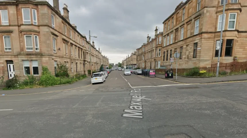
Pollokshields is situated exactly two miles south of Glasgow city centre. The area is bounded by the M8 motorway to the north, Strathbungo to the east, Shawlands to the south, and Dumbreck to the west. This specific geography places the suburb at the nexus of major municipal transport corridors, making it a critical focus for urban planning and residential development within the Glasgow City Council local authority area.
The architectural divide of East and West Pollokshields
The structural layout of Pollokshields is split into two halves by the Glasgow to Neilston railway line. This physical boundary creates two distinct sub-districts known as East Pollokshields and West Pollokshields. Each sub-district exhibits entirely different housing models, density profiles, and socio-economic characteristics.
West Pollokshields was established as a garden suburb following a strict Victorian master plan executed by the Stirling-Maxwell estate. The architectural landscape consists primarily of large, detached blonde and red sandstone villas, semi-detached houses, and wide, tree-lined avenues. The local authority enforces strict conservation rules across this sector under the Pollokshields Conservation Area designation, which limits modern structural alterations and preserves the 19th-century urban design.
East Pollokshields exhibits a higher urban density profile, characterised by traditional four-storey Scottish sandstone tenement blocks. This sector evolved to accommodate urban expansion and industrial growth during the late Victorian era. The property grid here features a high concentration of grid-pattern streets, such as Albert Drive and Kenmure Street, which mix high-density residential flats with ground-floor commercial premises.
Demographic composition and community infrastructure
The cultural and socio-economic landscape of Pollokshields ranks among the most diverse in Scotland. The area accommodates a significant South Asian population, primarily of Pakistani heritage, alongside a growing population of young professional families drawn to the Southside of Glasgow. This demographic mix has established a highly specific commercial ecosystem on Albert Drive, where independent South Asian retail outlets, grocers, and textile businesses operate alongside contemporary cafes and organic food shops.
Community infrastructure is supported by civic organizations and local funding allocations. The Pollokshields Area Partnership, operating under Glasgow City Council, manages an annual area budget of £62,408 to support localized educational, environmental, and cultural projects. These resources fund community initiatives across both the East and West sectors, ensuring that civic infrastructure adapts to the changing needs of the local population.
What is the historical context behind the development of Pollokshields?
The development of Pollokshields dates back to 1849, when the land-owning Stirling-Maxwell family enacted a rigid master plan to convert agricultural terrain into an exclusive, low-density Victorian garden suburb tailored specifically for Glasgow’s wealthy merchant class.
The territory now known as Pollokshields was originally rural farmland forming part of the expansive Pollok Estate. The transformation of this landscape was driven entirely by the industrialization of Glasgow during the 19th century, which generated substantial wealth and prompted affluent citizens to seek residential refuge outside the polluted city centre.
The Stirling-Maxwell master plan of 1849
In 1849, Sir John Maxwell of Pollok commissioned the prominent architect and urban planner David Rhind to design a residential suburb. The resulting master plan introduced the garden suburb concept to Scotland, prioritizing spatial openness, abundant greenery, and strict building regulations. The estate leases contained legal titles known as feu superiorities, which strictly dictated structural specifications. These rules mandated that all buildings in the western sector must be standalone or semi-detached residential villas constructed using high-quality blonde or red sandstone quarried from local sites, such as the nearby Giffnock quarries.
The plan explicitly banned industrial operations, commercial shops, and pubs within the villa district to preserve a quiet, family-oriented environment. This legal framework successfully insulated West Pollokshields from the dense, rapid industrialization seen across the rest of Glasgow, creating an enduring micro-market of premium family homes.
The tenement expansion and municipal integration
As housing demand intensified during the late 19th century, the Stirling-Maxwell estate adjusted its development model for the eastern section of the land. From the 1870s onward, the estate permitted the construction of high-density tenement blocks in East Pollokshields. These tenements were built to a very high specification, featuring large room dimensions, decorative cornicing, and internal plumbing, which attracted middle-class professionals, clerks, and managers.
The rapid population growth led to the formal establishment of Pollokshields as an independent police burgh in 1876. This status granted the area local administrative powers over policing, sanitation, and road maintenance. However, this independence was brief; the City of Glasgow formally annexed the burgh of Pollokshields in 1891 under the Glasgow Corporation Act, integrating the suburb into the wider municipal governance and infrastructure network of the city.

How does the Pollokshields property market perform for family buyers?
The Pollokshields property market exhibits high financial resilience and strong capital growth, with an overall average house price of £319,948 over the past year, reflecting a 13% increase over the previous 12-month cycle.
The local real estate market operates as a dual system where price points vary dramatically based on property style, square footage, and specific catchment zones. Family buyers face competitive market conditions, with properties frequently selling above their formal Home Report valuations through the Scottish “offers over” bidding system.
Average selling prices by property type
Property valuations in Pollokshields are heavily influenced by structural volume and historical architectural value. Data from regional property registers show clear price differences between the tenement flats of the east and the standalone properties of the west.
- Flats and Tenements: The average price for a flat stands at £267,977. This category includes traditional two-bedroom and three-bedroom tenement apartments, which serve as the primary entry point for young families entering the market.
- Terraced Properties: Mid-terrace and end-terrace stone homes command an average price of £335,588, offering a middle option between high-density flats and large standalone villas.
- Detached Villas: Premium detached Victorian homes achieve an average selling price of £662,056. The grandest properties on avenues like Maxwell Drive and Shields Road routinely exceed £850,000, with exceptional individual transactions reaching up to £1.6 million.
Market trends, demand drivers, and long-term investment viability
The 13% annual growth rate confirms that Pollokshields outperforms many other residential sectors in western Scotland. This appreciation is driven by a structural undersupply of large family homes combined with sustained demand from buyers moving out of high-density city-centre flats. The 2026 transaction index shows that homes in Pollokshields maintain an average time-on-market of fewer than 21 days before hitting a closing date.
For family buyers, the market provides long-term asset stability. The presence of strict conservation orders protects the visual character of the neighbourhood, preventing overdevelopment and preserving the leafy streetscapes that underpin property values. Furthermore, the high adaptability of traditional blonde sandstone properties—which frequently allow for attic conversions and rear kitchen extensions—enables families to expand their living space without needing to relocate.
What educational options and school catchments exist in Pollokshields?
Educational options in Pollokshields comprise an excellent network of top-performing state primary schools, dedicated denominational institutions, local secondary schools, and some of Scotland’s leading independent private schools situated directly on the neighborhood boundaries.
School placement in Glasgow is strictly governed by geographic catchment zones managed by Glasgow City Council. Because Pollokshields contains several overlapping catchment grids, the exact street address of a property determines state school allocations, making specific location choice a critical factor for property buyers.
State primary school provisions
Primary school education in the area is highly rated, with local schools demonstrating strong performance metrics under Education Scotland inspection frameworks.
- Pollokshields Primary School: Located on Albert Drive, this institution serves a highly diverse student population. The school operates under class size limits set by the Scottish Government, restricting Primary 1 classes to a maximum of 25 pupils, Primary 2 and 3 to 30 pupils, and Primary 4 through 7 to 33 pupils.
- Glendale Primary School: Situated on Mcculloch Street, Glendale sharing a campus with Glendale Gaelic Primary School (Bunsgoil Ghàidhlig Ghleann Dail). This co-location gives families direct access to state-funded, total immersion Gaelic medium education.
- St Albert’s Primary School: This nearby denominational option provides state-funded Catholic primary education, scoring highly in community engagement and inclusive learning initiatives.
Secondary schooling and independent institutions
State secondary education is primarily delivered via Bellahouston Academy and Shawlands Academy, both located within adjacent catchment zones. Shawlands Academy is particularly notable for its dedicated international education programs and extensive modern languages curriculum, serving a large student population drawn from across the Southside.
For families seeking private education, Pollokshields sits next to two of the most prestigious independent schools in Scotland:
- Hutchesons’ Grammar School: Located on Beaton Road in the heart of West Pollokshields, this co-educational independent school provides continuous education from nursery through to secondary graduation (Primary 1 to Secondary 6).
- The Glasgow Academy South: Located on Shields Road, this preparatory facility offers private early-years and primary education, feeding directly into the main secondary campus in the West End of Glasgow.
What transport infrastructure connects Pollokshields to wider Glasgow?
Pollokshields possesses one of the most comprehensive public transport networks in Scotland, featuring three dedicated railway stations, direct access to the Glasgow Subway system, multiple bus routes, and immediate proximity to the strategic motorway network.
The transport framework is designed to move commuters from suburban residential zones into the commercial core of Glasgow within minutes, minimizing reliance on private cars and providing options for daily travel.
Rail network and subway connections
The area is unique in Glasgow for containing three separate railway stations within its formal boundaries, all managed by ScotRail on behalf of Transport Scotland.
- Pollokshields West Railway Station: Situated on the Cathcart Circle and Neilston lines, this station provides a direct rail link to Glasgow Central Station, with an average transit time of exactly seven minutes.
- Pollokshields East Railway Station: Located on the Cathcart Circle and Newton lines, this facility services the high-density eastern sector, providing identical seven-minute commute times to the city centre.
- Maxwell Park Railway Station: Positioned in the western villa district, this station sits on the Cathcart Circle Line, offering regular loop services around the southern suburbs and into the city centre.
On the northern boundary, the Strathclyde Partnership for Transport (SPT) operates the underground subway system. The Shields Road Subway Station and Kinning Park Subway Station connect residents to the subway loop. This allows commuters to reach Buchanan Street in five minutes and the University of Glasgow campus in the West End in less than ten minutes.
Road networks and active travel infrastructure
For vehicular transport, Pollokshields connects directly to Junction 5 of the M8 motorway and Junction 1 of the M77 motorway. This strategic positioning provides driving access to Glasgow International Airport within 15 minutes and links the area directly to the central Scotland motorway network, connecting to Edinburgh and the south.
Active travel is supported by ongoing regional funding investments. Under the SPT People and Place Programme, part of an active £8.6 million regional transport expansion, new cycling lanes and pedestrian safety structures are being added to the Southside transport grid. These upgrades connect local paths directly to the Southwest City Way, a dedicated, segregated cycle path that lets residents cycle safely from Pollokshields into the city centre without sharing lanes with motor traffic.
Explore More Area Guide
Best Glasgow Neighbourhoods for Schools: Family Guide
Is Govanhill Safe? A Guide to Glasgow Rental Costs and Safety
What parks, green spaces, and recreational facilities are available?
Recreational options in Pollokshields are anchored by historic public parks, specialized community gardens, and established sports clubs that provide families with extensive green space and structured leisure activities.
The abundance of public green space directly reflects the original 19th-century master plan, which sought to weave nature into the everyday urban environment. These spaces are protected by national planning designations, ensuring they remain preserved for public use.
Maxwell Park and Queen’s Park
Maxwell Park is a formal 21-acre public park located in West Pollokshields, gifted to the burgh by Sir John Stirling-Maxwell in 1884. The park features a large ornamental swan pond, fully equipped children’s play areas, mature willow and oak trees, and wide paths suitable for prams and walking. It acts as a central outdoor gathering point for families living in the surrounding villa district.
Directly on the south-eastern border lies Queen’s Park, an expansive 148-acre public park designed by the renowned landscape architect Sir Joseph Paxton. Queen’s Park provides comprehensive recreational amenities, including:
- Six all-weather tennis courts managed by Glasgow Life.
- A dedicated glasshouse display conservatory containing exotic plants and reptiles.
- A formal amphitheatre, the Queen’s Park Arena, which hosts family events, outdoor cinema screenings, and live performances during summer months.
- A high-altitude viewing platform providing panoramic views across the entire Glasgow basin north to the Campsie Fells.
The Hidden Gardens and community green spaces
Located behind the Tramway arts centre on Albert Drive, The Hidden Gardens is an award-winning public garden designed to promote community integration and outdoor learning. The site features a mix of native Scottish flora, medicinal herb beds, quiet seating zones, and dedicated workshop spaces.
The garden is regularly funded by the Pollokshields Area Partnership, receiving regular budget grants to run family workshops, outdoor arts sessions, and ecological education programs for children aged 12 to 16.

What are the long-term future implications of living in Pollokshields?
The long-term outlook for Pollokshields points to sustained property demand, steady population growth, and high environmental value, driven by strict conservation protections and significant public and private investments in local infrastructure.
As Glasgow transitions toward tighter sustainability goals and low-emission urban planning, suburbs that offer complete local amenities within walking distance—often called 20-minute neighbourhoods—are becoming highly desirable.
Strategic urban development and environmental protections
The strict enforcement of the Pollokshields Conservation Area statement by Glasgow City Council ensures that the architectural character of the neighborhood cannot be eroded by low-quality modern developments. This legal protection maintains the low-density, leafy character of the western sector, guaranteeing that the visual features that attract family buyers remain intact for decades.
Concurrently, the area is benefiting from municipal climate adaptation strategies. Glasgow City Council’s Surface Water Management Plans are introducing nature-based drainage solutions, rain gardens, and increased tree canopy coverage along urban avenues. These physical interventions protect local properties against changing weather patterns while enhancing air quality and creating safer streets for pedestrians.
Long-term capital value security for families
From an economic perspective, Pollokshields presents a highly stable environment for family capital. The combination of top-tier independent and state schools, multiple rail links, and direct access to major parks creates a highly resilient micro-market. Historically, even during broader economic contractions, the structural demand for the specific lifestyle offered by Pollokshields has shielded the area from severe property devaluations.
As buyers increasingly prioritize rapid transport links and excellent local schools, Pollokshields is exceptionally well-positioned. The suburb provides the space and green benefits of an outer suburb while retaining the quick infrastructure connections of an inner-city district, ensuring its status as one of Glasgow’s most desirable and secure family neighbourhoods for generations to come.
What makes Pollokshields one of Glasgow’s most desirable family neighbourhoods?
Pollokshields is considered one of Glasgow’s most desirable family neighbourhoods because of its attractive Victorian architecture, excellent schools, extensive green spaces, strong transport links, and close proximity to Glasgow city centre. The area’s conservation status and family-friendly environment continue to attract long-term residents and property buyers.