Glasgow Central Station is the largest railway terminal in Scotland, serving over 32 million passengers annually. Its susceptibility to flooding is a result of its low-lying topography, proximity to the River Clyde, and a complex network of subterranean Victorian infrastructure.
- Why is Glasgow Central Station prone to flooding?
- How does the River Clyde affect station flooding?
- What role does the Argyle Line play in flooding events?
- How does the Victorian drainage system impact modern rail operations?
- What are the most complete ways to prevent Glasgow Central from flooding?
- What happens to the station during a major flood event?
- How is climate change increasing the risk of station flooding?
- What are the long-term solutions for Glasgow’s rail infrastructure?
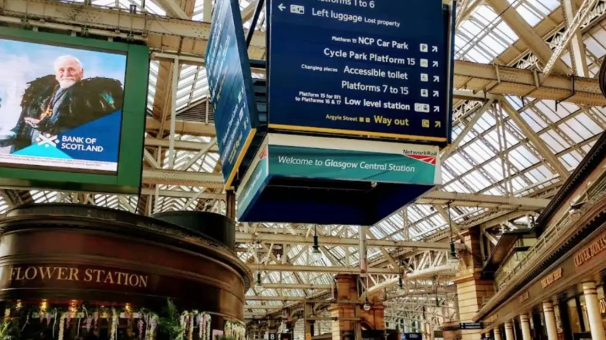
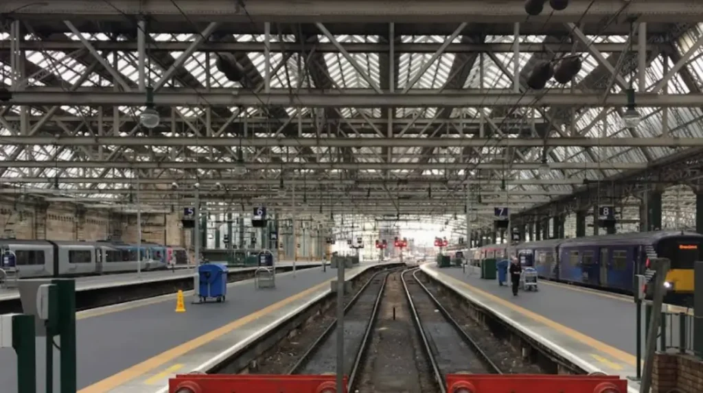
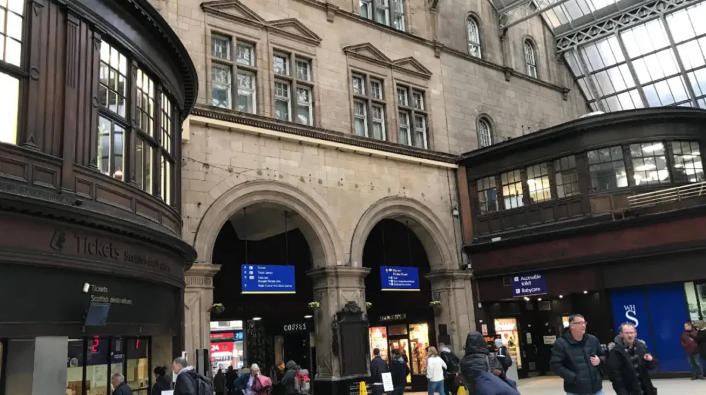
Glasgow Central Station, located at 79 Gordon Street, functions as the primary rail gateway to the west of Scotland. It consists of two distinct levels: the high-level station, which serves the West Coast Main Line and suburban routes, and the low-level station, which handles the Argyle Line. The station’s vulnerability to flooding is fundamentally tied to its geographic position within the Clyde Valley and its reliance on historical drainage systems.
Urban flooding in Glasgow, particularly within the city center, is classified into three primary categories: fluvial (river), pluvial (surface water), and sewer flooding. Fluvial flooding occurs when the River Clyde exceeds its bank capacity. Pluvial flooding is caused by intense rainfall that overwhelms local drainage. Sewer flooding occurs when the combined sewer system, which carries both wastewater and rainwater, reaches maximum capacity and surcharges.
The low-level platforms of Glasgow Central are particularly at risk. These platforms are situated below the local water table and adjacent to several culverted watercourses. Historically, the city was built over numerous burns, such as the St. Enoch Burn and the Molendinar Burn. While these are now largely encased in stone culverts, they remain active conduits for water. During extreme weather events, these culverts can fail or leak, leading to significant inundation of the subterranean rail infrastructure.
Why is Glasgow Central Station prone to flooding?
The station is prone to flooding due to its subterranean low-level platforms, its location on a natural floodplain, and the limitations of an aging Victorian drainage system that cannot cope with modern high-intensity rainfall events and urban runoff.
The primary reason for flood vulnerability at Glasgow Central is the elevation of the low-level station. This section of the station is built in a cutting that sits significantly lower than the surrounding street level. Gravity naturally directs surface water runoff from the North and East of the city center toward this low point. When rainfall exceeds the capacity of the street-level gullies, the water follows the gradient of the tracks and tunnels, accumulating at the lowest accessible points.
A second major factor is the “combined sewer” system. Unlike modern developments that separate rainwater from foul waste, much of Glasgow’s city center uses a single pipe system. During a “1-in-100-year” storm event—a term used by the Scottish Environment Protection Agency (SEPA) to describe a flood with a 1% annual probability—the volume of water enters the sewers faster than it can be processed. This causes a backflow of water through the drainage pipes directly into the station’s basement levels and track beds.
Geologically, the ground beneath Glasgow Central consists of alluvial deposits and glacial till. These materials have varying levels of permeability. In areas where the soil is saturated, the water table rises, putting hydrostatic pressure on the tunnel walls. Over time, this pressure can cause “weeping” or “seeping” through the brickwork, a common issue in 19th-century railway engineering.
Finally, the “urban heat island” effect and increased “impermeable surfacing” in the city center exacerbate the issue. As Glasgow has developed, natural soil that once absorbed rain has been replaced by asphalt and concrete. This results in 100% runoff, meaning every drop of rain remains on the surface until it find a drain. This “flash” runoff often overwhelms the station’s internal pumping systems, which are designed for steady flows rather than sudden surges.
How does the River Clyde affect station flooding?
The River Clyde affects station flooding through tidal surges and high river levels that prevent drainage systems from discharging. When the river is high, water from the station’s pumps has nowhere to go, causing an internal backup.
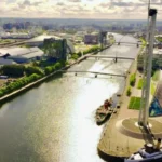
The River Clyde is a tidal river up to the Tidal Weir at Glasgow Green, which is located less than one mile from the station. High tides, particularly when combined with a “storm surge” caused by low atmospheric pressure, can raise the river level significantly. If the river level rises above the outfall pipes used by the station’s drainage system, the water cannot be discharged into the river. This phenomenon is known as “tide-locking.”
During a tide-locked state, the pumps within Glasgow Central may continue to operate, but they are fighting against the weight of the river. If the pressure from the river is greater than the pump’s output, water can actually be forced backward into the station’s lower levels. This was a contributing factor in historical incidents where the Argyle Line was closed for several days following heavy rain and high tides.
The Scottish Environment Protection Agency (SEPA) monitors the river levels at the Broomielaw, adjacent to the station. Their data indicates that climate change is causing a rise in sea levels, which in turn increases the frequency of tidal flooding in the Clyde. A rise in the mean high-water mark means that the “window” for the station to safely drain its surface water is narrowing, making the facility more reliant on mechanical intervention.
Furthermore, the River Clyde acts as the ultimate destination for the city’s Strategic Drainage Plan. If the river is at capacity, the entire city center’s drainage slows down. This creates a “bottleneck” effect. Even if it is not raining directly over the station, heavy rainfall in the Southern Uplands or the Lanarkshire hills can swell the Clyde, indirectly increasing the flood risk for subterranean structures in the Glasgow city center.
What role does the Argyle Line play in flooding events?
The Argyle Line acts as a subterranean conduit for floodwater because it is a continuous tunnel located at the city’s lowest drainage point. It collects water from multiple entry points and concentrates it within the station.
The Argyle Line is a crucial part of Glasgow’s rail network, running from Rutherglen to Exhibition Centre and passing directly through Glasgow Central Low Level. Because it is a long, interconnected tunnel system, it functions similarly to a large drain. If water enters the tunnel at any point—such as at Dalmarnock or Bridgeton—it will travel along the track bed toward the lowest point, which is frequently the section beneath Glasgow Central.
In July 2002, Glasgow experienced a catastrophic flood event where 85mm of rain fell in just a few hours. The Argyle Line was severely impacted, with water levels reaching the height of the platforms. The flooding was not just clean rainwater; it was a mixture of surface runoff and “surcharged” sewage. The cleanup required the removal of silt, debris, and contaminants, illustrating that the tunnel structure itself facilitates the spread of floodwater across the city.
The infrastructure within the Argyle Line is highly sensitive to moisture. The signaling systems, which use electrical track circuits to detect the position of trains, can short-circuit if submerged. Additionally, the “ballast”—the crushed stone that supports the tracks—can be “washed out” by fast-moving water. A washout destabilizes the rails, making it unsafe for trains to run until the stone is replaced and compacted.
Network Rail has installed high-capacity pumps at several locations along the Argyle Line to mitigate this risk. These pumps are designed to activate automatically when water reaches a certain level. However, the sheer volume of the tunnel means that if a major breach occurs—such as a burst water main or a collapsed Victorian culvert—the pumps can be overwhelmed within minutes, leading to a full suspension of services.
How does the Victorian drainage system impact modern rail operations?
The Victorian drainage system impacts modern operations because it was designed for lower population densities and less frequent extreme weather. Its integration with the rail tunnels creates a high risk of “cross-contamination” during floods.
The majority of the drainage infrastructure surrounding Glasgow Central was constructed in the mid-to-late 19th century. These systems use brick-built “egg-shaped” sewers and stone culverts. While these structures were engineering marvels at the time, they are now over 150 years old. Over time, the mortar between the bricks can degrade, leading to “voids” or “collapses” that allow water to escape the sewer and enter the railway tunnels.
Modern rail operations require a dry environment for sophisticated electronic equipment. The Victorian system, however, was designed to be “porous” to some extent. In the 1870s, it was acceptable for tunnels to be damp. Today, even minor dampness can trigger “signal failures,” which are the leading cause of delays at Glasgow Central. The interdependence of the old city drains and the railway’s own drainage means that a failure in the city’s infrastructure often results in a failure of the rail service.
Another issue is the “capacity gap.” Since the Victorian era, Glasgow has seen significant urban densification. Thousands of new homes and commercial buildings have been connected to the same old sewers. According to Scottish Water, the volume of wastewater handled by the city center pipes is significantly higher than originally intended. This leaves very little “spare capacity” for rainwater during a storm, leading to the frequent “Combined Sewer Overflows” (CSOs) that plague the station.
To address this, the Glasgow Strategic Drainage Partnership (GSDP) is working to “retrofit” the city with sustainable urban drainage systems (SuDS). This involves creating “green” areas that can hold water during a storm, taking the pressure off the Victorian pipes. For Glasgow Central, this means that the future of flood prevention lies not just within the station walls, but in the streets above, where water must be managed before it ever reaches the railway.
What are the most complete ways to prevent Glasgow Central from flooding?
The most complete ways to prevent flooding include the installation of high-capacity pumping stations, the construction of “attenuation tanks” to hold excess water, and the use of physical flood barriers at tunnel entrances.
Preventing flooding at a site as complex as Glasgow Central requires a multi-layered engineering approach. The first layer is “mechanical extraction.” Network Rail maintains a series of industrial-grade pumps beneath the platforms. These pumps are the last line of defense, designed to remove water that has already entered the station. Upgrading these to “smart pumps” that activate based on predictive weather modeling is a key strategy for the 2020s.
The second method is “source control.” This involves capturing rainwater before it enters the station or the sewers. The Glasgow City Council has implemented “Surface Water Management Plans” (SWMPs) which include the creation of “raingardens” and “swales” in the surrounding streets, such as Union Street and Argyle Street. These nature-based solutions slow down the flow of water, preventing the “surge” that typically overwhelms the station’s drainage.
Thirdly, “structural sealing” is used to protect the station’s perimeter. This involves injecting “grout” or specialized resins into the ground and the brickwork of the tunnels to fill voids and stop leaks. In extreme cases, “flood gates” or “stop logs” can be installed at the entrances to the low-level tunnels. These are physical barriers that can be deployed when a red weather warning is issued by the Met Office, effectively sealing the station off from the city’s rising water.
Finally, “data-driven resilience” is becoming a primary tool. By using sensors in the sewers and burns (like the St. Enoch Burn), engineers can receive real-time alerts when water levels are rising blocks away. This allows staff to proactively divert trains and protect sensitive equipment before the water reaches the station. This “integrated catchment management” is considered the most comprehensive way to handle the unpredictable nature of modern flooding.
What happens to the station during a major flood event?
During a major flood, the station experiences a “tiered shutdown” where the low-level platforms are closed, power is isolated to prevent electrical fires, and specialist “flood response teams” are deployed to pump out water.
The first stage of a flood event at Glasgow Central is the “Amber Warning” phase. This occurs when rainfall exceeds 20mm per hour or when the River Clyde reaches a critical level. At this stage, trains on the Argyle Line are often slowed down to 20 mph to reduce the risk of “aquaplaning” and to minimize the displacement of water onto electrical equipment. Passengers may see “wet floor” signs and temporary barriers around the low-level escalators.
If the water levels continue to rise, the station enters a “Red Warning” phase. This results in the immediate suspension of all services on the low-level platforms. Network Rail staff will “isolate” the overhead lines and the third-rail power systems to ensure there is no risk of electrocution to passengers or staff. The station’s “Emergency Pumping Plan” is activated, which may involve bringing in mobile pumping units to supplement the permanent infrastructure.
The impact on passengers is significant. Because Glasgow Central is a “hub,” a closure of the low-level station causes a “ripple effect” across the entire Scottish rail network. Passengers traveling from Lanarkshire to Dunbartonshire are forced to find alternative routes, often involving bus replacement services that are themselves hampered by flooded roads. The station concourse often becomes overcrowded as thousands of people are diverted to the high-level platforms.
Post-flood recovery is the final stage. Once the water is removed, the “track circuits” must be tested and the ballast must be inspected for stability. If “fines”—the small particles of sand and silt—have been washed out, the track may need to be “re-tamped.” This recovery process can take anywhere from six hours to several days, depending on the severity of the contamination and the extent of the structural damage.
How is climate change increasing the risk of station flooding?
Climate change is increasing the risk by causing more frequent “convective storms” and rising sea levels. These factors increase the volume of surface water and the likelihood of “tide-locking” at the station’s outfalls.
Scientific data from the “UK Climate Projections” (UKCP18) indicates that Scotland will experience warmer, wetter winters and more intense summer downpours. For Glasgow, this means a projected 10% to 15% increase in winter rainfall by 2050. More importantly, the “intensity” of the rain is increasing. Rainfall that used to be spread over 24 hours is now falling in 60 minutes, which is exactly the scenario that overwhelms Victorian-era drainage.
Rising sea levels are a direct threat to the River Clyde. As the global temperature increases, thermal expansion of the oceans and melting ice caps cause the sea level at the Firth of Clyde to rise. This increases the “base level” of the river in Glasgow. A higher base level means that even moderate rainfall can cause the river to reach the “tide-lock” threshold, preventing the station from draining its runoff.
The “Scottish Flood Forecast,” a joint initiative between SEPA and the Met Office, now provides more granular data to help the station prepare. However, the “resilience gap” is widening. The infrastructure was built for a climate that no longer exists. Engineering solutions that were “once-in-a-career” events are now becoming annual requirements. This shift is forcing a move away from “reactive maintenance” toward “climate adaptation.”
To combat this, Network Rail has launched its “Weather Resilience and Climate Change Adaptation” (WRCCA) strategy. This involves spending millions of pounds on “hardening” the infrastructure. Examples include raising the height of electrical cabinets, installing more powerful pumps, and using “flood-resilient” materials for platform construction. Despite these efforts, the increasing volatility of the weather remains the greatest challenge to the station’s long-term operational stability.
What are the long-term solutions for Glasgow’s rail infrastructure?
Long-term solutions involve the “decoupling” of surface water from the sewer system, the daylighting of historical burns, and the construction of “strategic drainage tunnels” to bypass the city center entirely.
The most ambitious long-term solution is the “Glasgow Strategic Drainage Plan” (GSDP). A key component of this plan is “decoupling.” This means redirecting rainwater into separate pipes or natural watercourses rather than allowing it to enter the combined sewers. By removing the “clean” rainwater from the “dirty” sewage pipes, the risk of the sewers surcharging into the station is drastically reduced.
“Daylighting” is another innovative technique. This involves reopening the historical “burns” (streams) that were buried in pipes 150 years ago. For example, parts of the Camlachie Burn have been “daylighted” to create open-air channels that can hold huge volumes of water during a storm. While it is difficult to do this directly at Glasgow Central due to the dense urban environment, daylighting burns upstream reduces the total volume of water flowing toward the station.
The construction of “Strategic Drainage Tunnels” is perhaps the most effective large-scale intervention. The “Shieldhall Tunnel,” completed in 2018, is a 3.1-mile long sewer tunnel that can hold the equivalent of 90 Olympic-sized swimming pools of water. While it primarily serves the south side of the city, similar “super-sewer” projects are being considered for the city center. These tunnels act as massive underground reservoirs, storing water during a storm and releasing it slowly once the rain has stopped.
Finally, “Green Infrastructure” is a critical long-term strategy. This includes the widespread adoption of “permeable paving” and “green roofs” across the city center. If the buildings surrounding Glasgow Central—such as the St. Enoch Centre and the various office blocks—can “harvest” or “delay” their rainwater, the cumulative impact on the station’s drainage will be immense. These solutions require cooperation between Network Rail, Scottish Water, and Glasgow City Council, marking a shift toward a “whole-city” approach to flood resilience.
What is Glasgow Central Station?
Glasgow Central Station is Scotland’s largest railway station and the main rail hub for western Scotland, handling both high-level and low-level rail services in Glasgow city centre.