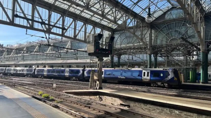
Key Points
- Network Rail and ScotRail have issued severe weather warnings for rail passengers across the Glasgow network and wider Scotland ahead of forecasted 80mph winds.
- The Met Office has upgraded weather alerts, issuing an official amber weather warning for wind covering Glasgow, Strathclyde, and surrounding areas over the weekend.
- Temporary speed restrictions and safety precautions will be implemented across several major routes, including the West Coast Main Line between Glasgow Central and Carlisle.
- Transport authorities are warning of potential service cancellations, extended journey times, flying debris, falling trees, and power cuts.
- Passengers are strongly urged to check their planned journeys prior to travelling, verify live service updates, and consider altering non-essential travel plans.
Glasgow (Glasgow Express) October 23, 2026 – Rail passengers travelling into and out of Glasgow are being urged to plan ahead and check their routes in advance, with severe stormy weather and extreme winds expected to bring widespread disruption to Scotland’s transport infrastructure this weekend.
As reported by transport reporter Ruth Suter of Glasgow Live, rail operators and infrastructure managers Network Rail Scotland have issued urgent safety travel advice after meteorological forecasters upgraded weather warnings across the central belt. The Met Office issued an amber weather warning for high winds, with forecast gusts expected to reach up to 80mph in exposed and coastal areas across Strathclyde and the wider Glasgow region. Transport authorities confirmed that the severe conditions are likely to cause significant delays, emergency speed restrictions, line closures, and potential cancellations across both suburban and main line rail networks throughout Saturday and Sunday.
What severe weather alerts are currently active across Glasgow?
As reported by the Met Office forecasting team, an amber weather warning for wind has been officially designated for Glasgow, Greater Glasgow, and surrounding council areas across southern and central Scotland. The amber alert indicates a heightened risk to life and property, alongside high confidence in severe structural and transport disruption.
According to meteorological analysts at the Met Office, strong crosswinds and heavy rainfall are predicted to sweep across the region, with widespread gusts between 55mph and 65mph expected inland, and localized gusts peaking between 70mph and 80mph in exposed locations. The Met Office warned that “injuries and danger to life from flying debris are possible, alongside damage to buildings, such as tiles blown from roofs, fallen trees, and power outages affecting mobile phone coverage and signal equipment.” Furthermore, coastal areas around the Firth of Clyde are expected to experience spray and large sea waves, compounding transport risks across nearby rail routes and road links.
How will train operations and routes be impacted by the stormy weather?
As reported by railway correspondent Craig Williams of The Herald, Network Rail Scotland and ScotRail have drawn up extensive contingency measures to ensure operational safety across the network during the storm. To protect trains from the risk of running into fallen trees or overhead line failures caused by extreme wind gusts, blanket emergency speed restrictions are being introduced across multiple key corridors.
As stated by operational managers at Network Rail Scotland, speed restrictions will be enforced along sections of the West Coast Main Line connecting Glasgow Central to Carlisle via Lockerbie, as well as routes extending towards Edinburgh, the South West, and the Highlands. Network Rail stated that
“speed limits are a necessary safety precaution during high winds to allow drivers adequate time to react and stop if obstacles or debris appear on the track.”
As reported by senior transport writer Martin Williams of the Glasgow Times, passenger operator ScotRail confirmed that the speed limits will lead to reduced line capacity and extended travel times across almost all services passing through Glasgow Central and Glasgow Queen Street. ScotRail advised that services on coastal lines—including routes to Largs, Ardrossan, Gourock, and Wemyss Bay—are particularly vulnerable to high winds, severe sea spray, and potential overhead line disruption.
What precautionary advice have transport officials issued to passengers?
As reported by community news journalist Lauren Brown of local transport news bulletins, rail bosses are asking members of the public to carefully evaluate their necessity to travel during the peak periods of the storm.
As stated by a spokesperson for Network Rail Scotland,
“We are working closely with weather forecasters and train operators to monitor the impact of the incoming weather system across the Glasgow network. Safety is our top priority, and engineering teams, chainsaw crews, and overhead line specialists are being stationed at strategic locations to respond rapidly to any reports of fallen trees or infrastructure damage.”
As reported by transport editor John Simpson of regional news networks, ScotRail customer services have reminded travelers that tickets purchased for travel during the affected storm period will remain valid for alternative services where applicable, or eligible for refund processing should journeys be cancelled. ScotRail stated that
“passengers should check their entire journey using the ScotRail app or National Rail Enquiries website before leaving home, as timetables may be revised at short notice to keep passengers safe.”
Background of the particular development after the news
The Scottish railway network and the Greater Glasgow urban transport system have historically shown acute vulnerability to severe autumn and winter storm systems. Glasgow serves as the primary hub for Scotland’s passenger rail network, with Glasgow Central handling heavy cross-border traffic alongside suburban services, and Glasgow Queen Street managing key intercity connections to Edinburgh, Dundee, Aberdeen, and Inverness.
Due to the geography of west Scotland, railway infrastructure in the Strathclyde region relies heavily on overhead electric wires and traverses exposed terrain, including coastal tracks along the Firth of Clyde and elevated main lines through the Southern Uplands. High winds exceeding 50mph pose direct hazards to these systems by blowing debris onto track beds, damaging overhead catenary wires, and uprooting mature trees adjacent to railway corridors.
In recent years, Network Rail Scotland has invested significantly in vegetation management, line-side tree clearing, and weather-monitoring technology across Glasgow and the surrounding routes. However, when wind speeds reach the 70mph to 80mph threshold—as covered in amber weather warnings—standard safety protocols mandate the imposition of strict speed limits (often restricted to 50mph or 20mph in severe sectors) to prevent catastrophic derailments or collisions with fallen obstacles. These emergency speed restrictions naturally reduce the total volume of trains that can safely pass through Glasgow’s major hubs, creating cumulative delays across the nationwide transport network.
Prediction
Impact on daily commuters, transport users, and the local economy
The implementation of severe weather warnings and speed restrictions across Glasgow’s rail network is expected to have multi-faceted short-term and mid-term consequences for passengers, local businesses, and regional transport authorities:
- Short-Term Travel Disruption and Delays: Passengers attempting to travel into or out of Glasgow over the weekend will face significantly prolonged journey times, missed connections, and overcrowding on reduced service schedules. Commuters reliant on morning and evening weekend services may encounter unexpected short-notice cancellations if tracks become blocked by fallen debris or if overhead lines sustain wind damage.
- Economic Consequences for Business and Retail: Glasgow’s city-centre retail, hospitality, and entertainment sectors are likely to experience reduced footfall over the weekend. With transport warnings discouraging non-essential travel and high-sided vehicle restrictions on major road bridges, foot traffic in commercial districts will temporarily dip as residents stay indoors.
- Operational and Financial Strain on Transport Operators: Network Rail and ScotRail will incur operational costs related to deployment of emergency clearance teams, overtime for maintenance engineers, and ticket refund processing. The necessity to repair line infrastructure post-storm may also bleed into early weekday schedules, potentially causing knock-on morning delays for weekday commuters if clearance operations extend past Sunday night.
- Increased Reliance on Alternative Transport: Travelers unable to use rail services may place higher demand on local road networks and bus services. However, given that heavy rain and high winds also affect road visibility and bridge access, overall regional mobility across Greater Glasgow will remain constrained until the weather system fully clears.