

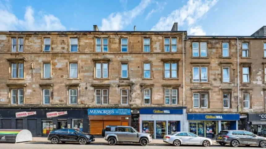
Shawlands and Dennistoun are established Glasgow neighbourhoods with distinct locations, built environments, transport patterns and local amenities. Shawlands sits in Glasgow’s south side beside Queen’s Park, while Dennistoun lies east of the city centre around Duke Street and Alexandra Parade. The choice depends on priorities such as commuting, housing, green space, local services and proximity to central Glasgow.
- What are Shawlands and Dennistoun?
- How does Shawlands compare with Dennistoun for location?
- What is the historical character of Shawlands?
- What is the historical character of Dennistoun?
- Which area has better access to green space?
- Which area has better public transport?
- What are Shawlands and Dennistoun like for housing?
- Which area is more convenient for commuting into Glasgow city centre?
- Which area has stronger local shopping and food options?
- Which area is more suitable for students and young adults?
- Which area is better for families?
- How do Shawlands and Dennistoun compare for everyday lifestyle?
- What should you check before choosing between Shawlands and Dennistoun?
- How do future developments affect Shawlands and Dennistoun?
- What are the main differences between Shawlands and Dennistoun?
What are Shawlands and Dennistoun?
Shawlands is a south Glasgow neighbourhood centred on Pollokshaws Road and Kilmarnock Road, while Dennistoun is an east Glasgow neighbourhood centred on Duke Street and Alexandra Parade. Both combine traditional housing, local commerce and transport links.
Shawlands forms part of Glasgow’s wider Southside. Its built environment includes Victorian and early twentieth-century tenements, terraces, villas and later residential development. Queen’s Park provides a major green-space feature immediately beside the neighbourhood. Glasgow City Council identifies early nineteenth-century villas, Victorian gardens and historic buildings as important elements of the local townscape.
Dennistoun forms part of Glasgow’s north-east and sits much closer to the city centre. Its main streets include Duke Street, Alexandra Parade, Onslow Drive and nearby residential streets. The area contains substantial Victorian and later nineteenth-century housing, together with commercial premises, churches, schools and public spaces.
The two neighbourhoods are not directly comparable as identical administrative units. Shawlands crosses parts of Glasgow City Council’s Pollokshields and Langside wards, while Dennistoun has its own council ward. Glasgow’s Ward 22, Dennistoun, had a population of 20,861 in the council’s published ward data, while Ward 7 Langside had 29,060. Those figures describe wards rather than the neighbourhoods themselves.
This distinction matters when using population statistics. National Records of Scotland publishes population estimates for electoral wards, while Scotland’s Census provides census statistics at a range of geographic levels.
How does Shawlands compare with Dennistoun for location?
Shawlands is positioned south of Glasgow city centre and connects naturally with the wider Southside, while Dennistoun is immediately east of central Glasgow. Their different positions affect commuting, access to parks, connections with neighbouring districts and everyday travel patterns.
Shawlands is approximately south of the city centre, with Pollokshaws Road and Kilmarnock Road forming important commercial and transport corridors. Queen’s Park sits directly north-east of the main Shawlands commercial area.
Dennistoun is positioned east of central Glasgow. Duke Street and Alexandra Parade provide major east-west corridors. The neighbourhood also connects with Haghill, Calton, the East End, the Glasgow Royal Infirmary area and other north-eastern districts.
The geographical difference is significant for people whose daily activities centre on Glasgow city centre. Dennistoun’s location places residential streets relatively close to central Glasgow. Shawlands provides a Southside setting with access towards Pollokshields, Strathbungo, Battlefield, Langside, Pollokshaws and other southern districts.
The location also affects access to major green spaces. Shawlands has Queen’s Park as its defining nearby parkland. Dennistoun has Alexandra Park within its wider local area.
Neither location works as an isolated neighbourhood. Both form parts of larger urban networks. Their surrounding districts therefore matter when considering housing, schools, shopping, leisure, commuting and public transport.
What is the historical character of Shawlands?
Shawlands developed from an estate and rural-edge landscape into a dense Southside neighbourhood, with nineteenth-century villas, Victorian tenements, commercial streets and Queen’s Park forming important parts of its historical character and present-day townscape.
The historical development of Shawlands is closely connected with the expansion of Glasgow beyond its older central districts. Early villas appeared around the Pollokshaws Road and Kilmarnock Road area during the nineteenth century.
Glasgow City Council’s townscape assessment identifies early nineteenth-century villas along Pollokshaws Road and describes surviving plots associated with former Croosmyloof development. It also identifies Springhill Gardens and Waverley Gardens as examples of Victorian residential gardens.
Queen’s Park is particularly important to Shawlands’ historical setting. The park occupies land associated with the former Camphill Estate. Camphill House and Langside Hall remain important historic structures around the park.
The park includes paths, gardens, a boating pond, allotments, bowling facilities and sports areas. Glasgow City Council describes Queen’s Park as the principal recreational green-space resource within the relevant Shawlands townscape study area.
Shawlands therefore combines urban density with a substantial historic landscape. Its identity comes from the relationship between residential streets, commercial roads and Queen’s Park.
The historical character remains visible rather than existing only in archival records. Tenement streets, villas, gardens, churches and parkland continue to shape the physical environment.
What is the historical character of Dennistoun?
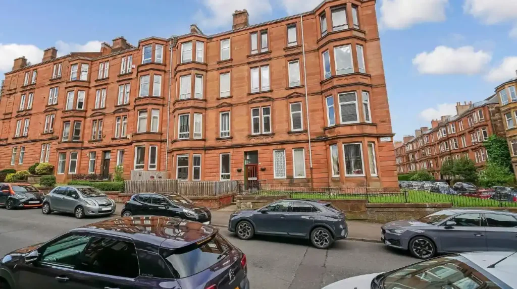
Dennistoun developed substantially during the nineteenth century as a planned residential district, with terraces, tenements, churches, schools and public spaces creating a distinctive urban environment close to Glasgow’s expanding industrial and commercial centre.
The name Dennistoun is associated with Alexander Dennistoun, who promoted residential development in the area during the nineteenth century.
Historic Environment Scotland records that Alexander Dennistoun commissioned architect James Salmon Senior to develop a masterplan between 1854 and 1857. The plan proposed a suburban environment with houses, terraces, gardens and green spaces. The completed development from the 1860s onwards followed parts of that architectural concept.
The surviving built environment contains examples of nineteenth-century residential architecture. Seton Terrace is one documented example. Historic Environment Scotland identifies it as part of an early planned suburban development and records its association with mid-nineteenth-century residential planning.
Dennistoun also contains significant civic and religious buildings. Dennistoun Central Church of Scotland on Armadale Street dates from 1874 and was designed by James Salmon and Son. Historic Environment Scotland records it as a Category B listed building.
Alexandra Parade adds another layer of architectural history. Alexandra Parade Public School was constructed between 1895 and 1899 and is also listed.
This historical pattern gives Dennistoun a strong nineteenth-century urban structure. Its proximity to the centre means the historic residential fabric sits within a densely connected inner-city environment.
Which area has better access to green space?
Shawlands has direct access to Queen’s Park, one of Glasgow’s major historic public parks, while Dennistoun has Alexandra Park and smaller local green spaces. The two areas therefore provide different combinations of large parkland, residential streets and urban recreation.
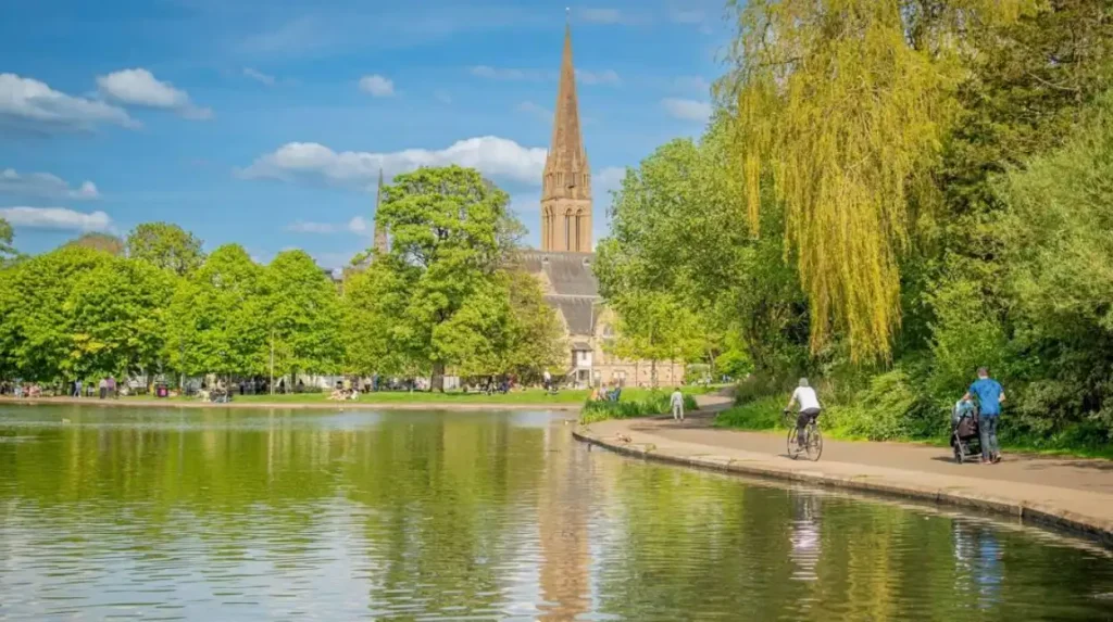
Queen’s Park is the most important green-space asset associated with Shawlands. The park contains sports pitches, bowling facilities, allotments, gardens, paths and a boating pond. Its landscape also frames historic buildings including Camphill House and Langside Hall.
The park’s location makes outdoor activity an integrated part of the Shawlands environment. Walking routes connect residential streets with the park. The park also provides space for recreation and community events.
Dennistoun’s main historic park resource is Alexandra Park. Historic Environment Scotland records that land was acquired by the City Improvements Trustees in 1866 to create a public park. The original park was completed by 1870 and expanded during 1874–75 and again in 1903.
Alexandra Park therefore has a documented Victorian public-park history. Its entrances and boundary features also contribute to the architectural character of the area.
Dennistoun’s green-space network is also connected to current local infrastructure planning. Glasgow City Council documents identify projects involving Glenconner Park, Hogarth Park and other public-space improvements in the wider Dennistoun area.
For everyday outdoor access, the difference is mainly geographical. Shawlands places Queen’s Park directly within its immediate environment. Dennistoun provides Alexandra Park and several smaller spaces within a denser inner-city setting.
Which area has better public transport?
Both areas have rail and bus connections, but their transport geography differs. Shawlands has a direct ScotRail station with services towards Glasgow Central, while Dennistoun benefits from several nearby rail stations and strong road corridors linking the East End with central Glasgow.
Shawlands railway station is on Ravenshall Road. ScotRail lists the station on the Glasgow–Cathcart/Newton/Neilston timetable and provides ticket facilities, seating, accessible ticket machines and bicycle storage.
ScotRail’s published journey information shows direct trains from Glasgow Central to Shawlands with an average journey time of about 10 minutes on the referenced timetable. Up to 37 services are listed for the Monday timetable used by the journey planner.
This gives Shawlands a straightforward rail connection into central Glasgow.
Dennistoun has access to multiple stations depending on the precise street. Duke Street station is located on Duke Street in Dennistoun. ScotRail lists ticket machines, seating, accessible facilities and other passenger services at the station.
Alexandra Parade station is another important local rail point. Its location connects Dennistoun with routes through Glasgow’s wider suburban rail network.
The practical difference is therefore not simply whether an area has rail. Both do. The important factor is the destination. Shawlands’ direct Glasgow Central connection is relevant for people travelling through the city centre and Southside rail network. Dennistoun’s stations provide access to central Glasgow and destinations across the north and east of the metropolitan area.
Bus services also operate along major roads in both neighbourhoods. Exact routes and timetables change, so current journey planning should be checked before travel.
What are Shawlands and Dennistoun like for housing?
Shawlands and Dennistoun both contain traditional Glasgow tenements, but their housing settings differ. Shawlands combines tenements, terraces and villas around Queen’s Park, while Dennistoun has a denser nineteenth-century urban pattern shaped by terraces and tenement streets.
Traditional tenement housing is central to both neighbourhoods. These buildings form a major part of Glasgow’s nineteenth- and early twentieth-century residential heritage.
Shawlands contains a mixture of tenement blocks, terraces, villas and semi-detached residential streets. Glasgow City Council’s townscape assessment records differences in plot sizes and building forms around Waverley Park and Pollokshaws Road.
Dennistoun contains numerous traditional tenements and terraces. Historic Environment Scotland’s record for Seton Terrace highlights the surviving relationship between houses, front gardens and communal or open spaces.
Housing condition varies significantly within both areas. Building age creates maintenance considerations involving roofs, masonry, windows, common stairwells, stonework, drainage and communal repairs.
For buyers and renters, property-level assessment is therefore important. A neighbourhood name does not establish the condition of an individual building.
Tenement ownership arrangements also matter. Shared maintenance responsibilities, common insurance, factoring arrangements and repair obligations can affect ongoing housing costs.
Current asking rents and sale prices also change with market conditions. A reliable comparison requires checking current listings and recent completed-sale evidence rather than relying on historic averages.
Which area is more convenient for commuting into Glasgow city centre?
Dennistoun has a geographic advantage for short inner-city journeys because it sits immediately east of central Glasgow, while Shawlands provides a direct rail route to Glasgow Central and strong Southside connections. The most practical choice depends on the commuter’s exact destination.
Dennistoun’s position makes walking, cycling, bus and rail travel into central Glasgow relevant for many residents. Duke Street and Alexandra Parade provide major east-west movement corridors.
Shawlands sits farther south. Its rail connection compensates for some of that geographical distance. ScotRail records an average Glasgow Central to Shawlands journey of approximately 10 minutes on its published timetable.
The distinction becomes more important when the destination is outside the city centre.
A worker travelling to Glasgow Central, for example, has a direct Shawlands rail option. A person travelling towards the East End, Glasgow Royal Infirmary area or eastern suburbs has different transport considerations from someone commuting towards the Southside.
Dennistoun’s location also makes it relevant for people who regularly combine city-centre activities with East End destinations.
Commuting decisions should therefore consider the whole journey rather than station-to-station travel time. Walking distance to the station, service frequency, interchange requirements and the final destination all affect practical travel time.
Which area has stronger local shopping and food options?
Shawlands has established commercial streets around Pollokshaws Road and Kilmarnock Road, while Dennistoun has a concentrated inner-city local economy around Duke Street, Alexandra Parade and surrounding streets. Both support everyday shopping, independent businesses and food-led local activity.
Shawlands’ commercial environment is closely connected with Pollokshaws Road, Kilmarnock Road and Shawlands Cross. Glasgow City Council’s townscape assessment identifies a mixture of small shop plots, larger commercial premises and civic buildings in this area.
The commercial structure serves both local residents and visitors from nearby Southside neighbourhoods.
Dennistoun’s commercial activity follows its main transport corridors. Duke Street and Alexandra Parade contain shops, food businesses, services and other local facilities.
The difference relates partly to urban structure. Shawlands has a Southside high-street environment linked closely with Queen’s Park and neighbouring residential districts. Dennistoun has an inner-city commercial pattern integrated with dense residential streets.
Neither neighbourhood’s food scene should be reduced to a single category. Both contain cafés, restaurants, takeaways, pubs, bakeries and independent businesses, with individual businesses changing over time.
For visitors, the main practical consideration is location. Shawlands works well as part of a wider Southside itinerary. Dennistoun works naturally with central Glasgow, the East End and nearby cultural destinations.
Which area is more suitable for students and young adults?
Dennistoun has a strong concentration of working-age residents and close proximity to central Glasgow, while Shawlands provides access to Southside amenities, Queen’s Park and established residential streets. Both support younger residents, but their transport and housing environments differ.
Understanding Glasgow’s 2022 Census-based neighbourhood profile records Dennistoun as having 9,660 residents and states that 82% of its population is aged 16–64. The same profile reports that 71% of residents aged 16 and over are in employment.
A separate Understanding Glasgow profile records 2,396 children and young people aged 0–24 in Dennistoun and reports a higher proportion of 18–24-year-olds than the Glasgow average.
These figures describe the defined Dennistoun neighbourhood rather than the larger electoral ward.
Shawlands forms part of a wider Southside residential network containing students, young professionals, families and established households. Its proximity to Queen’s Park and local commercial streets adds recreational and everyday facilities.
Students also need to consider their campus location. The most useful neighbourhood is determined by travel time to the University of Glasgow, Glasgow Caledonian University, the University of Strathclyde, Glasgow School of Art or another institution.
Dennistoun’s central-east position is particularly relevant for institutions around the city centre and east side. Shawlands is more relevant when the daily journey connects with the Southside or south-western parts of Glasgow.
Which area is better for families?
Shawlands provides direct access to Queen’s Park, residential streets and Southside community facilities, while Dennistoun provides schools, parks, services and central-city access within a denser urban setting. Family suitability depends on the specific street, school catchment and housing requirements.
Family decisions require more than a neighbourhood reputation. Housing size, outdoor space, school catchment, traffic, pedestrian routes, childcare access and transport all affect daily life.
Shawlands’ proximity to Queen’s Park provides extensive public open space. The park includes play, sports, gardens, walking routes and other recreational infrastructure.
Dennistoun provides Alexandra Park and smaller local green spaces. Its location also places residents close to central services and major transport corridors.
School catchments must be checked using current Glasgow City Council information. Catchment boundaries can differ from neighbourhood boundaries and can change independently of local street identity.
Families considering either area should therefore assess the exact address rather than using Shawlands or Dennistoun as a proxy for school access.
How do Shawlands and Dennistoun compare for everyday lifestyle?
Shawlands combines Southside residential streets, Queen’s Park and established commercial roads, while Dennistoun combines dense inner-city housing, historic architecture, local businesses and rapid access to central Glasgow. The practical difference is mainly suburban Southside versus inner-city eastern neighbourhood structure.
Shawlands has a strong relationship with Queen’s Park and the wider Southside. The park creates a substantial open-space boundary and separates parts of the neighbourhood from neighbouring communities.
Dennistoun has a more continuous urban form. Residential streets connect directly with commercial corridors, railway infrastructure and the central city.
The two areas also have different architectural identities.
Shawlands contains a mixture of villas, terraces, tenements and twentieth-century development. Its historic character is strongly connected with Queen’s Park and former estate landscapes.
Dennistoun contains planned nineteenth-century terraces, tenements, churches and schools. Historic Environment Scotland records several listed buildings in the area, including Alexandra Parade Public School and Dennistoun Central Church.
Both neighbourhoods therefore offer established urban environments rather than newly created residential districts.
What should you check before choosing between Shawlands and Dennistoun?
The most useful comparison uses exact housing location, commute, transport, green-space access, property condition, local services and current costs. Neighbourhood-level reputation does not replace address-specific research when choosing where to rent, buy or stay.
Start with the exact property location. Check the walking distance to the nearest railway station and bus corridor.
Next, calculate the complete commute. Include walking time, waiting time, train or bus travel and any interchange.
Property condition deserves particular attention in both areas. Traditional tenements require assessment of common areas, roofs, stonework, windows, stairwells and shared repair responsibilities.
Check current housing costs rather than historical articles. Rental markets and sale prices change over time.
School access requires current catchment information. The same applies to nurseries, healthcare services and other public facilities.
Green-space access should also be assessed at street level. A property advertised as being in Shawlands can sit several minutes from Queen’s Park. A property advertised as being in Dennistoun can vary significantly in its distance from Alexandra Park.
Transport availability also changes. ScotRail timetables, station facilities and service patterns should be checked before making a long-term decision.
Explore More Area Guide
West End vs Southside Glasgow: Where Should You Live?
Most Expensive Areas to Live in Glasgow: Top Premium Neighbourhoods and Property Prices
How do future developments affect Shawlands and Dennistoun?
Both neighbourhoods remain part of Glasgow’s wider regeneration, transport and public-realm planning. Dennistoun has documented infrastructure projects, while Shawlands continues to benefit from its established commercial streets and Southside public-space network.
Glasgow City Council’s current planning documents identify a range of transport and public-realm proposals affecting the wider Dennistoun area. These include active-travel routes, pedestrian improvements, streets-for-people projects and work around local parks and town centres.
Dennistoun also has an active local Area Partnership structure. Glasgow City Council’s 2026 programme includes neighbourhood infrastructure, Pride in Place and local community investment discussions.
Shawlands also forms part of ongoing Southside planning and community infrastructure activity. Glasgow City Council’s recent documentation for Pollokshields and surrounding areas includes neighbourhood infrastructure investment.
Future change should therefore be assessed through official planning documents rather than property marketing descriptions.
Transport improvements, public-realm projects, housing development and commercial changes can alter local conditions over time. The long-term relevance of either neighbourhood depends partly on how these projects are delivered and maintained.
What are the main differences between Shawlands and Dennistoun?
Shawlands is defined by its Southside location, Queen’s Park, established commercial roads and mixed historic housing, while Dennistoun is defined by its eastern inner-city position, nineteenth-century architecture, dense housing and proximity to central Glasgow.
The central distinction is geography.
Shawlands provides a Southside setting with a major public park immediately integrated into the neighbourhood. Dennistoun provides an inner-city eastern setting with direct connections towards central Glasgow and the wider East End.
Their histories also differ. Shawlands developed from estate and rural-edge landscapes into a residential and commercial Southside district. Dennistoun developed through nineteenth-century planned suburban expansion close to Glasgow’s growing industrial city.
Transport creates another distinction. Shawlands has a direct ScotRail connection to Glasgow Central. Dennistoun has Duke Street and Alexandra Parade stations within its wider local network.
Housing overlaps substantially because both contain Glasgow tenements and historic residential buildings. However, Shawlands has a more varied mixture of villas, terraces and tenements around Queen’s Park, while Dennistoun has a stronger concentration of nineteenth-century urban terraces and tenement streets.
The choice therefore rests on measurable requirements rather than a universal neighbourhood hierarchy. Commute, property type, green space, school catchment, local services and current housing costs provide the most useful comparison points.
Is Shawlands a good area of Glasgow?
Yes. Shawlands is an established Southside neighbourhood with Queen’s Park, local shops, restaurants, cafés, traditional housing and rail connections to Glasgow Central. Its location also provides access to nearby areas including Strathbungo, Pollokshields, Langside and Battlefield.