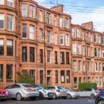

Glasgow’s West End and Southside are two major residential areas with distinct urban identities, housing stock, transport connections and amenities. The West End centres on Hillhead, Partick, Hyndland and Byres Road, while the Southside includes Shawlands, Strathbungo, Pollokshields, Battlefield and Langside. Both provide strong access to central Glasgow.
- What are the main differences between Glasgow’s West End and Southside?
- How did Glasgow’s West End and Southside develop historically?
- What types of homes are available in the West End?
- What types of homes are available in Glasgow’s Southside?
- Which area has better public transport, West End or Southside?
- How easy is it to commute from the West End to Glasgow city centre?
- How easy is it to commute from the Southside to Glasgow city centre?
- Which area has better access to shops, restaurants and nightlife?
- Which area has better parks and green spaces?
- Which area is more suitable for students?
- Which area is more suitable for families?
- Which area is better for young professionals?
- How do West End and Southside property prices compare?
- Which area has stronger access to cultural attractions?
- How do West End and Southside communities differ?
- How are the West End and Southside changing?
- What should you check before choosing between Glasgow’s West End and Southside?
- Is the West End or Southside better for living in Glasgow?
What are the main differences between Glasgow’s West End and Southside?
Glasgow’s West End combines university life, Victorian architecture, cultural venues and dense city living, while the Southside combines established residential districts, diverse communities, local town centres and extensive rail connections. The choice depends on housing type, commuting patterns, amenities and preferred neighbourhood character.
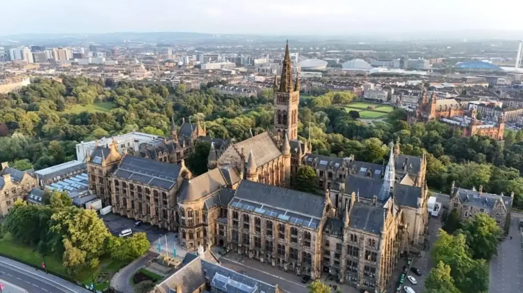
The West End sits immediately west and northwest of Glasgow city centre. Its best-known neighbourhoods include Hillhead, Hyndland, Dowanhill, Partick, Kelvinbridge and Finnieston. The University of Glasgow’s main Gilmorehill campus is a major institutional landmark. The university moved from High Street to Gilmorehill in 1870.
The Southside covers a broad area south of the River Clyde. Important residential districts include Shawlands, Strathbungo, Pollokshields, Battlefield, Langside, Mount Florida, Govanhill and Cathcart. Glasgow City Council identifies Pollokshields, Shawlands and Strathbungo within Pollokshields Ward, while Langside Ward includes Battlefield, Camphill and Mount Florida.
The distinction is not simply geographic. Each area contains several neighbourhoods with different housing markets and local facilities. A flat in Hyndland represents a different residential proposition from a house in Pollokshields. Similarly, Partick has a different transport profile from Langside.
How did Glasgow’s West End and Southside develop historically?
The West End expanded strongly during Glasgow’s nineteenth-century westward growth, while the Southside developed through suburban expansion, industrialisation and residential construction south of the Clyde. Victorian and Edwardian buildings remain important parts of both areas today.
Glasgow experienced rapid expansion during the Industrial Revolution. Population growth, manufacturing, commerce and transport infrastructure pushed development beyond the historic city centre.
The University of Glasgow played a major role in the West End. The university left its original High Street location and moved to Gilmorehill in 1870. The move followed industrialisation around the old campus and created space for a larger academic complex.
The university campus remains central to the identity of the West End. Its surrounding districts developed around institutional, residential and commercial activity. Byres Road became an important commercial spine, while Kelvingrove Park provided a major green-space setting. A University of Glasgow city-context study describes the West End through Victorian and Edwardian sandstone tenements and residential terraces.
The Southside developed through Glasgow’s nineteenth- and twentieth-century expansion. Areas such as Pollokshields, Shawlands, Strathbungo and Langside contain substantial Victorian and Edwardian housing.
The Southside also developed strong commercial centres. Shawlands became an important local centre serving surrounding residential districts. Glasgow City Council records town-centre improvement activity, housing investment and business development in Shawlands.
Historic development explains much of today’s housing pattern. Large sandstone tenements, traditional terraces and later suburban housing create a varied residential landscape across both sides of Glasgow.
What types of homes are available in the West End?
West End housing includes traditional sandstone tenements, Victorian and Edwardian terraces, modern apartments and converted properties. Hillhead, Hyndland, Dowanhill and Partick contain substantial traditional flats, while newer developments add contemporary apartments near major transport and commercial locations.
Traditional tenements define many West End streets. These buildings typically contain flats arranged around shared communal entrances, staircases and internal courtyards.
Hyndland and Dowanhill contain substantial stocks of traditional sandstone properties. Hillhead also contains many tenements close to Byres Road and the University of Glasgow.
Partick has a more mixed housing profile. Traditional tenements sit alongside modern apartment buildings and commercial premises. The area’s redevelopment has added contemporary residential accommodation around transport corridors.
Finnieston also demonstrates the transition from traditional urban housing toward newer apartments and mixed-use development. Its location between the city centre and West End makes it particularly connected to employment and leisure destinations.
Property condition is an important consideration for older flats. Glasgow City Council has highlighted the maintenance requirements associated with pre-1919 tenement stock across the city. Owners of traditional flats need to consider communal repairs, factoring, building insurance and long-term maintenance.
What types of homes are available in Glasgow’s Southside?
Southside housing includes sandstone tenements, traditional terraces, villas, semi-detached houses, modern flats and new developments. Pollokshields, Strathbungo, Shawlands, Battlefield and Langside each contain different combinations of period properties and contemporary housing.
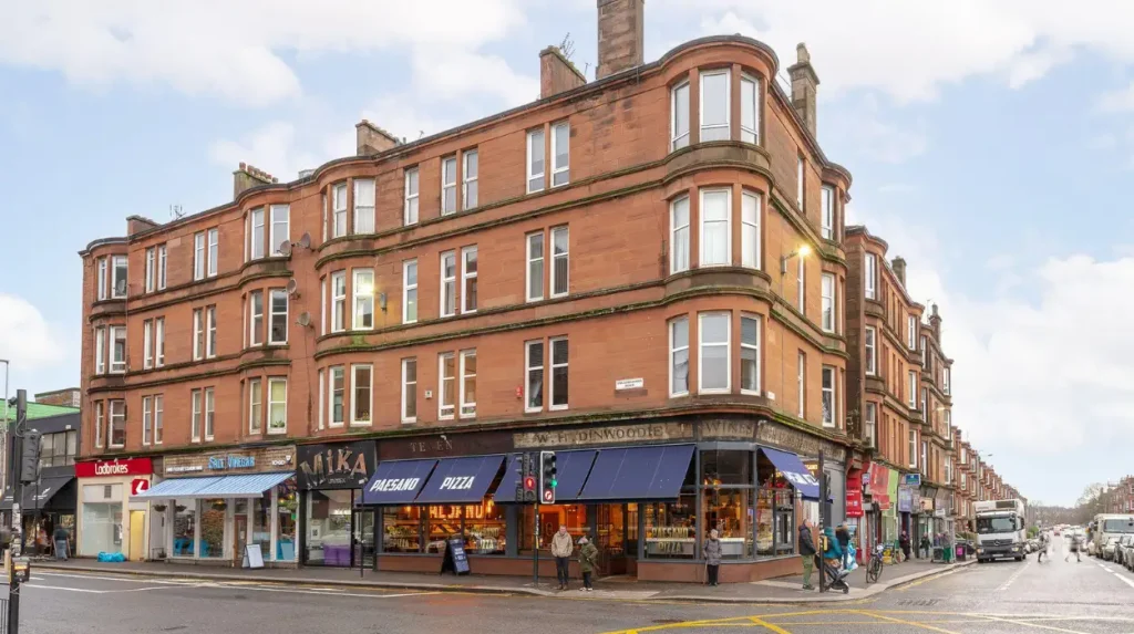
Pollokshields contains extensive traditional sandstone housing and large residential streets. The district includes substantial pre-1919 building stock, making property maintenance an important ownership consideration.
Strathbungo is characterised by Victorian tenements, terraces and streets close to Shawlands and Pollokshields.
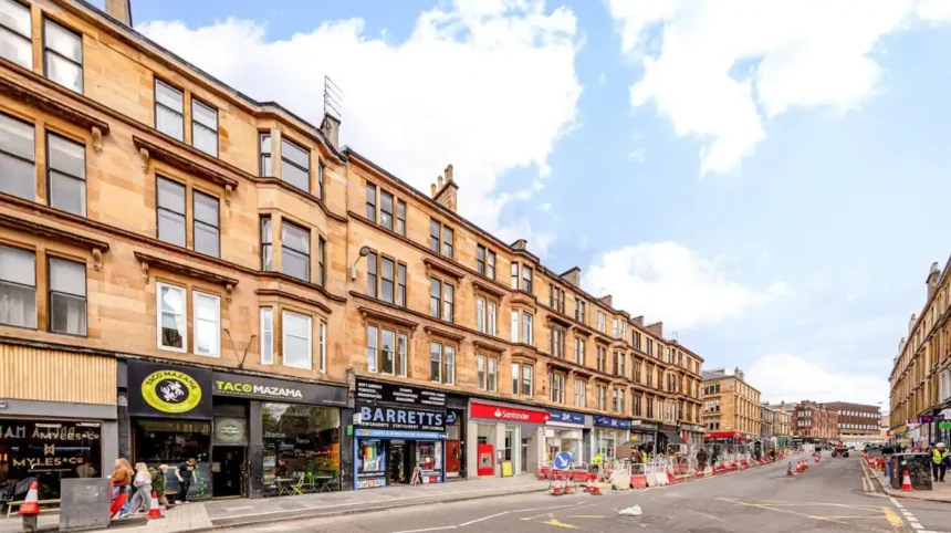
Shawlands provides a dense residential environment around Kilmarnock Road and Pollokshaws Road. Traditional tenements dominate many streets, while newer residential projects provide contemporary alternatives.
Battlefield and Langside contain traditional flats alongside larger homes. Their residential form varies considerably between main roads, side streets and areas near parks.
Mount Florida provides another housing pattern. Tenements and terraces dominate many streets, while proximity to Hampden Park creates a distinct sporting and event-related environment.
The Southside therefore offers a broad range of housing within a relatively compact geographical area. Buyers and renters need to assess individual streets rather than relying only on the broader Southside label.
Which area has better public transport, West End or Southside?
The West End has particularly strong Subway access through Hillhead, Kelvinhall, Partick, Kelvinbridge and St George’s Cross, while the Southside benefits from rail stations including Pollokshields, Shawlands, Crosshill and Mount Florida and direct bus routes toward central Glasgow.
The Glasgow Subway is a major advantage for several West End neighbourhoods. SPT operates a 15-station circular Subway network covering approximately 10 miles. Stations serving the West End include Partick, Kelvinhall, Hillhead, Kelvinbridge and St George’s Cross.
SPT states that the Subway is designed for movement around Glasgow city centre and the West End. Peak services run at four-minute intervals, while a full circuit takes approximately 24 minutes.
Partick provides particularly strong multimodal connectivity because it combines Subway, railway and bus services. SPT identifies Partick Subway station as being close to Partick rail station and bus station.
The Southside relies heavily on the suburban rail network. Stations include Pollokshields East, Pollokshields West, Shawlands, Crosshill and Mount Florida, depending on the specific neighbourhood.
Rail access is especially relevant for residents travelling toward Glasgow Central and destinations on the Cathcart Circle and related routes.
Bus services provide another layer of connectivity. Routes vary by street and operator, so residents should assess the exact journey from a potential home rather than comparing neighbourhoods solely by headline transport options.
How easy is it to commute from the West End to Glasgow city centre?
The West End provides direct and frequent connections to Glasgow city centre through the Subway, rail services, buses and walking routes. Partick and Hillhead offer particularly strong public transport access, while Finnieston sits within easy reach of central employment and leisure districts.
The West End is physically close to central Glasgow. Great Western Road, Dumbarton Road and other major routes connect the area with the city centre.
The University of Glasgow describes its Gilmorehill campus as being within easy reach of the city centre by public transport or on foot.
The Subway provides a fast orbital connection between West End stations and central stations such as Buchanan Street and St Enoch. This supports commuting to offices, retail districts and major transport hubs.
Walking also provides a practical option from areas such as Finnieston, Kelvinbridge and parts of Partick.
How easy is it to commute from the Southside to Glasgow city centre?
Southside commuting benefits from frequent rail services, bus routes and road connections across the River Clyde. Stations around Pollokshields, Shawlands, Crosshill and Mount Florida provide direct access toward central Glasgow and support commuting without relying exclusively on private cars.
Southside residents have several rail corridors into central Glasgow. The exact journey depends on the station and destination.
Pollokshields benefits from its position close to Glasgow Central and the southern rail network. Shawlands also has a railway station, supporting residents in the surrounding residential districts.
The Southside has direct road connections through routes including Pollokshaws Road, Kilmarnock Road and other major corridors.
Bus services provide additional connections across the Clyde and into central Glasgow. Travel times vary with traffic, service frequency and destination.
For commuters, the most useful comparison is therefore street-to-station or street-to-bus-stop distance. A property close to Shawlands station has a different commuting profile from a property several streets away.
Which area has better access to shops, restaurants and nightlife?
The West End concentrates major food, drink, shopping and nightlife activity around Byres Road, Ashton Lane, Finnieston and Partick, while the Southside centres activity around Shawlands, Strathbungo, Pollokshields and surrounding local streets with independent businesses.
The West End has a strong concentration of hospitality businesses. The University of Glasgow identifies the area as home to cafés, bars, restaurants, vintage boutiques and cultural attractions.
Byres Road is one of the area’s principal commercial streets. Ashton Lane provides a concentrated collection of bars and restaurants close to the university.
Finnieston has developed a strong food-and-drink identity. The University of Glasgow describes Finnieston as a major food destination next to the university.
The Southside has a different commercial structure. Shawlands functions as a major local centre, with shops, restaurants, cafés and services serving surrounding neighbourhoods.
Strathbungo provides another concentration of independent businesses. Pollokshields and Govanhill add further restaurants, cafés, shops and community facilities.
The difference is therefore one of commercial geography. The West End has major destination-oriented streets, while the Southside combines town-centre activity with neighbourhood businesses.
Which area has better parks and green spaces?
The West End has major access to Kelvingrove Park, the Botanic Gardens and the River Kelvin corridor, while the Southside provides access to Queen’s Park, Pollok Country Park, Linn Park and several neighbourhood green spaces across its residential districts.
Kelvingrove Park is one of the West End’s defining green spaces. It sits beside the University of Glasgow campus and provides open space between residential and institutional areas.
The Botanic Gardens provide another major green destination in the northern West End around Great Western Road and the River Kelvin.
The River Kelvin corridor also creates walking and cycling opportunities through several West End neighbourhoods.
The Southside has an equally significant green-space network. Queen’s Park is a major landmark for residents around Shawlands, Strathbungo and Battlefield.
Pollok Country Park provides extensive open space farther southwest. Linn Park provides another major green area around Cathcart.
Green space therefore exists in both parts of Glasgow, but the character differs. West End green spaces are closely integrated with university, museum and central-city destinations. Southside parks often serve established residential communities.
Which area is more suitable for students?
The West End has a particularly strong student environment because the University of Glasgow’s main campus is located at Gilmorehill, close to student housing, cafés, restaurants, cultural attractions and nightlife. The Southside provides student housing alternatives with different transport and rental locations.
The University of Glasgow is one of the defining institutions of the West End. Its main campus is located at Gilmorehill and contains most of the university’s teaching and research facilities.
Hillhead, Kelvinbridge and Partick provide relatively direct access to the university. This makes location especially important for students attending regular campus-based teaching.
The West End also contains student-oriented commercial activity. Byres Road and surrounding streets provide food, entertainment, shopping and everyday services.
The Southside also attracts students because of its transport connections and housing diversity. Areas such as Shawlands, Strathbungo, Pollokshields and Govanhill provide alternatives outside the immediate university district.
The best location depends on the campus being attended. Students studying at the University of Glasgow have different transport requirements from students attending Glasgow School of Art, Glasgow Caledonian University or the University of Strathclyde.
Which area is more suitable for families?
The Southside provides a broad mixture of larger homes, parks, schools and established residential streets, while selected West End districts offer family housing close to parks, universities, cultural venues and transport. Family suitability depends heavily on the specific street and property.
The Southside contains many established residential streets with larger traditional properties. Pollokshields, Langside, Battlefield and parts of Shawlands provide access to parks and local amenities.
Queen’s Park is particularly important for families living around Strathbungo, Shawlands and Battlefield. The park provides open recreational space close to dense residential areas.
The West End also contains family-oriented neighbourhoods. Hyndland and Dowanhill have larger flats and houses, while Kelvinside and surrounding areas provide access to green space and established residential streets.
Schools require property-specific research. Catchment areas operate at local authority level and can vary by address. Families should check current Glasgow City Council school information for each property before making a housing decision.
Which area is better for young professionals?
The West End places young professionals close to universities, cultural venues, restaurants, bars and central Glasgow, while the Southside combines strong transport links with independent businesses, period housing and neighbourhood commercial centres such as Shawlands and Strathbungo.
The West End has a high concentration of employment and leisure destinations. Finnieston provides direct access toward the city centre and major business areas.
Hillhead and Partick combine residential accommodation with cafés, restaurants and public transport.
The Southside provides a different urban lifestyle. Shawlands functions as a major commercial hub, while Strathbungo offers dense residential streets close to independent businesses.
Transport is central to the decision. People commuting to central Glasgow can use rail, Subway, bus services or active travel depending on their location.
The Southside also provides access to several employment corridors south of the Clyde. Residents working around the city centre can use rail and bus connections.
How do West End and Southside property prices compare?
Glasgow property prices vary significantly between individual neighbourhoods, property types and streets, so there is no single West End or Southside price. Registers of Scotland reported a £198,000 median Scottish residential sale price in 2025–26, while Glasgow recorded 11,305 residential sales.
Registers of Scotland reported that the median residential sale price across Scotland reached £198,000 in 2025–26, up from £190,000 in 2024–25. Glasgow City recorded 11,305 residential sales, making it one of Scotland’s largest residential markets by transaction volume.
These figures apply to Scotland and Glasgow City rather than individual West End or Southside neighbourhoods. They therefore provide market context rather than a direct neighbourhood comparison.
Property type has a major effect on price. Registers of Scotland reported a Scottish median of £138,017 for flats and £324,995 for detached properties in 2025–26.
Traditional sandstone properties also have maintenance costs that influence ownership budgets. Pre-1919 tenements can require communal roof, stonework, stair, drainage and building repairs.
Buyers should therefore compare recent sold prices for the exact postcode, property type and size. Registers of Scotland provides official property transaction data for Scotland.
Which area has stronger access to cultural attractions?
The West End has concentrated access to major cultural institutions including Kelvingrove Art Gallery and Museum, the University of Glasgow, Glasgow Botanic Gardens and Riverside Museum, while the Southside offers community venues, heritage buildings, parks and cultural destinations across its neighbourhoods.
The West End contains several internationally recognised Glasgow attractions.
Kelvingrove Art Gallery and Museum sits beside Kelvingrove Park. The University of Glasgow campus provides another major architectural and cultural landmark.
Riverside Museum lies close to Partick and the River Clyde. The transport museum provides a major visitor attraction and connects the West End with Glasgow’s waterfront.
The Southside’s cultural landscape is more distributed. Pollok Country Park contains Pollok House and the Burrell Collection, creating a major cultural destination southwest of the central Southside.
The Burrell Collection provides an important museum resource within Pollok Country Park. Its location demonstrates the Southside’s combination of residential neighbourhoods, parks and major cultural institutions.
How do West End and Southside communities differ?
The West End has a strong university, professional, cultural and visitor-oriented identity, while the Southside contains a broader mixture of long-established communities, families, students, professionals and international communities across neighbourhoods such as Shawlands, Pollokshields and Govanhill.
The West End’s demographic structure reflects the presence of the University of Glasgow and private rental housing. Historic Glasgow City Council data for Hillhead showed a large 16–24 age group, reflecting the area’s student population.
The Southside contains greater neighbourhood variation. Pollokshields, Shawlands, Strathbungo, Govanhill, Battlefield and Langside each have distinct community profiles.
Pollokshields is particularly diverse. Glasgow City Council identifies Pollokshields as a distinct Area Partnership and continues to support local community planning and infrastructure activity there.
This diversity means that residents should assess individual neighbourhoods rather than treating the entire Southside as one uniform community.
How are the West End and Southside changing?
Both areas continue to experience investment in housing, transport, public spaces and commercial districts. The West End is influenced by University of Glasgow campus expansion, while Southside regeneration includes town-centre, housing and infrastructure projects around districts such as Shawlands and Pollokshields.
The University of Glasgow launched a major campus development programme in 2017 covering the former 14-acre Western Infirmary site. New academic buildings and public spaces have since been completed.
This development strengthens the institutional role of the West End and adds new research, teaching and public facilities.
The Southside also has active regeneration. Glasgow City Council planning records include major mixed-use development proposals around Shawlands Arcade, including retail, professional services, restaurants and residential uses.
Pollokshields also remains part of Glasgow’s ongoing neighbourhood infrastructure and community planning activity.
These projects affect future housing supply, public realm and local commercial activity. Prospective residents should therefore check current planning applications and development programmes for the specific neighbourhood.
Explore More Area Guide
Most Expensive Areas to Live in Glasgow: Top Premium Neighbourhoods and Property Prices
Cheapest Areas to Rent in Glasgow: Affordable Postcodes
What should you check before choosing between Glasgow’s West End and Southside?
Compare the exact property, transport route, housing condition, local services, council information, parking arrangements and ongoing development plans before choosing between the West End and Southside. Neighbourhood-level differences are more useful than broad labels when evaluating a home.
Start with the property itself. Check building condition, communal maintenance arrangements, energy performance and factoring arrangements for tenement flats.
Next, calculate the real commute. Check walking distance to the nearest railway or Subway station and compare the complete journey to work or study.
Local amenities also matter. Identify supermarkets, pharmacies, GP practices, schools, parks and other everyday services near the property.
Parking requires specific attention. Some streets have restricted parking or controlled arrangements. Availability varies significantly by neighbourhood and individual street.
Check planning activity as well. Major developments can change traffic patterns, public spaces, housing supply and commercial activity.
Finally, compare recent sold-property evidence rather than relying on asking prices. Registers of Scotland data provides official information on completed property transactions.
Is the West End or Southside better for living in Glasgow?
The West End and Southside serve different residential needs rather than representing one universal choice. The West End emphasises university access, Subway connectivity, cultural attractions and established urban amenities, while the Southside offers varied housing, rail connections, parks and diverse neighbourhood centres.
The West End is strongly associated with the University of Glasgow, Byres Road, Kelvingrove Park, Hillhead, Partick, Hyndland and Finnieston. Its transport network includes multiple Subway stations and Partick’s rail interchange.
The Southside extends across a larger collection of neighbourhoods. Shawlands, Strathbungo, Pollokshields, Battlefield, Langside and Mount Florida each offer different housing and transport characteristics.
Housing costs vary within both areas. Official Scottish statistics show substantial differences between property types, reinforcing the importance of comparing like-for-like homes.
For students and people seeking direct access to the University of Glasgow, proximity to Gilmorehill and West End transport is a central consideration. For residents seeking a broader choice of Southside neighbourhoods, rail access, parks and established local centres form important considerations.
The most reliable comparison is therefore property against property and neighbourhood against neighbourhood. West End and Southside are both substantial parts of Glasgow’s residential geography, and each contains streets with different housing, transport, amenities and development conditions.
Is the West End a good place to live in Glasgow?
Yes. Glasgow’s West End offers strong public transport, universities, parks, restaurants, cultural attractions and established residential neighbourhoods. Hillhead, Hyndland, Partick and Finnieston provide different housing and lifestyle environments.