

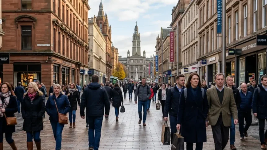
Walking across Glasgow city centre on foot typically takes between 20 and 35 minutes, depending on your start and end points and walking speed. A full cross-city route from the eastern edge near Glasgow Green to the western edge near Charing Cross or St. Vincent Place is about 2.5–3 km (1.6–1.9 miles) and takes most people around 30 minutes at a normal pace. Shorter diagonal routes across the compact core (for example, from Buchanan Street to Glasgow Central Station) can be done in 15–20 minutes.
- What Is Glasgow City Centre and How Is It Defined?
- How Far Is It to Walk Across Glasgow City Centre?
- How Long Does It Take to Walk Across Glasgow City Centre at a Normal Pace?
- How Does Walking Speed Affect Time Across Glasgow City Centre?
- What Are the Main Walking Routes Across Glasgow City Centre?
- How Long Does It Take to Walk from Glasgow Green to the West End Fringe?
- How Long Does It Take to Walk from Buchanan Street to Glasgow Central Station?
- How Long Does It Take to Walk from George Square to Merchant City?
- What Factors Change Walking Time Across Glasgow City Centre?
- How Do Special Events and Festivals Affect Walking Times in Glasgow City Centre?
- How Does the River Clyde Shape Walking Routes Across Glasgow City Centre?
- How Does Glasgow City Centre Compare to Other UK Cities for Walking Cross-City?
- What Is the Historical Context of Walking Across Glasgow City Centre?
- How Can Visitors Use Walking Times to Plan Days in Glasgow City Centre?
- Conclusion: What Is the Real Answer to “How Long Does It Take to Walk Across Glasgow City Centre on Foot?”
What Is Glasgow City Centre and How Is It Defined?
Glasgow city centre is the compact, mostly pedestrianised core of Glasgow bounded roughly by the River Clyde to the south and major transport corridors to the north. It includes the main shopping streets (Buchanan Street, Argyle Street, Sauchiehall Street), civic space (George Square), and key stations (Glasgow Central, Queen Street, Buchanan Street Subway). Official maps and visitor guides treat this area as the primary “city centre” zone for walking, cycling, and public transport.
The city centre is not a single legal boundary but a functional zone used by Transport for Greater Glasgow, Glasgow Tourism, and city planners. It generally covers:
- East: around Glasgow Green, Saltmarket, and Trongate
- West: Charing Cross, St. Vincent Place, and the start of Great Western Road
- North: Buchanan Street, Sauchiehall Street, and the area around St. Andrew Square
- South: the north bank of the River Clyde, including Clyde Street and Argyle Street
This definition matters because walking times vary depending on whether you use the narrow “core” or a wider “city centre plus immediate fringes” area.

How Far Is It to Walk Across Glasgow City Centre?
The straight-line distance across Glasgow city centre from east to west is around 2.5–3 km (1.6–1.9 miles), while typical walking routes are 3–4 km (1.9–2.5 miles) due to streets and detours. Measured along main pedestrian routes, the distance from Glasgow Green (east) to Charing Cross or St. Vincent Place (west) is roughly 3 km.
Key distance benchmarks:
- Glasgow Green to Glasgow Central Station: about 2 km (1.2 miles)
- Buchanan Street to Glasgow Central Station: about 1 km (0.6 miles)
- George Square to Merchant City (Via Trongate): about 0.8 km (0.5 miles)
- Buchanan Street to Byres Road (West End fringe): about 2.5 km (1.6 miles), taking around 30 minutes
Walking routes are rarely straight lines. Pedestrians follow streets like Ingram Street, Wilson Street, Buchanan Street, and Argyle Street, which add distance compared with a direct map line. This is why a “cross-city” walk often feels longer than the simple east–west distance.
How Long Does It Take to Walk Across Glasgow City Centre at a Normal Pace?
At a normal walking pace of about 5 km/h (3.1 mph), walking across Glasgow city centre from east to west takes around 30–35 minutes. This assumes a 3 km route with minimal stops and no major delays from crowds or traffic crossings.
Typical time ranges for different cross-city routes:
- Glasgow Green to Charing Cross / St. Vincent Place: 30–35 minutes
- Glasgow Green to Glasgow Central Station: 20–25 minutes
- Buchanan Street to Glasgow Central Station: 15–20 minutes
- George Square to Merchant City core (Trongate / Candleriggs): 10–15 minutes
- Buchanan Street to Byres Road (West End fringe): about 30 minutes
These times assume an average adult walking speed. Faster walkers may reduce times by 10–20%, while slower walkers, families with children, or people with mobility issues may need 40–50 minutes for the longest routes.
How Does Walking Speed Affect Time Across Glasgow City Centre?
Walking speed directly changes cross-city time: a fast pace of 6 km/h (3.7 mph) can cut 30–35 minutes to about 25–30 minutes, while a slow pace of 4 km/h (2.5 mph) can increase it to 40–45 minutes. Glasgow’s measured average walking speed on city centre routes is about 5.1 km/h (3.2 mph), based on a 5.3 km walk completed in just over 62 minutes.
Speed categories and their impact:
- Slow pace (4 km/h): 3 km takes ~45 minutes
- Normal pace (5 km/h): 3 km takes ~36 minutes
- Fast pace (6 km/h): 3 km takes ~30 minutes
On busy shopping streets like Buchanan Street, effective speed often drops below 4 km/h due to crowds, especially on weekends and during events. In quieter areas such as the Clyde walkway or parts of Merchant City, speeds closer to 5–6 km/h are common.
What Are the Main Walking Routes Across Glasgow City Centre?
The most common east–west walking routes across Glasgow city centre use combinations of Buchanan Street, Argyle Street, Ingram Street, Wilson Street, and Clyde Street, linking key points like Glasgow Green, George Square, and Glasgow Central. These routes are well signed, mostly pedestrian-friendly, and used by tourists, commuters, and local residents.
Three standard cross-city routes:
- East River Route (Clyde Street / Argyle Street)
- Start: Glasgow Green
- Path: Saltmarket → Trongate → Ingram Street → Wilson Street → Frederick Street → Queen Street → Buchanan Street → Argyle Street → Clyde Street → Glasgow Central
- This route follows the historic core and River Clyde, passing Merchant City, George Square, and the shopping district.
- Central Shopping Route (Buchanan Street / Argyle Street)
- Start: Near Glasgow Green or Merchant City
- Path: Via Trongate → Ingram Street → Buchanan Street → Argyle Street → St. Enoch → Glasgow Central
- This is the most direct route for shoppers, using the main retail spine.
- Northern Civic Route (Sauchiehall Street / George Square)
- Start: East near Townhead or Ouchterhouse
- Path: Via Albion Street → Bell Street → Wilson Street → Ingram Street → George Square → Sauchiehall Street → Charing Cross / St. Vincent Place
- This route emphasizes civic buildings, museums, and the concert hall area.
Each route is roughly 3 km and takes 30–35 minutes at a normal pace.
How Long Does It Take to Walk from Glasgow Green to the West End Fringe?
Walking from Glasgow Green to the West End fringe (around Byres Road or Kelvingrove) takes about 30–40 minutes, covering roughly 2.5–3 km (1.6–1.9 miles). This is effectively a full cross-city walk from the eastern edge of the city centre to its western fringe.
Typical path:
- Glasgow Green → Merchant City (Trongate / Candleriggs)
- → Ingram Street / Wilson Street → George Square
- → Queen Street / Buchanan Street → Sauchiehall Street
- → Charing Cross → integrate onto Great Western Road / Byres Road
At a normal pace, 3 km takes about 36 minutes. With stops for photos, cafes, or shops, total time often extends to 40–50 minutes.
How Long Does It Take to Walk from Buchanan Street to Glasgow Central Station?
Walking from Buchanan Street to Glasgow Central Station takes about 15–20 minutes, covering around 1 km (0.6 miles). This is one of the most common short cross-city walks, used by commuters and shoppers moving between the main train stations and shopping district.
Typical route:
- Buchanan Street → Princes Square / Royal Exchange Square
- → Argyle Street → St. Enoch Square
- → Glasgow Central Station (Gordon Street / Union Street entrance)
This route is flat, well lit, and mostly pedestrianised, making it reliable even in poor weather.
How Long Does It Take to Walk from George Square to Merchant City?
Walking from George Square to the Merchant City core (around Trongate, Candleriggs, or Wilson Street) takes about 10–15 minutes, covering roughly 0.8–1 km (0.5–0.6 miles). This is a short, central walk that links the civic heart with the historic commercial quarter.
Typical path:
- George Square → Queen Street / Royal Exchange Square
- → Trongate / Merchant Square
- → Candleriggs / Wilson Street
This route passes key landmarks such as the Gallery of Modern Art, Duke of Wellington statue, and historic streets like Candleriggs and Ingram Street.
What Factors Change Walking Time Across Glasgow City Centre?
Walking time across Glasgow city centre changes due to crowds, weather, route choice, pedestrian crossings, and personal pace, which can add 5–15 minutes to a standard 30–35 minute cross-city walk. These factors are consistent across UK city centres but are particularly relevant in Glasgow due to its dense retail core and frequent events.
Key factors:
- Crowds and shopping peaks
Buchanan Street and Argyle Street can become very congested on weekends, during festivals, and around Christmas. Effective speed may drop below 4 km/h, increasing a 30-minute walk to 40+ minutes. - Weather
Rain, wind, or snow slow walking and increase caution at crossings. Glasgow’s frequent rain can reduce speed by 10–20% compared with dry conditions. - Route choice
Direct routes via main streets are faster but may be busier. Side streets (Ingram, Wilson, Candleriggs) can be quicker in peak times but add complexity. - Pedestrian crossings and traffic
Routes crossing major roads (Sauchiehall Street, Great Western Road) involve waiting at lights, especially near busy intersections. - Personal pace and stops
Families, older walkers, or those stopping for photos, coffee, or shops will naturally take longer.
How Do Special Events and Festivals Affect Walking Times in Glasgow City Centre?
During major events such as the Glasgow International Festival, Celtic FMAs, Christmas markets, or street festivals, walking times across the city centre can increase by 10–20 minutes due to crowds, road closures, and redirected pedestrian flows. These events concentrate people on main routes like Buchanan Street, Sauchiehall Street, and George Square.
Examples:
- Glasgow International / Jazz festivals
Concerts and pop-up events near George Square and the Concert Hall area create localised crowding. - Christmas markets and New Year events
Buchanan Street and surrounding areas become heavily congested, especially in evenings. - Street festivals and parades
Temporary road closures on Sauchiehall Street or Argyle Street force pedestrians onto alternative routes, adding distance and time.
If you plan to walk during such events, expect slower speeds and consider using side streets or the River Clyde walkway to avoid the busiest areas.
How Does the River Clyde Shape Walking Routes Across Glasgow City Centre?
The River Clyde acts as a southern boundary to Glasgow city centre and provides a parallel, scenic walking route (Clyde Walkway) that connects the east side near Glasgow Green to the west side near Finnieston and the SSECC. This route is often used as an alternative to busy shopping streets and adds variety without significantly increasing distance.
Key points:
- The Clyde walkway runs from Glasgow Green eastwards towards the East End and westwards towards Finnieston, the SECC, and the Hydro.
- Crossings such as Victoria Bridge, Albert Bridge, and Kingston Bridge link the north bank (city centre) with the south bank (Clydebank, Broomhouse, etc.).
- For a cross-city walk, the Clyde route can replace parts of Argyle Street or Union Street, offering a quieter, more open experience.
Walking along the Clyde does not significantly change total time compared with central routes, but it can improve comfort and reduce exposure to crowds.
How Does Glasgow City Centre Compare to Other UK Cities for Walking Cross-City?
Glasgow city centre is more compact and walkable than many larger UK cities, with a typical east–west cross-city walk taking 30–35 minutes, compared with 40–60 minutes in cities like Manchester, Leeds, or Birmingham. Glasgow’s core is roughly 3 km across, whereas some comparable cities have wider central zones or more fragmented layouts.
Comparison points:
- Glasgow: ~3 km core, 30–35 minutes cross-city
- Manchester: larger central zone, often 40–50 minutes
- Leeds: similar scale but more fragmented, around 35–45 minutes
- Birmingham: wider and more complex, often 45–60 minutes
Glasgow’s relatively linear layout, strong pedestrianisation on Buchanan Street and Argyle Street, and clear east–west axis make it efficient for walking.
Explore More Area Guide
Comparing Glasgow Nightlife: Finnieston Independent Bars Versus Busy City Centre Clubs
The Ultimate Guide to the Best Craft Beer Bars in Glasgow Southside
What Is the Historical Context of Walking Across Glasgow City Centre?
Walking across Glasgow city centre has been the primary mode of movement since the city’s medieval core developed around Glasgow Cross, Trongate, and the cathedral, with later Victorian expansion creating the current grid of streets and squares. The historic route from Glasgow Green through Merchant City to George Square and the shopping district reflects centuries of urban development.
Key historical elements:
- Medieval core: Glasgow Cross, Trongate, and Saltmarket formed the main east–west route.
- Victorian expansion: George Square, Buchanan Street, and Queen Street were developed as civic and commercial hubs.
- Industrial era: The River Clyde and associated bridges supported movement of goods and people, shaping walking routes.
Modern walking routes follow these historic lines, reinforcing their logic and familiarity.
How Can Visitors Use Walking Times to Plan Days in Glasgow City Centre?
Visitors can use 30–35 minute cross-city walking times to plan efficient days, grouping activities by east, central, and west zones and allowing 10–15 minutes buffer for crowds and stops. This approach minimises travel time and maximises time for sightseeing, shopping, and dining.
Suggested planning approach:
- Morning: Start in the east (Glasgow Green, Merchant City), walk west through George Square and Buchanan Street.
- Midday: Explore central shops and cafes along Buchanan Street and Argyle Street.
- Afternoon: Continue west to the West End fringe (Byres Road, Kelvingrove) or south to the Clyde walkway.
Using walking times as a framework helps avoid overloading a day with too many distant locations and ensures a realistic flow.
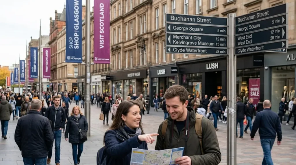
Conclusion: What Is the Real Answer to “How Long Does It Take to Walk Across Glasgow City Centre on Foot?”
The real answer is that walking across Glasgow city centre on foot typically takes 30–35 minutes for a standard east–west route of about 3 km, with shorter core routes taking 15–20 minutes and longer routes to the West End fringe taking 35–45 minutes. This time is based on a normal walking speed of around 5 km/h and assumes typical city centre conditions without major event crowding.
For most visitors and residents, this means:
- You can walk from Glasgow Green to the West End fringe in under 40 minutes.
- You can move between main stations (Queen Street, Buchanan Street, Central) in 15–25 minutes.
- You can plan a day with multiple zones (east, central, west) and still have ample time for activities.
Glasgow city centre’s compact size, clear layout, and strong pedestrian infrastructure make walking a practical, efficient, and enjoyable way to move across the city.
How long does it take to walk across Glasgow city centre?
Walking across Glasgow city centre typically takes 30–35 minutes, covering around 3 km (1.9 miles) at a normal walking pace.