
A weather forecast is a scientific prediction of atmospheric conditions over a specific location and time period, describing temperature, precipitation, wind, humidity, and other elements. In Glasgow, forecasts typically cover one to 14 days and are issued by national services such as the UK Met Office and shared through local and global weather platforms. These forecasts help residents, visitors, and businesses plan daily activities, travel, and events in a city known for frequent cloud cover and changeable conditions.
- What is a weather forecast and how does it work?
- What does Glasgow’s climate look like overall?
- How are Glasgow weather forecasts created step by step?
- What key elements are always included in a Glasgow forecast?
- How accurate are short‑term and long‑range forecasts for Glasgow?
- How do Glasgow’s seasons affect the weather forecast?
- What types of weather events are common in Glasgow forecasts?
- How do Glasgow forecasts differ inside the city versus suburbs?
- How should people use Glasgow weather forecasts in daily life?
- How have Glasgow forecasts changed over time?
- How might Glasgow weather forecasts develop in the future?
What is a weather forecast and how does it work?
A weather forecast is an estimate of future atmospheric conditions for a defined area, based on observations, numerical models, and expert analysis. It answers practical questions such as whether it will rain, how warm it will feel, how windy it will be, and what the overall sky conditions will look like. Forecasts are produced on scales ranging from a few hours to seasons, with short‑term forecasts (today and tomorrow) being the most accurate.
Weather services like the Met Office collect data from land stations, satellites, radar, and weather balloons, then run that data through computer models that simulate the atmosphere. Forecasters interpret these model outputs, adjust for local effects, and translate them into human‑readable forecasts such as “cloudy with light showers” or “bright and dry.” These forecasts are updated several times a day as new observations arrive, ensuring the latest information for Glasgow and surrounding areas.
In practice, Glasgow users see forecasts in formats such as hourly, daily, and 10‑day outlooks, each with temperature highs and lows, chance of precipitation, wind speed, and pressure. For example, a typical Glasgow bulletin might state: “maximum 13°C, 40% chance of rain, wind 14 mph from the west‑southwest.” These numbers are then wrapped in plain‑language summaries such as “dull and cloudy with a few light showers,” which are easier for the public to understand.
What does Glasgow’s climate look like overall?
Glasgow has an oceanic (maritime) climate, classified as temperate and wet, with relatively mild winters and cool summers. The city sits on the west coast of Scotland, where the North Atlantic Ocean and prevailing south‑westerly winds moderate temperatures and sustain frequent cloud cover and rainfall. Glasgow’s climate is typical of the Central Lowlands, with fewer extremes than inland or northern Scottish regions.
Annual average temperatures in Glasgow cluster around 8–10°C, with January averages roughly 4–5°C and July averages around 15–17°C. The city receives around 1,100–1,300 millimetres of rainfall per year, distributed across many light‑to‑moderate events rather than long, dry spells. Days with measurable rain number around 150–170 per year, which is higher than many English cities but consistent with western Scotland.
Glasgow’s skies are cloudy much of the year, with overcast or partly cloudy conditions dominating more than half of all days. Sunshine totals are modest, typically 1,200–1,500 hours annually, compared with over 1,600 hours in parts of southern England. This combination of moderate temperatures, frequent rain, and limited sunshine shapes how residents dress, plan outdoor events, and choose indoor activities.
How are Glasgow weather forecasts created step by step?
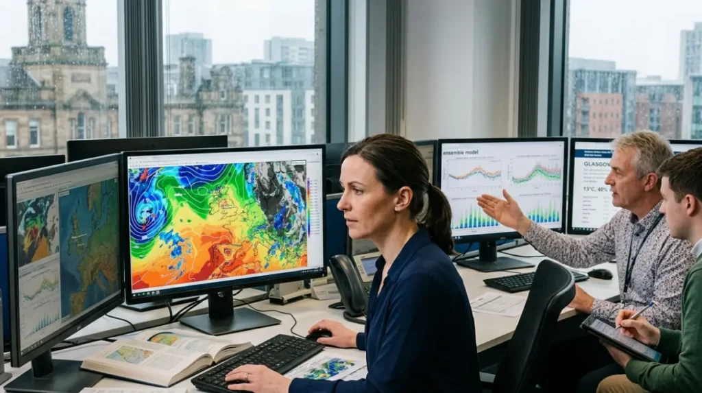
Glasgow weather forecasts are created through a multi‑step process: observation, data assimilation, modelling, interpretation, and publication. Observations come from fixed stations around Glasgow, including city‑centre weather sensors, airport instruments, radar, and satellite imagery. These measurements capture temperature, humidity, wind, pressure, cloud cover, and precipitation intensity at regular intervals.
This observational data is fed into data‑assimilation systems that blend measurements with background model fields to produce a consistent, three‑dimensional snapshot of the atmosphere. The refined snapshot then drives numerical weather prediction models such as the Met Office’s Unified Model, which solve physical equations to project how the atmosphere will evolve over the next hours and days.
Met Office forecasters analyse multiple model runs, comparing them with each other and with historical patterns for Glasgow and the West of Scotland. They adjust for local effects such as urban heat, the River Clyde, and nearby hills, which can modify wind and rain patterns. The final step is converting these technical outputs into public forecasts, such as “a few light showers” or “cloudy with isolated showers,” supplemented by temperature and wind figures.
What key elements are always included in a Glasgow forecast?
Every Glasgow weather forecast includes at least five core elements: temperature, precipitation probability and type, wind, cloud cover, and pressure trend. Temperature is given as a maximum and minimum for the day, often with a “feels like” value that accounts for wind and humidity. Precipitation is described by chance (for example, 30–70%) and form (rain, showers, or drizzle), with heavier events sometimes flagged as “thunder” or “heavy rain.”
Wind forecasts specify direction (such as south‑west or north‑east) and average speed, often in miles per hour or kilometres per hour, with gusts also noted. Cloud cover is expressed qualitatively as “clear,” “partly cloudy,” “cloudy,” or “overcast,” complementing any remarks about “bright spells” or “dull conditions.” Pressure is usually presented as a trend (rising, falling, steady) rather than raw millibars, because changes in pressure indicate approaching fronts or anticyclones.
Additional elements that frequently appear in Glasgow forecasts include humidity, UV index, and visibility. Relative humidity around 70–90% is common, especially in winter, affecting how damp the air feels. The UV index, often low in Glasgow, is still noted for summer days when short‑term sun exposure can matter. Visibility may be flagged in foggy or heavy‑rain situations, which can affect travel along the M8 and into the city centre.
How accurate are short‑term and long‑range forecasts for Glasgow?
Short‑term forecasts for Glasgow (today and tomorrow) are typically the most accurate, with daytime temperature and general conditions often within 1–2°C and the right category (dry, rain, showers) more than 80% of the time. Rainfall timing and location are harder to pin down, so Glasgow forecasts may correctly predict “a chance of showers” without hitting the exact hour or suburb. Hourly forecasts are useful for planning, but users should expect some shift in timing as new data arrives.
For three‑ to five‑day outlooks, accuracy declines but still provides valid guidance about trends such as “becoming drier” or “turning cooler.” Seven‑day forecasts are broadly reliable for the overall pattern (for example, “mild and unsettled” versus “cooler and brighter”), though individual days may change. Beyond one week, forecasts focus on broad tendencies rather than detailed conditions, and are best treated as indicative rather than precise.
Met Office skill scores for the UK show that forecast accuracy for temperature and bulk precipitation has improved steadily over decades, thanks to better models and more observations. However, Glasgow’s maritime location and complex topography mean that local micro‑climates can still produce surprises, such as a shower passing over the south side while the north side remains dry.
How do Glasgow’s seasons affect the weather forecast?
Glasgow’s four seasons each carry distinct forecast patterns that repeat from year to year. Winter (December–February) forecasts emphasise cool temperatures, frequent rain or showers, and the occasional frost or snow, especially in the nearby hills. Typical winter bullets note “maximum 6–8°C, cloudy with spells of rain,” with north‑easterly winds bringing colder, showery conditions on some days.
Spring (March–May) forecasts increasingly mention lengthening days, rising temperatures, and more changeable conditions. Glasgow often sees “showers and sunny spells” patterns, where short bursts of rain alternate with brighter periods. Frost gradually recedes, and maximum temperatures climb from 8–10°C in March to 14–16°C by May, with more frequent “dry intervals” noted in forecasts.
Summer (June–August) brings forecasts of milder nights, higher daytime temperatures, and occasionally longer dry spells. Typical summer language includes “cloudy with sunny intervals” and “a chance of showers,” with daytime highs around 18–21°C. Thunderstorms are possible but relatively rare, and long stretches of settled, hot weather are uncommon compared with southern England.
Autumn (September–November) forecasts return to cooler, wetter themes. Early autumn often has “mild and unsettled” conditions, with 12–15°C days and regular rain, then shifts toward “cooler and dull” as November approaches, with temperatures around 7–9°C and frequent cloud. After around 15 November, forecasts may begin to mention the possibility of more prolonged rain or gales, especially if a deep Atlantic system affects western Scotland.
What types of weather events are common in Glasgow forecasts?
Glasgow forecasts frequently mention several recurring weather types: drizzle and light showers, steady rain from frontal systems, cloudy or overcast days, and occasional sunnier, drier interludes. Drizzle and light showers arise from Atlantic low‑pressure systems and maritime air masses, often producing brief wet periods followed by brighter breaks. Steady rain is associated with slow‑moving fronts that can bring several hours of continuous precipitation across the city.
Cloudy or overcast conditions dominate many days, particularly in winter and autumn, leading to forecasts with phrases such as “dull and cloudy” or “mostly cloudy.” These conditions contribute to Glasgow’s relatively low annual sunshine totals and higher perceived gloom. Sunnier spells are more common in late spring and summer, when forecasts may describe “sunny intervals” or “partly sunny” periods.
Wind and exposure are another recurring theme, especially in westerly or south‑westerly flows off the Atlantic. Glasgow forecasts often note “breezy” or “windy” conditions, with gusts that can affect outdoor events and cycling. In rare cases, strong wind warnings or gale alerts may appear for the wider West of Scotland, though the city centre is somewhat sheltered compared with exposed coastal or hill areas.
How do Glasgow forecasts differ inside the city versus suburbs?
Forecasts for Glasgow are generally given for the city centre or a central district, but micro‑climates exist between the core and surrounding suburbs. Areas closer to open water, such as the Clyde estuary, may retain slightly higher temperatures at night and experience more frequent drizzle, while elevated suburbs like Cathkin or the Campsies foothills can be cooler and more prone to hill fog or light snow.
Urban heat‑island effects mean the city centre often records 1–2°C higher night‑time temperatures than rural outskirts, which forecasters sometimes highlight in extended outlooks. Suburbs further from the River Clyde or situated in sheltered valleys may see slightly different wind patterns, with stronger gusts on exposed ridges and lighter winds in low‑lying, built‑up areas. These local differences rarely change the broad category (“rain,” “cloudy,” “showers”) but can affect the intensity and timing of precipitation.
When planning for sports stadia, music venues, or outdoor markets, users should check forecasts that specify the exact district (e.g., Glasgow city centre, Glasgow Airport, or a named suburb) and read any local notes. Some forecast products explicitly label districts such as G3, G4, or G11, allowing more precise timing for events in areas like the South Side, North Side, or the West End.
How should people use Glasgow weather forecasts in daily life?
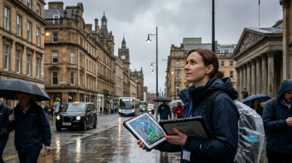
Residents, commuters, and visitors use Glasgow forecasts to make practical decisions about clothing, travel, and activities. A forecast of “cloudy with showers” prompts people to carry a waterproof jacket or umbrella, while a “dry and bright” outlook supports walking, cycling, or outdoor events. Temperature forecasts help people choose between light layers, heavy coats, or scarves and hats, especially in winter when real‑feel values can be several degrees below the air temperature.
Transport planning is another key use of forecasts. Warnings of heavy rain, fog, or strong winds can signal possible delays on trains, buses, and the M74/M8 corridors, prompting earlier departure or alternative routes. Similarly, forecast high temperatures in summer may lead to reduced travel times during peak heat or extra hydration for outdoor work.
For events such as concerts, sports matches, and festivals, organisers rely on multi‑day outlooks to assess risk of disruption from rain or wind and to plan contingency spaces or rescheduling thresholds. Small businesses such as cafes, markets, and construction sites also monitor forecasts to balance outdoor service, staffing, and site safety. By treating forecasts as probabilistic guidance rather than guarantees, users can adapt fluidly when conditions shift during the day.
How have Glasgow forecasts changed over time?
Weather forecasting in Glasgow has evolved from simple local observations and barometer readings to satellite‑driven, computer‑modelled predictions. In the 19th and early 20th centuries, forecasts were short‑range and qualitative, often based on cloud patterns and pressure changes recorded by a few stations. Communication channels were limited, so forecasts reached only a small fraction of the population.
From the mid‑20th century, national networks such as the Met Office expanded observational coverage and began issuing regular forecasts for cities including Glasgow. The introduction of weather radar and satellite imagery allowed forecasters to track Atlantic systems approaching western Scotland, improving the lead time for rain and wind warnings. By the 1980s and 1990s, numerical models became central to forecasting, enabling more detailed, quantitative outlooks.
In the 21st century, digital platforms have transformed how Glasgow residents access forecasts. Instead of waiting for TV bulletins or radio updates, people now check live‑updating apps, websites, and smart‑device integrations that display hourly and multi‑day forecasts tailored to GPS location. These advances have increased forecast accuracy and accessibility, but the underlying science still rests on the same principles of observation, modelling, and expert interpretation.
How might Glasgow weather forecasts develop in the future?
Future Glasgow forecasts are likely to become more precise in time, location, and impact, thanks to higher‑resolution models and new data sources. Localised, street‑level forecasts may highlight differences in rainfall intensity or temperature between neighbourhoods, helping users plan routes and events more finely. Machine‑learning techniques are being explored to refine short‑term now‑casting, where the next‑hour outlook is updated automatically as radar and observations arrive.
Climate‑change information may increasingly be integrated with shorter‑term forecasts, helping users understand how recurring “mild and wet” patterns or rare heatwaves relate to long‑term trends across Scotland. However, short‑term forecasts will still focus on the next few days, distinguishing between weather (hours to weeks) and climate (decades). This separation ensures that Glasgow residents receive clear, practical guidance about coming conditions while also being able to access broader climate context when needed.
What information is included in a weather forecast?
A weather forecast usually includes temperature, chance of rain, wind speed and direction, cloud cover, and general conditions like sunny or cloudy.