Key Points
- Significant Lane Restrictions: South Portland Street in the Southside of Glasgow is set to be reduced to a single lane for nearly three months due to major public realm civil works.
- Duration and Timing: The strict traffic management rules will commence at midnight on Monday, May 25, 2026, and are projected to stay in place until mid-August.
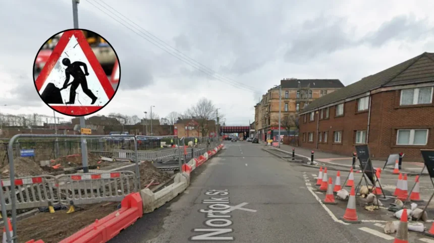
- Affected Zones: The primary lane closure targets the critical stretch between Oxford Street and Norfolk Street, directly impacting local commuters and cross-city traffic.
- Broader Network Revisions: Accompanying works will implement three-way temporary traffic management at the South Portland Street junction, alongside structural lane updates extending beyond Coburg Street.
- Strategic Project Alignment: The infrastructure disruption stems from Glasgow City Council’s extensive “Avenues Plus” initiative, which is funded by Transport Scotland and delivered via Sustrans.
Glasgow (Glasgow Express) May 22, 2026 – Drivers utilising the main arteries of Glasgow’s uk/local/southside/">Southside are being instructed to plan for extensive delays and re-evaluate their normal commuting routes ahead of structural engineering works that will restrict key roads for approximately three months. Beginning at 00:00 on Monday, May 25, South Portland Street will be systematically reduced to just one operational lane. According to transport notices published by local authorities, the narrow bottlenecks will explicitly impact the heavily industrial and residential stretch operating between Oxford Street and Norfolk Street. The closures are expected to remain functional day and night, significantly reshaping the local traffic flow from the late spring period well into the middle of August.
- Key Points
- Why is South Portland Street Being Reduced to One Lane?
- How Will This Development Impact Local Traffic Routing and Public Consultations?
- Background of the Avenues Plus Infrastructure Development
- Predictions: How These Closures Will Affect Southside Commuters and Residents
- Footfall and Access Adjustments for Local Businesses
- Enhanced Safety Environment for Residents
As reported by senior municipal reporters of the Glasgow Times, the localized traffic management strategy will apply dense restrictions starting directly from the South Portland Street junction.
To facilitate the safely partitioned engineering zones, a three-way temporary traffic management system will be erected on-site. This layout is designed to regulate competing streams of regional traffic attempting to navigate the Southside grid.
To mitigate the unavoidable congestion expected near the primary construction perimeter, civil engineers have scheduled a series of offset lane expansions nearby. Specifically, the westbound section situated at the Coburg Street junction is slated to be completely reinstated to two full lanes.
Documentation from Glasgow City Council highlights that this particular corridor will further expand, increasing cleanly to three distinct lanes beyond the Coburg Street junction to help disperse vehicles fleeing the primary bottleneck.
Why is South Portland Street Being Reduced to One Lane?
The upcoming three-month traffic configuration is dictated by the physical construction requirements of the South Portland Street Public Realm project.
This development forms a critical infrastructure arm of Glasgow’s expansive “Avenues Plus” initiative.
The overarching city-wide scheme is financed through the Glasgow City Region City Deal, with targeted funding from Transport Scotland administered via Sustrans’ long-term “Places for Everyone” programmatic framework.
The physical narrowing of the active roadway is legally and logistically required to establish a secure perimeter for civilian construction teams.
Workers will be installing major “green and blue” civic infrastructure directly into the old road layout.
This work involves the implementation of integrated rain gardens, extensive urban tree planting, and sustainable biodiverse drainage zones designed to capture localized surface runoff.
Concurrently, heavy machinery will be utilized to widen and structurally continuous the existing footways for pedestrians, while carving out dedicated, physically segregated cycling lanes that are entirely isolated from motor vehicle traffic.
Because these enhancements require breaking up the existing asphalt and re-laying traditional Scottish granite whin setts, cubes, and whinstone kerbing, the usable footprint of the street must be temporarily sacrificed.
How Will This Development Impact Local Traffic Routing and Public Consultations?
The engineering footprint of this phase directly interferes with long-established through-traffic movements that link the south and west quadrants of Glasgow to the eastern districts.
Historically, a substantial volume of commuter traffic originating from the south utilizes a route running through Coburg Street, executing a turn onto Oxford Street, continuing through South Portland Street, and finally feeding into Norfolk Street to travel eastwards.
A secondary heavy stream of traffic originating from the west uses Oxford Street as a direct slip onto South Portland Street.
By squeezing South Portland Street down to a single lane for nearly a quarter of a year, the city’s transport division is purposefully altering the capacity of this commuter bypass.
This long-term restriction aligns closely with data gathered during the initial public engagement and stakeholder consultation workshops.
During those public exercises, local residents and vulnerable road users flagged traffic speed and sheer vehicular volume along South Portland Street as primary safety concerns.
In response to those findings, municipal planners have used these construction phases to experiment with permanent traffic calmers.
This includes actively testing long-term adjustments to neighborhood road priorities, such as evaluating options to reverse the one-way travel directions of both Coburg Street and South Portland Street entirely to permanently discourage non-local through-traffic.
Explore More Southside News
Scottish Power Works Cause Delays on Cathcart Road, Glasgow 2026
Glasgow Southside Voter Guide: 2026 Election Questions
Background of the Avenues Plus Infrastructure Development
The current works on South Portland Street represent a major milestone in Glasgow’s strategic master plan to re-engineer its core urban landscape.
The “Avenues Plus” project was conceived as an extension of the original £115 million Avenues Programme, which is funded through the Glasgow City Region City Deal.
The primary objective of the program is to shift the city’s transport equilibrium away from fossil-fuel vehicle dependency and toward active travel options, including walking, wheeling, and cycling.
South Portland Street was selected as a priority site because it acts as a crucial link connecting the historical Clyde walkways to the residential and commercial redevelopments across Laurieston.
Public data from Glasgow City Council surveys conducted during the design phases indicated that 32% of regular commuters highlighted poor onward links, while 24% cited an inherently unsafe environment as major barriers to choosing active travel in the Southside.
Furthermore, 22% of surveyed participants demanded increased public seating, and 17% explicitly requested secure cycle storage.
The structural overhaul now occurring behind the lane closures aims to directly address these historical shortcomings by installing two brand-new controlled pedestrian crossings at Norfolk Street and Oxford Street, introducing custom seating equipped with arm and back rests, and creating a continuous green corridor linking the riverfront deep into the Southside.
Predictions: How These Closures Will Affect Southside Commuters and Residents
The implementation of these three-month lane closures will directly alter daily routines across several distinct groups within the local population.
For everyday motorists and commercial delivery drivers who rely on South Portland Street as a cross-city connector, the immediate result will be a steep escalation in peak-hour delays.
The reduction to a single lane will cause significant tailbacks that are highly likely to spill backward onto Oxford Street and surrounding residential side roads.
Commuters should expect their average morning and evening transit times through the Southside grid to increase by an estimated 10 to 15 minutes during the initial weeks of adjustment.
Footfall and Access Adjustments for Local Businesses
For local businesses operating along the Norfolk Street and Carlton Place boundaries, the impact will be mixed. While the presence of construction barriers and the loss of temporary curbside stopping points may complicate delivery logistics and temporarily lower drive-by visibility, the long-term projection remains highly positive.
Once the lane restrictions are removed in August, businesses will be positioned inside a high-footfall pedestrian avenue designed to attract substantially higher levels of walking and cycling consumers.
Enhanced Safety Environment for Residents
For local Southside residents, the closures will initially present access frustrations and heightened ambient noise from construction machinery. However, the reduction in usable road space will instantly suppress the volume and speed of transient traffic using their neighborhood as a shortcut. This creates an immediate, albeit temporary, safety buffer for local families and individuals with accessibility needs, paving the way for the permanent traffic-calmed environment that the final infrastructure project promises to deliver.