

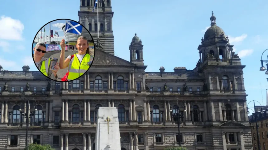
Key Points:
- Mass Distribution: Over 15,000 copies of the “Wee Yellow Guide” pocket map were distributed to visitors during the 2026 Commonwealth Games.
- Organiser Effort: The distribution was carried out directly by the Glasgow Taxis street team across key city locations.
- Product Features: The guide is a foldable, double-sided, pocket-sized city map designed for quick navigation.
- Target Audience: The initiative targeted international tourists, official delegates, and visiting guests navigating Glasgow during the event.
- Launch Timeline: The mapping resource was officially launched earlier in the summer ahead of the Games period.
Glasgow (Glasgow Express) August 22, 2026 – A tailored navigation initiative achieved significant reach during the recent 2026 Commonwealth Games, with official figures confirming that over 15,000 pocket-sized city maps were distributed to international visitors, event delegates, and tourists navigating Glasgow. The street-level campaign was managed and executed directly by Glasgow Taxis in an effort to enhance public transport access and spatial orientation across the city’s main venues and cultural hotspots during the high-density sporting event.
Why Was the Pocket Map Introduced for the 2026 Commonwealth Games?
The initiative was designed to address spatial orientation challenges frequently experienced by large influxes of short-term visitors during major international events. Launched earlier in the summer season, the publication—titled the “Wee Yellow Guide”—was developed as a compact, double-sided, foldable physical map. According to representatives from Glasgow Taxis, the physical format offered a reliable, immediate alternative to digital navigation applications, which often suffer from network congestion or battery drain in high-density spectator areas.
Members of the Glasgow Taxis dedicated street team were stationed across high-footfall zones, transit hubs, and venue perimeter routes to hand out the printed guides free of charge.
The distribution campaign ran throughout the duration of the Commonwealth Games, providing immediate routing assistance, taxi rank locations, and key landmark markers to help guests move around Glasgow efficiently.
Background of the Glasgow Taxis Map Initiative
The public distribution of print-based city guides forms part of a broader, recurring host-city transport management strategy observed during large-scale athletic gatherings.
Glasgow Taxis, which operates as one of the major licensed taxi operators in the region, initially introduced the Wee Yellow Guide concept earlier in the summer season to establish a simplified, physical navigation tool ahead of the summer influx.
Large-scale multi-sport competitions such as the Commonwealth Games traditionally place exceptional operational demands on local transport networks, pedestrian corridors, and private hire services. In response, private operators and city transport bodies frequently deploy physical mapping and street-level ambassador teams to complement municipal signage and digital transit applications.
The deployment of over 15,000 physical guides highlights the ongoing reliance on tactile, immediate reference materials to mitigate congestion and assist international visitors who may lack local mobile data packages or familiarity with Glasgow’s urban layout.
How Will This Transport Initiative Affect Glasgow Visitors and Local Operators?
The successful deployment and wide uptake of the Wee Yellow Guide during the Commonwealth Games is expected to influence future host-city transport strategies for upcoming major events in Glasgow.
For visitors and future tourists, the wide distribution of free, physical navigation resources sets a practical benchmark for city accessibility. Guests benefit from enhanced independence when navigating urban centres, reducing reliance on mobile connectivity and ensuring clear guidance towards designated transport points, safety zones, and civic landmarks.
For local taxi drivers and transport coordinators, the widespread adoption of structured physical maps streamlines passenger interactions and reduces street-level confusion at major drop-off and pick-up zones. By establishing clear visual reference points for ranks and transit hubs, operators can maintain faster turnaround times and reduce localized traffic bottlenecks during peak demand periods. The outcome is likely to encourage similar collaborative initiatives between transport companies and city planners for future international gatherings.