
Glasgow is Scotland’s largest city and a major centre for business, education, tourism and culture. Its public transport network connects the city centre with residential neighbourhoods, universities, shopping districts, cultural attractions and surrounding towns. Visitors and residents can travel across Glasgow using the Subway, local buses, trains, walking routes and cycling infrastructure without owning or hiring a car.
- Why Is Glasgow Suitable for Travelling Without a Car?
- How Does the Glasgow Subway Work?
- How Can You Travel Around Glasgow by Bus?
- How Can You Use Glasgow’s Train Network Without a Car?
- Is Walking a Practical Way to Explore Glasgow?
- Which Glasgow Attractions Are Within Walking Distance?
- How Should You Prepare for Walking in Glasgow?
- Can You Cycle Around Glasgow Without a Car?
- How Do You Travel Between Glasgow Airport and the City Centre Without a Car?
- How Much Does It Cost to Get Around Glasgow Without a Car?
- How Can You Combine Different Transport Options in Glasgow?
- Is Glasgow Accessible for Travellers With Limited Mobility?
- How Can You Check Step-Free Transport Routes?
- What Should Travellers With Children or Luggage Consider?
- What Is the Best Way to Travel Around Glasgow at Night?
- How Can You Travel From Glasgow to Nearby Towns Without a Car?
- What Are the Main Challenges of Living in Glasgow Without a Car?
- How Can You Plan an Efficient Car-Free Visit to Glasgow?
- What Is the Future of Car-Free Travel in Glasgow?
Living or visiting Glasgow without a car requires an understanding of the city’s transport zones, ticketing systems, railway stations and connections between different modes of travel. The city centre is compact enough for many journeys on foot, while buses, trains and the Subway provide access to destinations farther away. Glasgow Airport also connects with the city through dedicated public transport services.
This guide explains how to get around Glasgow without a car, how each transport option works, how to plan journeys, and which practical factors affect travel costs, accessibility and journey times.
Why Is Glasgow Suitable for Travelling Without a Car?
Glasgow supports car-free travel through its urban railway network, circular Subway, extensive bus services, walkable central districts and developing cycling infrastructure. These options connect major attractions, universities, shopping areas and residential neighbourhoods, allowing travellers to combine public transport and walking for everyday journeys.
Glasgow developed as an industrial and commercial city around the River Clyde. Its growth created a network of railway lines linking the central business district with residential communities and neighbouring settlements. The modern transport system reflects this historical development, with Glasgow Central and Glasgow Queen Street serving as major railway gateways.
The city centre contains many destinations within walking distance of one another. George Square, Buchanan Street, the Gallery of Modern Art and Glasgow Central Station are all located in or close to the central area. Walking between these locations often eliminates the need for a bus or train.
For longer journeys, the Glasgow Subway serves central neighbourhoods and the West End. Local buses reach districts beyond the Subway network, while suburban and regional trains connect areas including Partick, Pollokshields, Mount Florida and other communities.
Car-free travel also reduces the need to pay for parking, fuel, vehicle insurance and maintenance. Travellers still need to budget for tickets, occasional taxis and journeys to destinations outside the main public transport network.
The most effective approach is to select transport according to the journey. Walking suits short central trips, the Subway serves its circular route, buses provide broad local coverage, and trains work well for longer cross-city or suburban journeys.
How Does the Glasgow Subway Work?
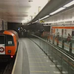
The Glasgow Subway is a circular underground railway serving 15 stations across the city centre and West End. It operates on an Inner and Outer Circle, providing frequent connections between major destinations such as Buchanan Street, St Enoch, Kelvinbridge and Partick.
The Glasgow Subway opened in 1896, making it one of the oldest underground railway systems in the world. Strathclyde Partnership for Transport, commonly known as SPT, operates the network. Its compact route makes it particularly useful for journeys between central Glasgow and popular West End neighbourhoods.
The system uses two directions around the same circular track. The Inner Circle and Outer Circle travel in opposite directions. Passengers select the direction that reaches their destination most efficiently rather than looking for separate northbound and southbound lines.
Which Glasgow Subway Stations Are Most Useful?
Buchanan Street provides access to central shopping streets and connections towards Glasgow Queen Street Station. St Enoch serves the southern part of the city centre and shopping areas near Argyle Street. These stations are useful for visitors staying in central hotels or exploring retail districts.
Kelvinbridge provides access to parts of the West End, including routes towards Great Western Road and nearby residential areas. Hillhead is particularly useful for Byres Road, the University of Glasgow area and West End cafés. Partick connects the Subway with the railway network and local bus services.
Cowcaddens serves destinations north of the central shopping district, while Kelvinhall provides access to attractions and residential areas in the West End. The most suitable station depends on the final walking distance to the destination.
How Do You Pay for the Glasgow Subway?
Passengers can use the ticketing options offered by SPT, including contactless payment where supported, Subway smartcards and available paper tickets. Contactless payment is convenient for occasional journeys, while a smartcard or season ticket suits regular users when its terms and pricing offer value.
Check the official SPT website for current fares, ticket conditions, operating hours and service updates before travelling. Ticket validity and payment arrangements differ between transport operators, so a Subway ticket should not automatically be treated as valid on buses or national rail services.
The Subway is especially useful when travelling between the city centre and the West End. It does not serve every Glasgow neighbourhood, so many journeys require a walk, bus connection or train transfer.
How Can You Travel Around Glasgow by Bus?
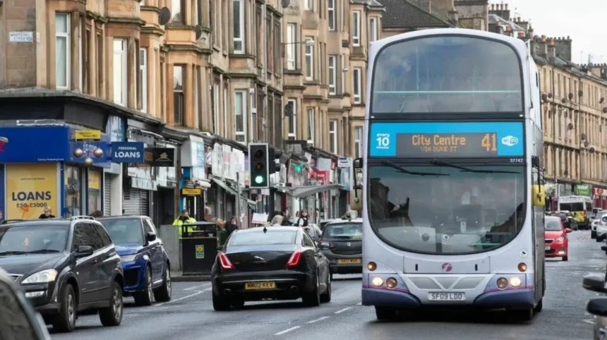
Glasgow’s bus network connects the city centre with neighbourhoods that the Subway does not serve directly. Local buses provide access to residential districts, shopping centres, hospitals, employment areas and surrounding communities, making them essential for journeys beyond the central railway network.
Buses provide one of the broadest forms of public transport coverage in Glasgow. Several operators run services across the city and surrounding areas. First Bus operates a significant network, while other operators provide selected local and regional routes.
Bus routes generally follow major roads and connect residential districts with transport hubs and commercial areas. This makes them practical for journeys between neighbourhoods that do not share a direct Subway or railway connection.
How Do You Find the Right Glasgow Bus Route?
Passengers can use operator journey planners, mobile applications and established transport information services to identify suitable routes. Enter the starting point and destination, then check the stop name, service number, departure time and direction of travel.
A route number alone is not sufficient because buses on the same route operate in different directions and may follow different stopping patterns. Confirm the destination displayed on the vehicle and check the stop information before boarding.
For example, someone travelling from the city centre to a residential area outside the Subway network can compare direct buses with a combination of train and bus. The direct bus reduces transfers, while a rail connection can offer a faster journey on suitable routes.
How Do Glasgow Bus Tickets Work?
Ticketing arrangements depend on the operator and ticket type. Some services accept contactless bank cards, mobile payments or operator-specific smartcards. Day tickets and multi-journey products are available on relevant networks, subject to their individual conditions.
Passengers travelling with different operators should check whether a ticket covers one company or a wider network. A ticket purchased for one operator does not necessarily cover every bus in Glasgow.
For occasional visitors, contactless payment is often convenient where accepted. Regular commuters should compare single fares, day tickets, weekly products and season tickets against their normal travel patterns.
Allow additional time during peak commuting periods and when travelling through busy city-centre corridors. Road congestion affects bus journey times, particularly during weekday morning and evening travel periods.
How Can You Use Glasgow’s Train Network Without a Car?
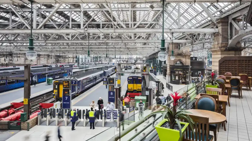
Glasgow’s railway network connects the city centre with suburban communities, neighbouring towns and destinations across Scotland. Glasgow Central and Glasgow Queen Street are the principal city-centre stations, while local stations provide access to residential districts and connections with the Subway and buses.
Rail travel is particularly effective for journeys that extend beyond the Glasgow Subway network. ScotRail operates many local and regional services, including connections between central stations and surrounding communities.
Glasgow Central mainly handles routes serving destinations to the south and west, alongside longer-distance services. Glasgow Queen Street serves many routes towards the north and east, including services to Edinburgh and other Scottish destinations. Exact routes depend on the service and timetable.
Which Glasgow Railway Station Should You Use?
Glasgow Central is convenient for the central shopping district, the financial area and connections towards the south side. Glasgow Queen Street is close to George Square and major shopping streets, making it practical for visitors travelling from Edinburgh and other destinations on its network.
Partick is an important interchange in the West End, connecting rail services with the Subway and buses. Other stations, including Exhibition Centre, Charing Cross and Mount Florida, provide access to specific neighbourhoods, venues and residential districts.
Before travelling, check the station and platform information in the ScotRail journey planner. Some journeys require a transfer between Central and Queen Street, which are separate stations rather than a single interchange platform.
How Do You Buy Train Tickets in Glasgow?
Passengers can purchase eligible tickets online, through the ScotRail app, at station ticket facilities or through other authorised sales channels. Ticket prices depend on the route, journey date, time, ticket restrictions and available discounts.
Advance tickets on eligible services often require travel on a specified train. Flexible tickets have different conditions and are more suitable when departure times are uncertain. Railcards offer discounts to eligible passengers, subject to the relevant terms.
Check the ticket conditions before boarding. Buying a ticket for the correct destination does not always mean it is valid on every train or at every time.
Rail services are useful for airport connections, suburban commuting and trips beyond Glasgow. For local journeys, compare rail with the Subway and buses based on the station’s location and the distance from the destination.
Is Walking a Practical Way to Explore Glasgow?
Walking is one of the most practical ways to travel around central Glasgow because major shopping streets, historic buildings, museums and railway stations sit relatively close together. Pedestrian routes also connect public transport stops with destinations that lack direct station access.
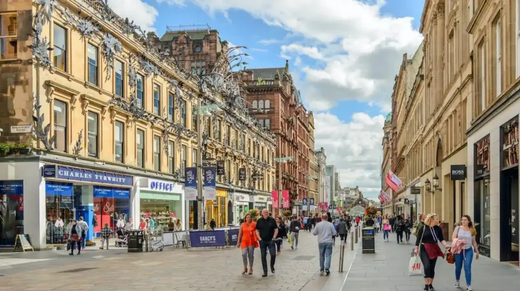
Glasgow’s central streets support walking between shopping, business and cultural destinations. Buchanan Street is a major pedestrian shopping street, while nearby streets lead towards George Square, Sauchiehall Street and the River Clyde. Walking also provides a direct way to explore the city’s architecture and public spaces.
The distance between two locations matters more than the straight-line distance shown on a map. River crossings, road junctions, station entrances and pedestrian crossings affect the actual route. Digital mapping applications help identify walking distances and estimated journey times.
Which Glasgow Attractions Are Within Walking Distance?
George Square, Buchanan Street and Glasgow Central Station form a useful starting area for central exploration. The Gallery of Modern Art stands near Buchanan Street, while the Merchant City lies to the east of the central shopping district.
The River Clyde provides access to waterfront routes and destinations farther south. Walking across the river connects the city centre with areas around the south bank, although the most convenient bridge depends on the starting point and destination.
The West End also supports walking between Byres Road, the University of Glasgow and nearby green spaces. Hillhead and Kelvinbridge Subway stations provide useful entry points for visitors who want to combine walking with public transport.
How Should You Prepare for Walking in Glasgow?
Scotland’s weather changes throughout the year, so a waterproof jacket and suitable footwear are practical choices. Rain affects comfort and walking speed, particularly on longer journeys or exposed riverside routes.
Check the route for steep sections, construction work and road crossings. Travellers with limited mobility should confirm step-free access and pavement conditions rather than relying solely on estimated walking times.
Walking is most efficient for short journeys with several nearby stops. For destinations farther apart, combine walking with the Subway, bus or train to reduce travel time.
Can You Cycle Around Glasgow Without a Car?
Cycling offers an alternative for short and medium-distance journeys across Glasgow. The city has on-road cycle facilities, designated cycling routes and access to shared paths, while Transport Scotland promotes walking, wheeling and cycling as forms of active travel for everyday journeys.
Cycling can connect residential neighbourhoods with workplaces, universities and public transport stations. It also reduces dependence on road-based transport for journeys that are too long to walk comfortably but do not justify a train or bus trip.
Transport Scotland defines active travel as purposeful journeys made by walking, wheeling or cycling. Its transport policies encourage safer infrastructure and greater use of these modes for everyday travel.
Where Can You Cycle in Glasgow?
Cycling routes vary by neighbourhood. Some streets have dedicated cycle lanes, while other routes use shared paths or quieter roads. The best route depends on traffic conditions, junction design, roadworks and the cyclist’s experience.
Kelvingrove Park and the wider West End provide access to paths and nearby destinations, although cyclists must follow signs governing shared spaces. Routes alongside the River Clyde also connect parts of the city, with the exact suitability depending on the section being used.
Use Glasgow City Council’s cycling information and current route maps to identify designated facilities. Check whether a route is suitable for everyday commuting, recreational riding or travel with children before setting off.
Can You Hire a Bicycle in Glasgow?
Bicycle access depends on the hire schemes and operators available at the time of travel. Check current bike-sharing availability, hire conditions, collection locations and return rules before planning a journey around a rental bicycle.
Privately owned bicycles offer greater flexibility for regular commuting but require secure storage and maintenance. Electric bicycles provide motor assistance while pedalling, making longer journeys and uphill sections more manageable.
Cyclists should use suitable lights in low-light conditions, wear a helmet if they choose to do so, and follow current road rules. Plan routes around safe crossings and protected infrastructure wherever practical.
How Do You Travel Between Glasgow Airport and the City Centre Without a Car?
Glasgow Airport connects with the city centre through dedicated airport buses and other local and regional bus services. The Glasgow Airport Express service 500 links the terminal with Buchanan Bus Station and central stops, providing a direct alternative to driving or taking a taxi.
Glasgow Airport is located in Paisley, west of Glasgow city centre. Unlike some major UK airports, it does not have a direct passenger railway station at the terminal. Bus services therefore play an important role in connecting arriving passengers with central Glasgow and the wider transport network.
The airport identifies Glasgow Airport Express service 500 as its official city-centre connection. The service operates between the terminal and Buchanan Bus Station, with additional stops in the city centre.
Where Do You Catch the Airport Express Bus?
At the airport, passengers should follow terminal signs to the designated bus stands and confirm the current departure point for service 500. The city-centre departure point is Buchanan Bus Station, stance 46, according to the airport’s published service information.
The service also provides central stops, which can be useful for travellers staying near Glasgow Central Station or other city-centre destinations. Check the latest timetable and stop information before travelling because roadworks and temporary diversions can affect boarding locations.
Passengers travelling with large suitcases should allow time to board and store their luggage. Travellers arriving late at night should verify the last departure rather than assuming that the airport bus operates at the same frequency throughout the day.
What Is the Best Alternative to the Airport Express?
Other buses and coaches connect Glasgow Airport with Paisley and destinations elsewhere in Scotland. The most suitable service depends on the final destination, departure time and available connections.
A taxi offers direct door-to-door travel but usually costs more than a public bus. Travellers can compare the airport bus with a taxi using their accommodation address, luggage requirements and arrival time.
For a journey to the West End, compare the airport bus followed by a Subway or local bus connection against other available services. A journey planner provides a clearer comparison than choosing a route based only on the airport’s distance from the destination.
How Much Does It Cost to Get Around Glasgow Without a Car?
The cost of car-free travel in Glasgow depends on journey frequency, distance, operator and ticket type. Single tickets suit occasional trips, while daily caps, season tickets and multi-operator products can reduce costs for visitors or residents who make several journeys.
Public transport costs should be assessed across the entire journey rather than by comparing individual fares in isolation. Someone travelling by bus to a railway station and then taking the Subway needs to check the ticket conditions for each leg.
What Are the Current Glasgow Subway Fares?
SPT’s published 2026 contactless fares list a single Subway journey at £1.80, a daily cap of £3.40 and a Monday-to-Sunday weekly cap of £15.50. These contactless caps apply when passengers consistently use the same payment card or device for their Subway journeys.
The daily cap limits the eligible contactless Subway charges for the day. The weekly cap limits eligible charges over the Monday-to-Sunday period. Passengers should tap in and out using the same card or device to ensure journeys are recorded correctly.
These fares apply to the Subway contactless system, not automatically to buses, ScotRail or airport services. Check the relevant operator’s fares before budgeting for a multi-stage journey.
Which Travel Pass Is Best for Regular Journeys?
SPT offers several ticketing products, including Subway smartcards, day tickets, concessionary travel and ZoneCard. ZoneCard provides unlimited travel on participating services within the zones covered by the ticket, subject to its terms.
A day ticket can suit a visitor who plans to make several journeys on covered services. A weekly product is more appropriate for regular commuting when its price is lower than buying individual tickets. The best option depends on the number of journeys, the operators used and the zones covered.
Compare the total cost of the planned journeys before purchasing a pass. A ticket that covers more transport modes is not automatically the cheapest choice for someone travelling only on the Subway.
How Can You Combine Different Transport Options in Glasgow?
Combining buses, trains, the Subway and walking helps travellers reach destinations that one transport service does not cover directly. A journey planner identifies transfer points, departure times and walking connections, helping passengers select practical routes across Glasgow.
Multimodal travel means using more than one transport mode during a journey. A passenger travelling from the airport to a hotel in the West End, for example, can take the Airport Express towards the city centre and continue by Subway, bus or walking.
The best interchange depends on the destination. Buchanan Bus Station provides connections with local and longer-distance buses. Partick connects rail, Subway and bus services in the West End. Glasgow Central and Glasgow Queen Street serve different railway routes and should not be treated as the same station.
ScotRail also operates a Glasgow stations link bus connecting Glasgow Central, Glasgow Queen Street and Buchanan Bus Station. Its published information describes a service with varying frequencies according to the day and time, so passengers should check the latest timetable before relying on it.
How Do You Plan a Journey With Multiple Transfers?
Start by entering the exact departure point and destination into a transport journey planner. Compare the suggested departure times, walking sections and transfer locations. Then check whether the journey requires separate tickets.
Allow additional time when changing between transport operators or travelling with luggage. A connection that looks straightforward on a map becomes less convenient when the next service departs from a different street or station entrance.
For example, a traveller visiting the University of Glasgow from the south side can compare a train to Partick followed by the Subway or walking with a direct bus. The better route depends on the origin, destination and timetable.
Is Glasgow Accessible for Travellers With Limited Mobility?
Glasgow offers accessible travel options across parts of its public transport network, including selected step-free railway stations, buses and pedestrian routes. Accessibility varies by station, vehicle, stop and street, so passengers should verify facilities before travelling.
Accessibility refers to how easily people with mobility, sensory or other access requirements can use transport and reach destinations. Glasgow’s transport network includes facilities such as wheelchair spaces on buses, accessible station entrances at selected locations and passenger assistance on eligible rail journeys.
However, not every station has step-free access, and some walking routes include steep gradients, uneven surfaces or busy crossings. A route planner’s estimated journey time does not necessarily account for these barriers.
How Can You Check Step-Free Transport Routes?
Check ScotRail station information for lift availability, platform access and passenger assistance. Confirm whether the required platform is accessible and whether engineering work affects the normal route.
For Subway journeys, review SPT’s station information before setting off. Check the location of entrances and the facilities available at the destination station rather than assuming every station has identical access arrangements.
Passengers using wheelchairs or travelling with mobility aids should also check bus accessibility and boarding arrangements with the operator. Where a journey requires several transfers, confirm access at every stage.
What Should Travellers With Children or Luggage Consider?
Families with prams and travellers with suitcases benefit from routes with fewer transfers and shorter walking distances. A direct bus is often simpler than changing between several transport modes, even when the latter route has a shorter scheduled journey time.
Use station lifts where available and allow time to board vehicles safely. During busy periods, crowded platforms and buses can make transfers more difficult.
What Is the Best Way to Travel Around Glasgow at Night?
Night-time travel in Glasgow depends on the operating hours of the Subway, local buses and railway services. Travellers should check the final departure for their route and identify an alternative before going out, especially when returning from venues outside the city centre.
Glasgow has a busy evening economy, including restaurants, music venues, theatres and nightlife districts. Transport availability changes later in the evening, and a route that operates frequently during the day does not necessarily maintain the same service after midnight.
The Subway operates to a published timetable, with the final trains varying by direction, station and day. Local buses and trains also follow operator-specific schedules. Weekend and public-holiday services can differ from normal weekday timetables.
How Should You Plan a Late-Night Return Journey?
Check the last train or Subway departure before leaving your accommodation. Confirm the final bus departure and the exact stop where you need to board. If public transport stops before your event finishes, identify a licensed taxi or another suitable option.
Keep enough time to reach the station before the last service. A missed connection can turn a short journey into a costly taxi trip, particularly when travelling to a neighbourhood outside the central area.
For groups, agree on a meeting point and confirm the final destination before travelling. Use well-lit, established walking routes and avoid assuming that a nearby station remains open simply because its entrance is visible.
How Can You Travel From Glasgow to Nearby Towns Without a Car?
Glasgow’s regional railway and coach networks connect the city with nearby towns and destinations across Scotland. Trains are useful for regular regional journeys, while coaches provide direct connections on selected routes, including longer trips that extend beyond the local transport network.
Glasgow functions as a regional transport hub. Rail services connect the city with destinations such as Paisley, Motherwell, Stirling and Edinburgh, depending on the route and departure station. Coaches also connect Buchanan Bus Station with towns and cities throughout Scotland.
The best mode depends on the destination, timetable and distance from the final station. Some towns have frequent rail connections, while other destinations require a bus or coach for the most direct journey.
How Do You Choose Between a Train and a Coach?
Compare the full journey time, ticket price, departure location and arrival point. Trains often suit journeys to destinations served by direct railway lines, while coaches can provide useful direct services to places not conveniently reached by train.
Check whether a rail ticket requires advance booking or has restrictions on the departure time. Coach operators have their own luggage allowances, ticket rules and boarding locations.
For trips involving rural destinations, confirm the onward connection before booking. A train or coach can reach a nearby town without providing direct access to the final attraction or accommodation.
Explore More Area Guide
Openreach Copper Phone Order Changes Hit Three Areas: Glasgow 2026
Glasgow Subway vs Bus: Which Is Better for Commuting?
What Are the Main Challenges of Living in Glasgow Without a Car?
Living without a car in Glasgow is practical for many urban journeys, but the experience depends on where you live, work and shop. Service frequency, late-night connections, weather, accessibility and journeys to less-connected destinations influence the convenience of a car-free lifestyle.
The city centre and areas close to major railway or Subway stations offer convenient access to public transport. Residents in neighbourhoods farther from these routes often rely more heavily on local buses or a combination of transport modes.
How Does Your Neighbourhood Affect Travel?
Before choosing accommodation, check the walking distance to the nearest bus stop, railway station or Subway entrance. Review the frequency of services at the times you normally travel, not only during the daytime.
A property near a station can simplify commuting and reduce dependence on taxis. However, the nearest station is not always the most useful one. Direct routes, service frequency and the location of workplaces or schools also matter.
How Do Weather and Disruptions Affect Journeys?
Rain, winter darkness, roadworks and railway engineering work affect travel planning. Bus services can experience road congestion, while trains and Subway services occasionally experience delays or disruption.
Check live departure boards and official operator announcements before important journeys. Allow extra time for airport transfers, appointments and travel involving several connections.
Keeping an alternative route in mind reduces the impact of disruption. A direct bus, a different railway station or a short taxi journey can sometimes provide a practical backup.
How Can You Plan an Efficient Car-Free Visit to Glasgow?
An efficient car-free visit begins with accommodation near suitable transport links and an itinerary organised by neighbourhood. Combining walking with the Subway, buses and trains reduces unnecessary backtracking and helps visitors reach central attractions, the West End and destinations beyond the city centre.
Visitors should identify the nearest transport stops to their accommodation before arriving. They should also check airport connections, ticket options and the opening hours of attractions that require a specific arrival time.
Morning: Explore central Glasgow
Start at George Square, walk towards Buchanan Street and explore the surrounding city-centre streets. Use Glasgow Central or Queen Street as a reference point for transport connections.
Afternoon: Visit the West End
Take the Subway towards Hillhead or Kelvinhall, depending on your destination. Explore Byres Road or visit Kelvingrove Art Gallery and Museum, checking walking distances and opening times in advance.
Evening: Explore the riverside
Travel towards the River Clyde for a walk along an accessible section of the waterfront. Check your return bus, train or Subway timetable before staying out late.
This itinerary uses central walking routes and public transport to connect separate parts of the city. Travellers should adjust the sequence according to weather, attraction opening hours and their accommodation location.
For a longer visit, add a regional train journey or a coach trip to a nearby destination. Confirm the return timetable before leaving Glasgow, particularly for locations with limited evening services.
What Is the Future of Car-Free Travel in Glasgow?
Car-free travel in Glasgow forms part of Scotland’s wider transport policy, which promotes walking, wheeling, cycling and public transport as alternatives to unnecessary car journeys. Future travel convenience depends on service reliability, accessible infrastructure, transport integration and investment in sustainable mobility.
Transport Scotland’s National Transport Strategy identifies the need for accessible, affordable and sustainable transport choices. Its active-travel policy also supports improvements that make walking, wheeling and cycling practical for everyday journeys.
For Glasgow residents, these priorities relate to practical improvements such as safer pedestrian crossings, connected cycle routes, reliable public transport and accessible stations. Better connections between transport modes also help people reach destinations without needing a private vehicle for every stage.
The usefulness of a car-free lifestyle will continue to depend on local conditions. People living close to frequent transport services have different needs from those travelling across the city’s outer neighbourhoods or visiting rural destinations.
Travellers can make informed choices by checking current timetables, selecting appropriate tickets and planning around their regular destinations.
Getting around Glasgow without a car is achievable through a combination of walking, the Subway, local buses, suburban trains and regional coaches. The Subway provides efficient travel between the city centre and the West End, buses reach a wider range of neighbourhoods, and trains connect Glasgow with surrounding communities and other Scottish cities.
For visitors, walking and the Subway cover many central attractions, while the Airport Express provides a direct connection between Glasgow Airport and the city centre. Residents can reduce travel costs by comparing single fares, daily caps, season tickets and eligible multi-operator passes.
The key is to plan journeys around actual destinations, current timetables and accessible connections. With suitable preparation, Glasgow’s transport network supports commuting, sightseeing, shopping and regional travel without requiring a private car.
Is it easy to get around Glasgow without a car?
Yes, Glasgow has an extensive public transport network, including the Subway, buses and trains. Walking is also practical in the city centre, while cycling and regional coaches provide additional travel options.