
Partick and Finnieston are neighbouring areas in Glasgow’s west end, but they have different historical identities, urban forms, transport roles and commercial patterns. Partick developed around an historic burgh and transport interchange, while Finnieston developed from an industrial riverside district into a mixed-use urban area.
- What is the main difference between Partick and Finnieston?
- Where are Partick and Finnieston located in Glasgow?
- Why does Partick have such a strong historical identity?
- Why is Finnieston associated with Glasgow’s industrial and modern urban development?
- How do Partick and Finnieston differ in transport?
- How do the streets, buildings and housing differ between Partick and Finnieston?
- What are Partick and Finnieston like for food, culture and leisure?
- How close are Partick and Finnieston to Glasgow city centre?
- How do Partick and Finnieston compare for living, visiting and everyday use?
- How has the relationship between Partick and Finnieston changed over time?
- What should you know before choosing between Partick and Finnieston?
The distinction is important because both names appear frequently in Glasgow addresses, property listings, restaurant guides and travel information. Their boundaries are not always understood in everyday conversation. Some streets sit close to the transition between the two areas, while official administrative boundaries use different terminology.
Partick is strongly associated with Partick Cross, Dumbarton Road, Byres Road, Partick Interchange, the River Kelvin and the wider Partickhill area. Finnieston is associated with Argyle Street, Finnieston Street, Kelvinhaugh, Kelvingrove and the River Clyde corridor.
Their historical development also explains their present-day character. Partick retains substantial evidence of its former burgh status, including historic buildings and transport infrastructure. Finnieston contains a mixture of Victorian and later industrial, commercial, residential and cultural development.
What is the main difference between Partick and Finnieston?
Partick is an historic west Glasgow district centred on Partick Cross and a major transport interchange, while Finnieston is a neighbouring mixed-use district centred around Argyle Street and the Clyde corridor, with stronger associations with restaurants, culture, former industry and contemporary urban development.
Partick has a distinct historical identity. It was formerly a separate burgh before incorporation into Glasgow. Glasgow City Council’s museum collections identify Partick among the surrounding burghs incorporated into the city.
Finnieston has a different historical trajectory. Its built environment reflects Glasgow’s industrial expansion, riverside activity and later redevelopment. Modern Finnieston includes residential buildings, restaurants, offices, cultural venues and regenerated development.
The two areas meet within Glasgow’s west-central urban fabric. Their proximity creates overlap in how businesses and residents describe locations.
Partick is more strongly associated with a traditional town-centre structure. Dumbarton Road and Partick Cross provide a concentration of shops, services, food businesses and transport connections.
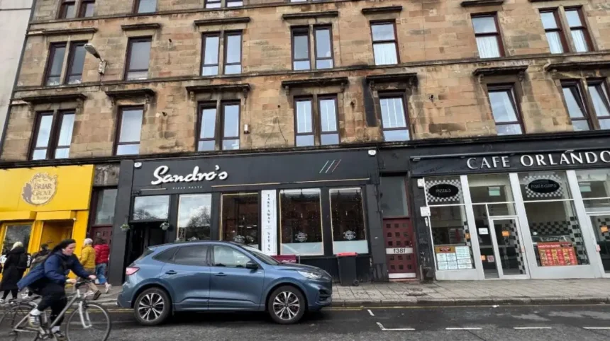
Finnieston has a more linear commercial pattern. Argyle Street is its principal commercial spine, while Finnieston Street, Minerva Street and surrounding streets contain residential, business and redevelopment sites.
The distinction therefore involves more than distance. Partick has an historic burgh identity and a major transport hub. Finnieston has an industrial and regeneration identity with a strong contemporary hospitality and cultural presence.
Where are Partick and Finnieston located in Glasgow?
Partick lies west of Glasgow city centre around the River Kelvin and north of the River Clyde, while Finnieston sits closer to the city centre along the Clyde corridor between Anderston, Kelvingrove, Yorkhill and the west-end districts surrounding the Kelvin.
Partick occupies a strategic position where several major Glasgow routes meet. Dumbarton Road runs through the district, connecting the west end with areas farther west. Byres Road begins close to the Partick area and provides a major north-south commercial connection.
The River Kelvin forms an important geographical feature. Partick Bridge crosses the river and forms part of the historic streetscape around Kelvingrove Park. Historic Environment Scotland records the present Partick Bridge as dating from the 1870s, with its foundation stone laid in 1877.
Finnieston is closer to central Glasgow. Argyle Street passes through the district and continues towards the city centre. Finnieston Street provides another important local route towards the Clyde.
Kelvingrove Park sits immediately north of the Finnieston-Partick transition. The park creates a major area of open space between dense urban neighbourhoods.
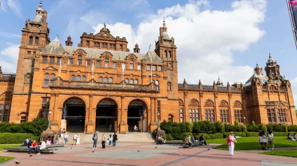
Kelvingrove Art Gallery and Museum is another major geographic reference point. Glasgow Life states that the museum opened in 1901 and contains 22 galleries.
The River Clyde defines the southern context of both districts. Riverside development has influenced transport, housing, commercial activity and public-realm investment across this part of Glasgow.
The exact boundary between neighbourhoods is not always marked by a single physical feature. Address conventions, business marketing and local usage can overlap. This explains why properties near Argyle Street, Kelvinhaugh, Dumbarton Road and Kelvingrove are sometimes described using more than one area name.
Why does Partick have such a strong historical identity?
Partick has a strong historical identity because it developed as a separate burgh with its own civic institutions, public services and urban infrastructure before becoming part of Glasgow, leaving a substantial architectural and civic legacy visible across the district today.
Partick’s history predates its modern role as a Glasgow neighbourhood. Its former burgh status is central to understanding the area.
The historic burgh developed alongside Glasgow’s industrial expansion. Its position beside the River Kelvin and close to the Clyde supported manufacturing, transport and commercial activity.
Industrial development also influenced local population growth. Workers moved into the wider west end as employment expanded. Historic Environment Scotland records this social change in buildings such as the former Partick East Free Church, which was built to accommodate an influx of workers from the Highlands.
The area’s civic development produced substantial public infrastructure. Historic buildings include the former Partick Fire Station on Sandy Road and Beith Street. The building dates from 1906 and was designed in an Edwardian Queen Anne Revival style. It is now converted into flats.
Partick also has important religious architecture. St Peter’s Church on Hyndland Street was completed in 1903 and was designed by Pugin & Pugin. Historic Environment Scotland identifies it as an important example of the firm’s church architecture in Scotland.
Partick Bridge provides another direct historical connection. Its construction in the late 1870s replaced earlier crossings over the River Kelvin and improved movement through the district.
Victoria Park also has a strong connection to the former burgh. Historic Environment Scotland records that the park was laid out in 1886–87 on land given to the burgh of Partick. The park was later extended between 1894 and 1909.
These features make Partick’s history visible in its streets, buildings, bridges and public spaces rather than existing only in archival records.
Why is Finnieston associated with Glasgow’s industrial and modern urban development?
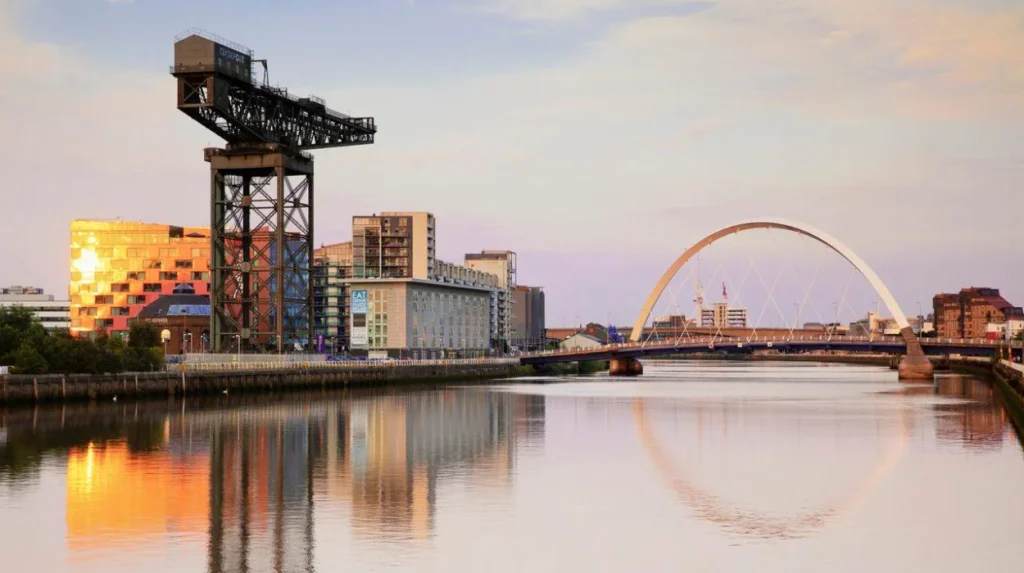
Finnieston developed within Glasgow’s industrial westward expansion and retains links to the Clyde, engineering, transport and commercial activity, while later regeneration introduced housing, restaurants, offices and cultural uses that define much of its contemporary identity.
Finnieston’s location explains much of its development. It sits close to the River Clyde and between central Glasgow and the western neighbourhoods.
The Clyde was fundamental to Glasgow’s industrial economy. Shipbuilding, engineering, warehousing and river-related commerce shaped the wider waterfront. Finnieston became part of this broader industrial landscape.
The area’s street pattern still contains evidence of that development. Finnieston Street and surrounding roads contain a mixture of older buildings, commercial premises, residential properties and redevelopment sites.
Contemporary planning documents demonstrate the area’s continued transformation. Glasgow City Council planning records include residential-led mixed-use proposals around Finnieston Street incorporating retail, professional services, food and drink, public realm, landscaping and infrastructure.
Clydeway Skypark is another example of the area’s modern commercial environment. Glasgow City Council records identify land at Clydeway Skypark on Finnieston Street within Ward 10.
Finnieston’s contemporary identity is also connected with culture. Its proximity to Kelvingrove Art Gallery and Museum, Kelvingrove Park, the University of Glasgow and the SEC area places major cultural and institutional destinations within a short distance.
Kelvingrove Art Gallery and Museum opened as part of the 1901 Glasgow International Exhibition. Glasgow Life marked its 125th anniversary in 2026.
The area therefore combines historical industrial geography with modern mixed-use development. This combination explains why Finnieston appears frequently in discussions about Glasgow’s restaurants, cultural attractions, workplaces, housing and urban regeneration.
How do Partick and Finnieston differ in transport?
Partick has the stronger transport interchange because Partick Interchange combines rail, Subway and bus services, while Finnieston relies more heavily on nearby rail stations, bus routes and walking connections to central Glasgow and surrounding west-end destinations.
Transport is one of the clearest practical differences between the areas.
Partick Interchange is a major multimodal facility. SPT describes it as integrating bus, rail and Subway services with cycle and walking networks. The interchange redevelopment cost £2.5 million.
The Partick Subway station operates with Inner and Outer Circle platforms. The station is integrated with Partick Rail Station and Partick Bus Station.
Rail connectivity is particularly significant. ScotRail currently lists direct services from Partick to Glasgow Queen Street, with an average journey time of about 10 minutes.
ScotRail also lists Partick-to-Glasgow Central journeys with an average journey time of about seven minutes and services operating several times per hour.
This gives Partick an important role for commuters, students, visitors and residents travelling across Glasgow.
Finnieston does not have an equivalent integrated interchange within the district. Its transport pattern depends more on nearby stations and bus services.
Exhibition Centre station is particularly relevant to the southern side of Finnieston. The station provides rail access to the SEC area and the wider network.
Walking also plays a major role. Finnieston’s location between central Glasgow, Kelvingrove and Partick makes many local journeys practical on foot.
The difference is therefore structural. Partick is a transport hub. Finnieston is a centrally positioned mixed-use district connected to several transport hubs nearby.
How do the streets, buildings and housing differ between Partick and Finnieston?
Partick contains a broad mix of traditional tenements, shops, civic buildings, churches and residential streets, while Finnieston combines Victorian and industrial-era structures with modern apartments, commercial premises, hospitality businesses and redevelopment along major streets.
Partick has a strong tenement tradition. Its residential streets include sandstone buildings and traditional Glasgow flats, particularly around Partickhill and nearby west-end streets.
Historic Environment Scotland records a notable group of Partickhill Road and North Gardner Street tenements dating from 1903–1905. The buildings display red sandstone, projecting balconies, bay windows and other features associated with Glasgow’s early twentieth-century architecture.
Partick also contains institutional buildings. Former churches, schools, fire stations and industrial structures provide evidence of its development as an independent burgh and later Glasgow district.
The built environment changes closer to the commercial core. Partick Cross and Dumbarton Road contain shops, food businesses, services and local commercial premises.
Finnieston has a more mixed building profile. Traditional tenements sit alongside converted industrial buildings and modern apartment developments.
Planning applications demonstrate ongoing redevelopment. Glasgow City Council records include proposals for residential-led mixed-use schemes incorporating housing, retail, food and drink, professional services and public spaces.
The difference is visible at street level. Partick often presents a stronger traditional neighbourhood structure. Finnieston contains a greater concentration of redevelopment sites and newer mixed-use buildings.
Neither area has a single uniform architectural style. Both contain historic buildings, ordinary residential properties and newer construction. The contrast comes from the concentration and relationship between these building types.
What are Partick and Finnieston like for food, culture and leisure?
Partick has a broad everyday commercial environment centred on local shops, cafés, services and west-end destinations, while Finnieston has a stronger concentration of restaurants, bars, cultural venues and visitor-oriented activity around Argyle Street and nearby streets.
Food and leisure are major parts of the modern identity of both districts.
Partick’s commercial environment has a practical neighbourhood function. Dumbarton Road contains everyday services alongside cafés, food businesses and independent shops.
Partick also benefits from its proximity to Byres Road, the University of Glasgow, Kelvingrove Park and the wider west end. This creates a large combined catchment for food, shopping, education and leisure.
Finnieston has a more concentrated hospitality reputation. Argyle Street is the principal focus for restaurants, cafés, bars and other food-and-drink businesses.
The district also benefits from nearby cultural destinations. Kelvingrove Art Gallery and Museum provides a major free-entry attraction. Glasgow Life records 22 galleries covering subjects ranging from art and natural history to ancient Egypt and Charles Rennie Mackintosh.
Kelvingrove Park provides another important leisure resource. The park links the urban neighbourhoods around Partick, Finnieston and Kelvingrove.
The SEC and OVO Hydro area also influence the southern part of the district. Large events increase visitor movement through the wider Finnieston and Clyde corridor.
Partick has a broader everyday retail and service role. Finnieston has a stronger concentration of destination-oriented hospitality and cultural activity.
The two areas therefore support different patterns of urban use. Partick functions strongly as a residential and transport centre. Finnieston functions strongly as a mixed residential, commercial, hospitality and cultural district.
How close are Partick and Finnieston to Glasgow city centre?
Partick and Finnieston are both close to central Glasgow, but Finnieston sits closer to the city centre while Partick extends farther west around the River Kelvin, Dumbarton Road and Partickhill, with fast public transport connecting both districts to central destinations.
Finnieston occupies a relatively central position within Glasgow’s west end. Argyle Street provides a direct east-west connection towards the city centre.
Partick lies farther west but remains highly connected. The rail journey from Partick to Glasgow Central averages around seven minutes according to ScotRail’s current route information.
This means geographical distance and travel time are different considerations.
Partick’s transport advantage reduces the practical impact of its location farther west. The Subway provides another direct connection into the central area and wider west end.
Finnieston benefits from walking access to central destinations. It is also close to Charing Cross, Anderston and the cultural attractions around Kelvingrove.
For visitors, the difference is mainly one of positioning. Finnieston places a traveller closer to the central-west cultural corridor. Partick provides stronger access to the wider west end and western Glasgow.
For residents, transport options create a similarly important distinction. Partick’s interchange supports rail, Subway and bus journeys. Finnieston relies more on a network of nearby stations and street-level routes.
Both districts therefore provide efficient access to central Glasgow without being part of the city centre itself.
How do Partick and Finnieston compare for living, visiting and everyday use?
Partick functions as a larger residential and transport-oriented neighbourhood with established local services, while Finnieston has a denser mixed-use environment shaped by hospitality, culture, employment, housing and regeneration, creating different patterns of everyday movement across Glasgow’s west end.
Partick’s residential identity is supported by its historic housing stock and local services. Traditional tenements remain an important part of the area’s built environment.
Its transport interchange is another major factor. Residents can combine rail, Subway and bus services from the same location. SPT reported approximately 2.8 million annual rail passengers and just under one million Subway passengers at Partick in figures associated with the interchange redevelopment.
Finnieston has a more central mixed-use character. Residential buildings sit close to restaurants, offices, cultural destinations and entertainment venues.
The area has also experienced substantial development pressure. Glasgow City Council planning records show residential and mixed-use proposals around Finnieston Street and neighbouring streets.
For visitors, Partick provides access to several major west-end destinations. Kelvingrove Park, the University of Glasgow area, the River Kelvin and transport connections are all nearby.
Finnieston provides particularly direct access to Kelvingrove, Argyle Street, the SEC area and central-west Glasgow.
For everyday errands, Partick has a stronger traditional neighbourhood-service structure. Finnieston has a stronger hospitality and mixed-use profile.
For commuting, Partick has the clearer transport interchange. For cultural and hospitality activity, Finnieston’s position near Argyle Street and Kelvingrove creates a dense concentration of destinations.
The areas should therefore be understood as neighbouring parts of one connected west-end urban system rather than completely separate environments.
Explore More Area Guide
Shawlands vs Dennistoun: Glasgow Area Comparison Guide
West End vs Southside Glasgow: Where Should You Live?
How has the relationship between Partick and Finnieston changed over time?
The relationship between Partick and Finnieston has changed as Glasgow expanded westward, industrial activity declined or relocated, transport infrastructure developed and former industrial land gained residential, commercial and cultural uses, creating a more continuous urban landscape between historic neighbourhoods.
During the nineteenth century, Glasgow experienced major population and industrial growth. Partick developed as an independent burgh while the wider western districts became increasingly connected to Glasgow.
The River Kelvin was important to industrial development. Bridges and infrastructure improved connections between communities on both sides of the river.
Partick Bridge illustrates this process. Historic Environment Scotland records its construction during the 1870s and identifies its role in the area’s streetscape.
Finnieston’s development was closely connected to the industrial city and the River Clyde. Industrial land, transport infrastructure and employment shaped the district.
The twentieth century brought major changes to Glasgow’s industrial economy. Former industrial areas gradually gained new uses.
The modern Finnieston area reflects this transition. Planning records show residential-led mixed-use development involving housing, retail, professional services, food and drink and public-realm improvements.
Partick also experienced change while retaining more visible evidence of its former civic identity. Historic buildings remain embedded within the residential and commercial environment.
Victoria Park provides another example of Partick’s historic civic investment. Its late nineteenth-century development demonstrates the former burgh’s commitment to public recreation and designed landscape.
Today, the two areas form part of a continuous west-end urban corridor. Their histories remain distinct, but transport, housing, culture and commercial activity increasingly connect them.
What should you know before choosing between Partick and Finnieston?
Partick and Finnieston offer different urban functions within Glasgow’s west end: Partick is defined by historic burgh identity, residential streets and exceptional transport connectivity, while Finnieston is defined by central positioning, mixed-use redevelopment, hospitality, culture and Clyde-side urban activity.
The most important distinction is identity.
Partick’s identity comes from its history as a burgh and its established neighbourhood structure. Its architecture, public buildings, bridges, parks and transport infrastructure preserve this history.
Finnieston’s identity comes from its position within Glasgow’s industrial and commercial expansion and its later transformation into a mixed-use urban district.
Transport creates another major difference. Partick Interchange combines rail, Subway and bus services. Finnieston instead benefits from several nearby transport options.
The built environment also differs. Partick contains substantial traditional tenement housing and historic civic architecture. Finnieston combines older tenements and industrial structures with newer residential and mixed-use development.
Food and leisure provide another distinction. Partick has a broad local-service economy. Finnieston has a particularly strong concentration of restaurants, cafés, bars and cultural activity.
Both areas benefit from proximity to Kelvingrove Park and Kelvingrove Art Gallery and Museum. Kelvingrove opened in 1901 and remains one of Glasgow’s major museums.
For understanding Glasgow’s west end, the areas are best viewed together. Partick represents an historic west-end centre with a major transport role. Finnieston represents a centrally positioned mixed-use district shaped by industrial heritage and modern regeneration.
The difference between Partick and Finnieston is therefore not simply a matter of where one neighbourhood ends. It reflects two distinct stages of Glasgow’s urban development that now operate within one closely connected part of the city.
Is Partick the same area as Finnieston?
No. Partick and Finnieston are neighbouring areas in Glasgow’s West End. Partick has a strong historic burgh identity and major transport interchange, while Finnieston has a mixed-use character shaped by hospitality, culture, former industry and regeneration.