

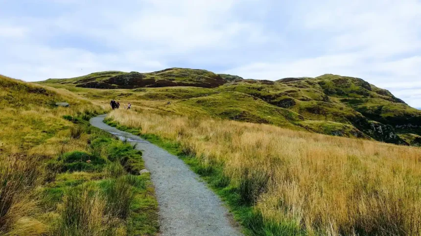
Glasgow sits within easy reach of several distinct walking environments. The city itself contains riverside paths, historic parks, woodland, and open green spaces. Beyond the urban boundary, walkers quickly reach Mugdock Country Park, the Campsie Fells, Loch Lomond, Clyde Muirshiel Regional Park, and the opening stages of the West Highland Way.
- Why does Glasgow have so many walking and hiking opportunities nearby?
- How did Glasgow’s walking routes develop historically?
- Is Kelvin Walkway one of the best walking routes from Glasgow?
- Why is Mugdock Country Park ideal for walking near Glasgow?
- What makes Cathkin Braes a good hiking route in Glasgow?
- Is Pollok Country Park suitable for longer walks?
- Can you walk the West Highland Way from Glasgow?
- Is Conic Hill worth visiting from Glasgow?
- What is the Greenock Cut walking route like?
- What other walking routes are available in Clyde Muirshiel Regional Park?
- How should you choose between Glasgow’s best walking routes?
- What should you take when walking near Glasgow?
- Can you reach Glasgow hiking routes by public transport?
- How will Glasgow’s walking and hiking network develop in the future?
The best route depends on distance, terrain, transport, and the type of landscape you want to experience. Short urban walks suit casual outings. Country parks provide woodland and open-ground walking. Hill routes add elevation and wider views. Long-distance paths provide more demanding full-day or multi-day experiences.
Why does Glasgow have so many walking and hiking opportunities nearby?
Glasgow has walking and hiking routes ranging from riverside paths and urban parks to moorland climbs and long-distance trails. Strong options include Kelvin Walkway, Mugdock Country Park, Cathkin Braes, Pollok Country Park, Conic Hill, and West Highland Way near Glasgow.
Glasgow’s geographical position explains the variety. The city sits on the River Clyde, while higher ground begins north, south and west of the urban area. This creates a transition from built-up streets to woodland, farmland, moorland and hills.
Several routes also follow historic transport corridors and waterways. The Kelvin Walkway follows the River Kelvin and Allander Water. The West Highland Way begins at Milngavie and continues north towards Fort William. East Dunbartonshire also provides access to the Campsie Fells, Forth and Clyde Canal and John Muir Way.
This geographic variety means walkers do not need to travel deep into the Highlands to experience Scottish countryside. A journey from central Glasgow to Milngavie provides access to one of Scotland’s best-known long-distance routes.
The surrounding landscape also contains significant historical features. Mugdock Country Park contains Mugdock Castle, Craigend Castle and Second World War gun sites. Its history extends back more than 5,000 years.
How did Glasgow’s walking routes develop historically?
Walking around Glasgow developed alongside the city’s parks, waterways, estates, and transport corridors. Modern routes combine historic landscapes with maintained paths, creating access to countryside near dense neighbourhoods. The network also connects Glasgow with Loch Lomond and Scotland’s trails.
Many modern walking routes use landscapes that previously served practical purposes. Rivers supported industry and transport. Estate grounds became public parks. Water infrastructure created paths across upland landscapes. Railway corridors became walking and cycling routes.
The Kelvin Walkway is a strong example of a route based around a natural corridor. The River Kelvin runs through several parts of Glasgow before joining the River Clyde. Today, the walkway provides a continuous recreational connection between central Glasgow and Milngavie.
Mugdock Country Park developed from historic estates and countryside north of Glasgow. The modern park contains woodland, heathland, moorland, marshland, lochs and formal paths. East Dunbartonshire Council states that the park was designated as a Country Park in 1987.
The West Highland Way represents another important development. It was officially opened on 6 October 1980 as Scotland’s first long-distance route. The 96-mile, or 154-kilometre, trail connects Milngavie with Fort William.
This history gives Glasgow’s walking network a distinctive structure. Routes are not limited to modern recreational paths. They often incorporate rivers, old estates, historic engineering works and established rural communication routes.
Is Kelvin Walkway one of the best walking routes from Glasgow?
Kelvin Walkway is a strong choice for a long, mostly linear route connecting central Glasgow with Milngavie. It follows the River Kelvin and Allander Water, linking urban landscapes with countryside. Rail and bus access simplifies route planning for walkers from Glasgow.
The Kelvin Walkway provides one of the most useful connections between Glasgow city and countryside north-west of the centre. The route begins around the River Clyde and Riverside Museum before following the River Kelvin.
Its major advantage is accessibility. Walkers can begin in an urban environment and progressively move into greener surroundings. The route eventually reaches Milngavie, where the West Highland Way begins.
The character of the path changes along the journey. Sections close to central Glasgow are more urban and generally easier underfoot. Further north, the route becomes more rural, with rougher and muddier sections.
Walkhighlands describes the Kelvin Walkway as a route of two distinct halves. The first section follows easier paths, while the countryside section becomes rougher.
The linear format also helps with transport planning. A walker does not need to complete a circular route. After reaching Milngavie, public transport provides options for returning towards Glasgow.
The route works particularly well for people who want a longer walk without committing to a remote mountain environment. It also provides a logical introduction to longer-distance walking.
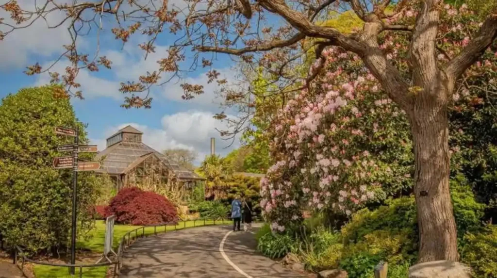
Why is Mugdock Country Park ideal for walking near Glasgow?
Mugdock Country Park is a versatile hiking area near Glasgow, with 270 hectares of woodland, moorland, heathland, paths, lochs, castles, and historic sites. Its varied terrain supports short walks, longer explorations, family outings, and nature-focused hiking.
Mugdock Country Park sits approximately 10 miles from Glasgow city centre near Milngavie. East Dunbartonshire Council describes the park as covering 270 hectares.
The park provides a combination of woodland and open landscape. Walkers can explore paths around Mugdock Loch, Mugdock Castle, Craigend Castle and surrounding moorland.
The park’s route variety makes it suitable for different walking abilities. Shorter paths can be combined around the central park area. Longer walks can extend across woodland and open ground.
Mugdock also provides a strong historical component. Mugdock Castle overlooks Mugdock Loch. Craigend Castle forms another historic feature. The park also contains remnants of Second World War defensive infrastructure.
The park is accessible without requiring a long journey from Glasgow. Milngavie railway station is the nearest rail station, and Mugdock can also be reached by road and bus services.
Mugdock’s landscape is also important for biodiversity. Almost 70% of the park has been designated a Site of Special Scientific Interest, while Mugdock Castle is a Scheduled Ancient Monument.
What makes Cathkin Braes a good hiking route in Glasgow?
Cathkin Braes provides one of Glasgow’s clearest viewpoints and strongest local hillwalking experiences. Its route network crosses open grassland, woodland, and rougher paths above the Southside. The Magnificent 11 links Cathkin Braes with southern green spaces in a 17-kilometre circuit.
Cathkin Braes is located on Glasgow’s southern edge. It provides elevated views across the city towards the Campsie Fells and Ben Lomond.
The area is particularly useful for walkers who want elevation without travelling outside Glasgow. It has open grassland, woodland and informal paths. Conditions become more demanding after wet weather because some sections become muddy.
The Magnificent 11 is one of the most substantial walking options around the southern Glasgow greenbelt. The circular route covers 17 kilometres and takes approximately four to five hours, with around 380 metres of ascent.
The route connects several green spaces rather than focusing on Cathkin Braes alone. This creates a longer walking experience through the Southside.
Cathkin Braes also has particular geographical importance within Glasgow. The summit area reaches approximately 200 metres and represents the highest point in Glasgow City.
For visitors staying in the city, Cathkin Braes offers a straightforward way to experience a hill environment without travelling to a national park.
Is Pollok Country Park suitable for longer walks?
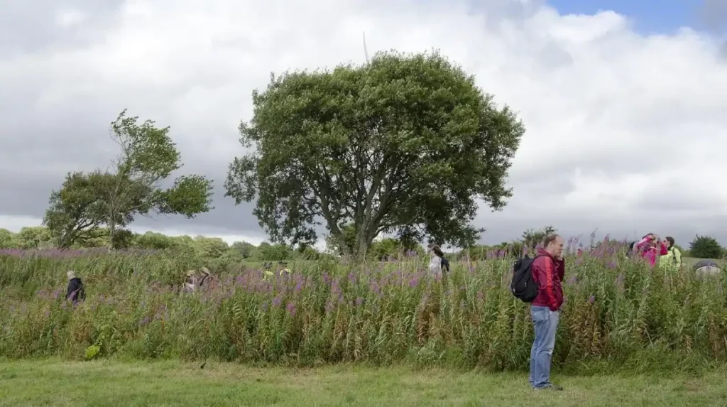
Pollok Country Park is a practical choice for accessible walking within Glasgow itself. Its estate landscape combines woodland, riverside paths, open parkland, and cultural attractions. It suits visitors wanting a substantial outdoor walk without travelling beyond the city boundary or complex transport.
Pollok Country Park is one of Glasgow’s largest and most significant urban green spaces. It occupies the Southside and combines open parkland with woodland and the River Cart.
Its location makes it particularly useful for visitors who want outdoor recreation without leaving Glasgow. Public transport and local roads provide access, while the park environment provides a clear break from dense urban development.
Walking here can also be combined with cultural attractions. Pollok House sits within the estate and provides an important historic connection.
The park is different from routes such as Conic Hill or the West Highland Way. It does not require mountain navigation or substantial elevation gain. Its principal value comes from accessible paths, woodland, riverside scenery and the scale of the estate.
For visitors planning a short Glasgow stay, Pollok Country Park provides an efficient option for combining sightseeing with outdoor activity.
Can you walk the West Highland Way from Glasgow?
Milngavie is the official starting point of the 96-mile West Highland Way, Scotland’s first long-distance route. The opening section to Drymen covers 12 miles and provides a relatively gentle introduction, passing through Mugdock Country Park before reaching Loch Lomond.
The West Highland Way begins in Milngavie, immediately outside Glasgow’s main urban area. Its official route covers 96 miles, equivalent to approximately 154 kilometres, between Milngavie and Fort William.
The first section runs from Milngavie to Drymen and measures 12 miles, or 19 kilometres. The official route describes this as a relatively simple introduction, with paths, tracks and lanes and no major climbs.
Mugdock Country Park forms an important feature of this opening section. Walkers then continue through countryside towards Drymen.
The full West Highland Way is significantly more demanding than a typical Glasgow day walk. Its terrain changes from lower-level paths to lochside sections, open moorland and mountainous landscapes.
The official route is traditionally walked from south to north. The southern stages provide a progressive introduction before the more demanding northern sections.
Transport is another advantage. Milngavie has regular train services from Glasgow, allowing walkers to reach the starting point without a car.
Walkers do not need to complete all 96 miles at once. The route can be divided into shorter sections using trains and buses.
Is Conic Hill worth visiting from Glasgow?
Conic Hill at Balmaha delivers a compact hillwalking experience near Glasgow with a 361-metre summit and views across Loch Lomond. The linear route is 5 kilometres, while the circular option is 10.5 kilometres. Recent improvements strengthen access and landscape protection.
Conic Hill sits on the eastern side of Loch Lomond within Loch Lomond & The Trossachs National Park. The summit reaches 361 metres.
The route is popular because it combines a relatively compact climb with major views. From the summit, walkers can see Loch Lomond and its islands, as well as the Arrochar Alps and Ben Lomond.
The official route card identifies a 5-kilometre linear option taking approximately 2.5 hours. A circular route covers 10.5 kilometres and takes around four hours.
The path also has wider significance because Conic Hill lies on the Highland Boundary Fault Line.
Recent infrastructure investment has improved the route. The National Park Authority completed a £900,000 path improvement project between 2022 and 2025. The improved section extends 1.4 kilometres from Balmaha Visitor Centre towards the summit.
Public transport from Glasgow involves travelling by train to Balloch and then continuing by bus to Balmaha. The National Park Authority gives an approximate journey time of two hours from Glasgow.
What is the Greenock Cut walking route like?
Greenock Cut offers a longer countryside walk within Clyde Muirshiel Regional Park, Scotland’s largest regional park. The signed circular route covers 12 kilometres around a historic water-supply system, combining moorland, reservoirs, woodland, engineering heritage, and Clyde views.
The Greenock Cut is located near Greenock within Clyde Muirshiel Regional Park. The route follows a historic water-supply system created during the nineteenth century.
The Greenock Cut itself is a Scheduled Monument. The surrounding landscape includes open moorland, reservoirs and woodland.
The official regional park information identifies a 12-kilometre circular Greenock Cut route. The route is signposted and provides views across the surrounding Clyde landscape.
The walk also has historical significance. Robert Thom designed the Greenock Cut engineering system during the 1820s. The infrastructure transported water towards Greenock and supported the town’s industrial development.
A shorter nature trail is also available around Shielhill Glen. The published trail information identifies a 2.5-kilometre circular route taking approximately one hour.
The Greenock Cut therefore provides two different walking scales. Visitors can choose a short nature-focused route or a longer countryside circuit.
What other walking routes are available in Clyde Muirshiel Regional Park?
Clyde Muirshiel Regional Park is Scotland’s largest regional park and covers 108 square miles. Its walking opportunities range from short family trails at Muirshiel Country Park to longer moorland routes and the Greenock Cut. The park provides countryside west of Glasgow.
Clyde Muirshiel Regional Park covers 108 square miles and provides walking opportunities across woodland, moorland, lochs and coastal landscapes.
Muirshiel Country Park provides shorter trails. The Windy Hill route offers a family-friendly climb through woodland and open moorland. The regional park describes the walk as approximately 1 kilometre to the summit.
Another route follows the old mine track towards the remains of the historic barytes mine. The published park material identifies this as an approximately 8-kilometre, two-hour walk.
Castle Semple Country Park near Lochwinnoch provides another accessible walking environment. It contains lochside paths, woodland and the Semple Trail.
The regional park therefore works well for walkers who want countryside variety rather than one specific summit. Different park sites provide different combinations of distance, terrain and landscape.
How should you choose between Glasgow’s best walking routes?
Route choice depends on distance, terrain, transport, and navigation demands. Urban paths such as Kelvin Walkway suit straightforward outings, while Cathkin Braes and Conic Hill add climbs. Longer routes such as the West Highland Way require preparation, weather awareness, navigation, and equipment.
For an urban walk, Kelvin Walkway and Pollok Country Park provide the most direct options. Both allow walkers to remain close to Glasgow’s built environment.
For woodland and history, Mugdock Country Park provides greater variety. Its castles, lochs and historic landscape add cultural context to the walking experience.
For city viewpoints, Cathkin Braes provides elevated Southside scenery. The Magnificent 11 offers a substantially longer option for experienced walkers.
For a compact hill climb, Conic Hill provides a 361-metre summit and views across Loch Lomond. Its upgraded path infrastructure also provides a clearly defined route.
For long-distance walking, the West Highland Way is the major choice. Its first 12-mile section from Milngavie to Drymen provides a manageable introduction, while the complete route requires multi-day planning.
For historic engineering and open moorland, Greenock Cut provides a 12-kilometre circular route within Clyde Muirshiel Regional Park.
The correct route therefore depends more on the walking objective than on a single ranking. Glasgow provides access to urban, woodland, riverside, hill and long-distance environments within a relatively compact geographical area.
What should you take when walking near Glasgow?
Glasgow walkers should follow the Scottish Outdoor Access Code, respect other land users, control dogs around livestock and wildlife, avoid damaging paths, and carry navigation equipment. Weather changes quickly on exposed ground, so clothing, footwear, water, food, and planning remain important in advance.
Appropriate preparation becomes more important as routes move away from urban areas.
Urban park walks usually have better access to roads, buildings and public transport. Remote paths have fewer immediate services. Hill routes also expose walkers to wind, rain, low cloud and changing ground conditions.
Walking footwear should match the terrain. Trainers can suit firm urban paths, while waterproof walking shoes or boots provide better protection on muddy, wet or uneven countryside paths.
Navigation remains important. A phone-based map is useful, but walkers should also carry a reliable backup navigation method on longer routes.
The Scottish Outdoor Access Code provides the framework for responsible access to Scotland’s countryside. Walkers should respect people working on the land, livestock, wildlife and the environment.
Dogs require particular attention around livestock and wildlife. They should remain under proper control.
Leave no litter, avoid damaging vegetation and use established paths where they exist. These practices help protect heavily visited landscapes such as Conic Hill and Mugdock.
Explore More Area Guide
Is Loch Lomond 20 Minutes From Glasgow by Train?
Is Loch Lomond 20 Minutes From Glasgow by Train?
Can you reach Glasgow hiking routes by public transport?
Public transport makes several routes practical without a car. Milngavie has regular train connections with Glasgow for the West Highland Way, while Balmaha is reachable through Balloch and a connecting bus. Mugdock is close to Milngavie, and Kelvin Walkway connects with transport services.
Public transport is one of the strongest advantages of walking around Glasgow.
Milngavie provides direct rail access from Glasgow and is the starting point of the West Highland Way. The official route organisation confirms regular train services between Glasgow and Milngavie.
Kelvin Walkway also supports public transport planning because the route begins close to central Glasgow and finishes in Milngavie.
Conic Hill requires more planning. The National Park Authority states that visitors from Glasgow can travel by train to Balloch and then use the 309 bus to Balmaha.
Mugdock Country Park is close to Milngavie. The nearest railway station is Milngavie, with walking and bus options available for continuing towards the park.
Greenock Cut is less convenient by public transport. The official information states that there is no direct public transport to the visitor centre. The nearest railway station is Drumfrochar in Greenock, followed by a substantially longer walk.
Transport planning therefore influences route selection. Walkers without cars should prioritise Milngavie, Kelvin Walkway and routes with established rail or bus connections.
How will Glasgow’s walking and hiking network develop in the future?
Glasgow’s walking network remains relevant because it connects daily urban life with accessible green space and longer Scottish trails. Route improvements, responsible access, and public transport links support sustainable outdoor recreation. Conic Hill’s £900,000 project demonstrates continued investment in walking infrastructure across the region.
Investment in walking infrastructure is increasingly important at popular destinations.
Conic Hill provides a clear example. More than 200,000 visitors use the hill annually, according to the Loch Lomond & The Trossachs National Park Authority. The recent £900,000 project focused on improving the path while protecting the surrounding landscape.
Mugdock Country Park also continues to receive attention as an important recreational and heritage landscape. In 2026, restoration work was completed on its Victorian walled garden, which dates from 1816.
The wider network is also supported by established long-distance routes. The West Highland Way connects Glasgow’s northern outskirts with Fort William, while the John Muir Way provides a 134-mile route across Central Scotland.
These connections strengthen Glasgow’s position as an outdoor recreation base. Visitors can start with an urban riverside walk, progress to a country park, or use public transport to reach a hill or long-distance trail.
The future relevance of these routes depends on maintaining paths, managing visitor pressure, protecting habitats and supporting responsible access. These priorities ensure that walking remains practical for residents and visitors while preserving the landscapes surrounding Glasgow.
What is the best walking route near Glasgow City?
Kelvin Walkway is one of the best accessible walking routes near Glasgow City. It follows the River Kelvin and connects central Glasgow with Milngavie, where walkers can also join the West Highland Way.